
Browse Archives
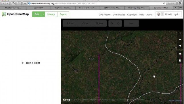
Tracing Demonstration for the Humanitarian OpenStreetMap Team (HOT)
0 Views0 Comments0 Likes
This is a simple demonstration of what it looks like to trace for the Humanitarian OpenStreetMap Team (HOT). It’s not meant as a full guide, just an example. If I’m too mumbly, please turn on the captions – the CC button below the video.
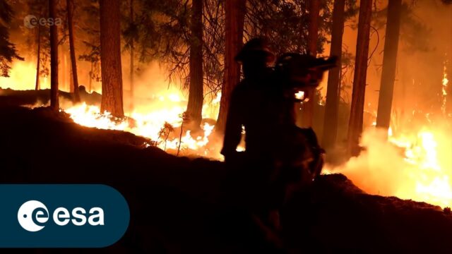
FIRE: An ESA documentary
0 Views0 Comments0 Likes
The summer fire season is well under way in Europe – countries all around the Mediterranean are experiencing record temperatures coupled with huge wildfires that have led to mass evacuations. In this enthralling new E...
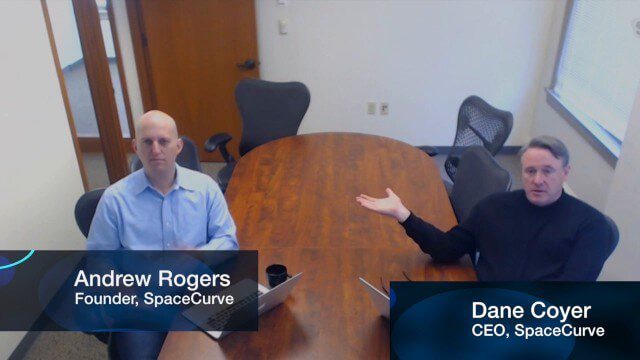
SpaceCurve Introduces Spatial at the Speed of Reality
0 Views0 Comments0 Likes
GeoSpatial Stream's Todd Danielson conducted an Internet Interview with SpaceCurve's CEO Dane Coyer and Founder Andrew Rogers. They spoke about the company's inception, Big Data, spatial indexing and business applications as well as how SpaceCurve created new technologies to integrate these varied components.
6_25 Infrastructure Broadcast (London’s Crossrail, DOT Grants and More)
0 Views0 Comments0 Likes
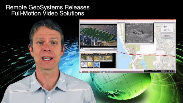
This infrastructure-themed GeoSpatial Stream broadcast discusses London's massive Crossrail project, Bentley's involvement in its BIM practices, and the completion of its tunnel boring; U.S. DOT grants to reduce traffic congestion; Canada's massive New Champlain Bridge project; an interview with HOK's Patrick MacLeamy; industry news from Remote GeoSystems, Esri, IMAGINiT Technologies, Pix4D, Innovyze, Flightline Geographics and Tablerock Land Survey; thoughts on Crossrail and the world's longest tunnel; and more.
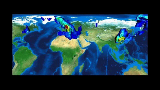
FFDAS Carbon Dioxide Emissions
0 Views0 Comments0 Likes
This video provides an overview of the Fossil Fuel Data Assimilation System (FFDAS). This system quantifies fossil fuel CO2 emissions for the whole planet at 10 km every hour for the 1997 to 2011 time period. We show both the fluxes of FFCO2 leaving the planet's surface and the realization of those fluxes in the atmosphere using an atmospheric transport simulation.
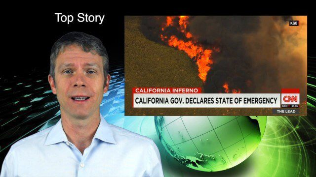
8_6 Wildfire Broadcast (Updates from California and Alaska, NASA and UN News, and More)
0 Views0 Comments0 Likes
This GeoSpatial Stream broadcast discusses the wildfires raging in California, the Pacific Northwest and especially Alaska; a NASA program to inventory Earth's surface waters; the Geovation startup hub; industry news from Esri, URISA and VisionMap; a UN video on the power of geospatial technology; and more.

12_17 Infrastructure Broadcast (Autodesk University, Sponge Parks and More)
0 Views0 Comments0 Likes
This Infrastructure-themed GeoSpatial Stream broadcast features a recap of the Autodesk University event in Las Vegas; recent coverage in Informed Infrastructure magazine about AU, Bentley Systems' Year In Infrastructure Event, and a cover story on a bridge rendering and model in Mobile, Ala.; a proposed Sponge Park near New York City to mitigate contaminated water; industry news from Terracon, Intelligent Light, Visual Technology Services, Atkins and Leica Geosystems; a Final Thought about the upcoming holidays and New Year; and more.
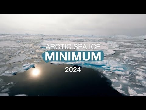
Arctic Sea Ice Near Historic Low; Antarctic Ice Continues Decline
0 Views0 Comments0 Likes
This summer, Arctic sea ice decreased to a its minimum extent on Sept. 11, 2024. According to the National Snow and Ice Data Center this is the 7th lowest in the satellite record. The decline continues the long-term t...

6_19 Asia-Pacific Broadcast (Toxic Sites, Bird Flu Maps and More)
0 Views0 Comments0 Likes
This Asia-Pacific-focused GeoSpatial Stream broadcast discusses an analysis from the Global Alliance on Health and Pollution; 3D images of the Fukushima Daiichi nuclear complex; an Indonesia forestry map; bird flu maps; China's Fengyun-3C satellite; India's Bhaskaracharya Institute for Space Applications and Geoinformatics; industry headlines from AAM and JTRS Registered Surveyor, Fugro, VisionMap and Acute3D, and Supergeo; the "Poisoned Poor"; and more.
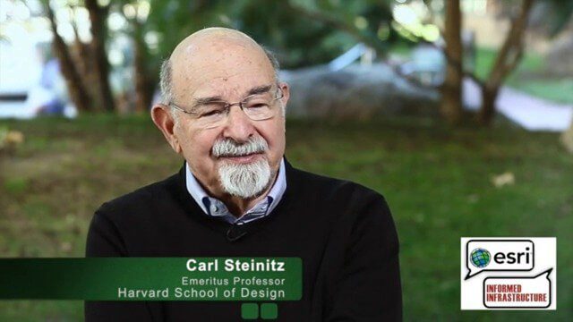
Carl Steinitz Discusses Increased Dangers and Urgency at the Geodesign Summit
0 Views0 Comments0 Likes
Carl Steinitz is an Emeritus Professor at the Harvard University Graduate School of Design and one of the true pioneers and visionaries of geodesign, with 50 years of experience. On behalf of V1 Media, Informed Infrastructure and GeoSpatial Stream, Todd Danielson interviewed Steinitz at the Geodesign Summit 2015 in Redlands, Calif.


