
Browse Archives
Open California: Our Data, Your Creativity
0 Views0 Comments0 Likes
We're releasing our growing California archive under an a CC BY-SA license. Join our community of image analysts, scientists, developers, and researchers: https://www.planet.com/open-california/
1_6 New Year Broadcast (2014 Predictions, National Map Corps, Gaofen-1 Satellite and More)
0 Views0 Comments0 Likes
This GeoSpatial Stream broadcast looks at predictions for 2014, the USGS National Map Corps, China's Gaofen-1 satellite, LiDAR "capturing" Billy the Elephant and more.

First Interstellar Asteroid Wows Scientists
0 Views0 Comments0 Likes
Scientists were surprised and delighted to detect--for the first time--an interstellar asteroid passing through our solar system.
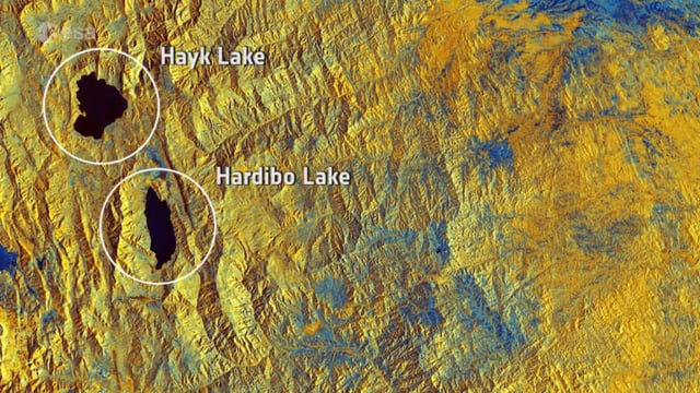
Earth from Space: Northeast Ethiopia
0 Views0 Comments0 Likes
In this week's Earth from Space from the ESA Web TV studios, the Copernicus Sentinel-1B satellite takes us over Northeast Ethiopia.
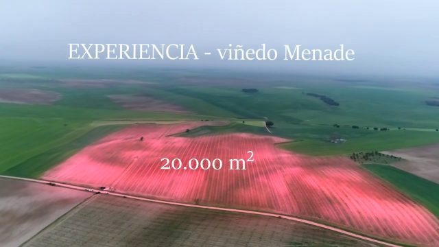
Agricultural Spraying Drone in Spain
0 Views0 Comments0 Likes
Due to heavy rain, the entry of motorized vehicles to the field was impossible, but thanks to HYBRiX technology, farmers in Rueda, Spain, were able to spray all their vid fields in one day of work obtaining the expected results.

OCO-2: NASA’s New Carbon Counter
0 Views0 Comments0 Likes
NASA's OCO-2 mission will shed new light on understanding carbon and its role in our planet's future.

Hexagon’s Schmidt Discusses Water Solutions
0 Views0 Comments0 Likes
Todd Danielson interviews Justin Schmidt, Executive Manager, Hexagon Solutions, at the HxGN LIVE event in Las Vegas, Nevada. They discuss the Hexagon Smart H2O Solution (the foundation for Hexagon Solutions), complete water systems and their challenges, dam monitoring and failures, and more.
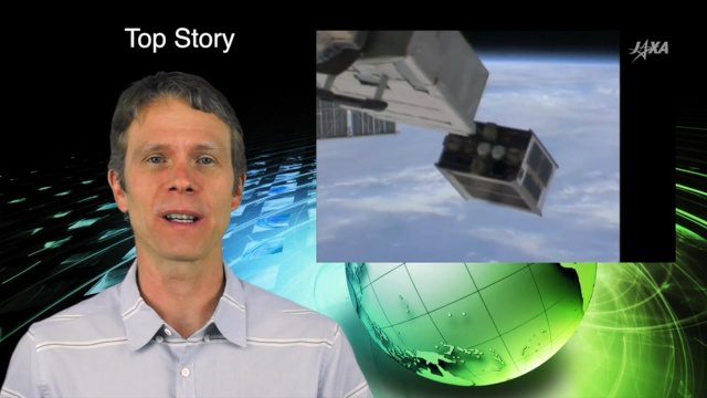
5_26 Asia Pacific Broadcast (DIWATA-1, Apple Maps and More)
0 Views0 Comments0 Likes
This Asia Pacific-themed GeoSpatial Stream broadcast covers the recent launch of DIWATA-1, The Philippines' first microsatellite; Australia's move toward more-accurate GNSS navigation at its airports; Apple opening a technical and support center in Hyderabad, India, for its Maps and navigation services; industry news from NTT Data, LizardTech, BJ Open Tide BoGan, Ozius Spatial and U-blox; a video clip from JAXA (in Japanese) about weather monitoring; and more.

10_15 Earth Imaging Broadcast (Hurricanes, Wildfire Mapping and More)
0 Views0 Comments0 Likes
This Earth Imaging-themed GeoSpatial Stream broadcast discusses satellite imagery used to track and understand hurricanes, including the Atlantic's Joaquin and the Pacific's triplet hurricanes of Kilo, Ignacio and Jimena; remote sensing used to map and characterize capuchin monkey habitat; a Re/Code video news story about smallsats helping with wildfires; industry news from MDA, Blue Water Satellite, NASA and Esri; clips from a V1 Media video interview of Patrick Meier, founder of the Humanitarian UAV Network; and more.
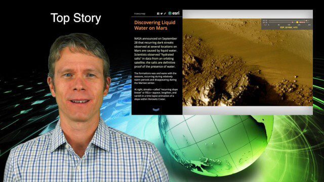
10_1 Science Broadcast (Mars Water, Neutrino and Tree Maps, and More)
0 Views0 Comments0 Likes
This GeoSpatial Stream broadcast discusses several intersections of science and geospatial technology, including NASA's announcement that Mars has liquid water; a map showing Earth's neutrinos; a video showing how scientists estimated the number of trees on Earth; industry news from exactEarth, US Topo maps, Teledyne Optech and Intergraph Government Solutions; opinions on the impact of the news from Mars; and more.


