
Monthly Archives: August 2016
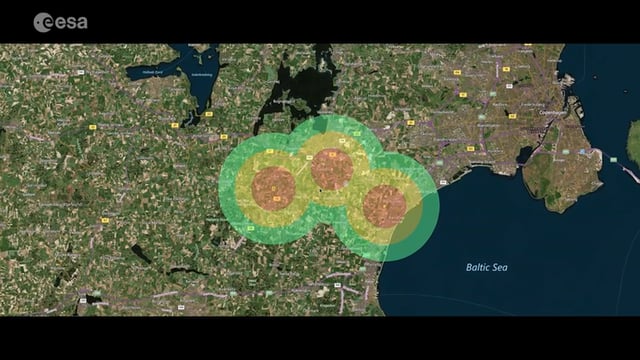
Satellite-Based Wildlife-Monitoring Tool for Airports
0 Views0 Comments0 Likes
Wildlife habitats close to airports pose a serious risk to safety at takeoff and landing. A new service lets airports use Earth-observation satellites to identify and manage these areas.

Mapping an Asteroid with Lasers
0 Views0 Comments0 Likes
The OSIRIS-REx Laser Altimeter (OLA) will provide a three-dimensional map of asteroid Bennu’s shape, which will allow scientists to understand the context of the asteroid’s geography and the sample location. OLA is provided by the Canadian Space Agency in exchange for Canadian ownership of a portion of the returned asteroid sample. Credit: NASA’s Goddard Space flight Center/Katrina Jackson
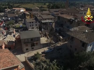
Drones Capture Italy’s Earthquake Scene
0 Views0 Comments0 Likes
Italian Prime Minister Matteo Renzi visited the site of an earthquake in Italy on Wednesday and pledged government support for the the affected area. Drone footage showed damage to buildings, some of which were completely reduced to rubble. (Aug. 24)
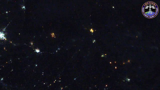
Meteors Encountering Earth’s Atmosphere
0 Views0 Comments0 Likes
This video was acquired August 10, 2016, with a high-resolution video camera onboard the International Space Station (ISS). Within the span of about 10 seconds, two meteors associated with the Perseid meteor shower streak across the sky above Pakistan. Video was provided by Tomoko Arai/Japan’s Planetary Exploration Research Center/Meteor Composition Determination (Meteor) investigation.

Google Geospatial Technologist Talks Trends
0 Views0 Comments0 Likes
INTERGEO TV interviews Ed Parsons, geospatial technologist at Google, about his thoughts on the future of the map and related technology.
Reshuffling Heat on a Warming Planet
0 Views0 Comments0 Likes
Earth's oceans could be concealing a mystery about climate change. Researchers have recently found evidence of hidden heat hundreds of meters below the ocean's surface.

8_4 Infrastructure Broadcast (TIGER Grants, Transit Tech and More)
0 Views0 Comments0 Likes
This Infrastructure-themed GeoSpatial Stream broadcast discusses $500 million in grants from the USDOT's TIGER program; highlights from the latest issue of Informed Infrastructure magazine; new virtual reality technology to promote transit; industry news from Pix4D, Thinkbox Software and the Global Infrastructure Hub; a video from the Mississippi Watershed Management Organization about a stormwater filtration system recently installed near Minneapolis; and more.

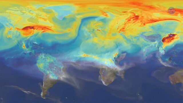
NASA Sees Intense Fires around the World
0 Views0 Comments0 Likes
This year’s wildfire season is off to a blazing start. The United States had an early start to the season, with more than 29,000 wildfires burning more than 2.6 million acres of land. The driest season in 14 years has left the southern Amazon primed for heavy wildfire activity as well.
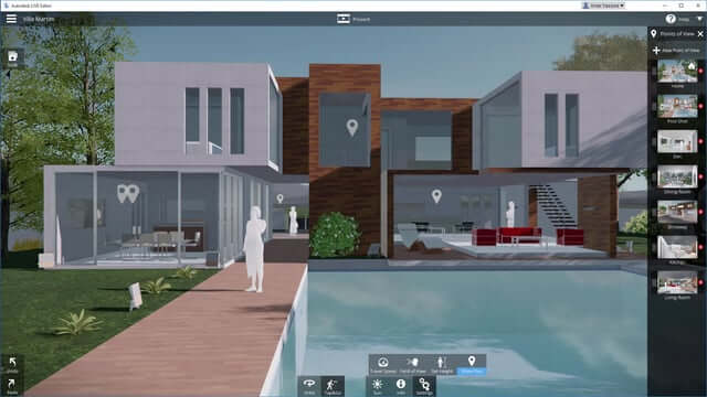
Autodesk LIVE Brings Interactive Storytelling to Life
0 Views0 Comments0 Likes
Autodesk Inc. recently launched Autodesk LIVE, a new interactive visualization service that offers Revit users in the architecture, engineering and construction industries (AEC) the ability to transform their designs into fully interactive 3D models. This video provides a demo of the new technology.


