


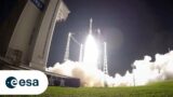
ESA’s Hera Mission Launch Highlight
0 Views0 Comments0 Likes
ESA’s Hera mission lifted off on a SpaceX Falcon 9 from Cape Canaveral Space Force Station in Florida on 7 Oct. 7, 2024. Hera is ESA’s first planetary defence mission. It will fly to a unique target among the 1.3 ...

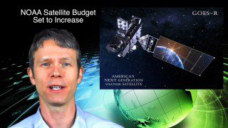
NOAA Debuts First Imagery from GOES-19
0 Views0 Comments0 Likes
On Sept. 18, 2024, NOAA shared the first images of the Western Hemisphere from its GOES-19 satellite. The satellite’s Advanced Baseline Imager (ABI) instrument recently captured stunning views of Earth. GOES-19, N...
A Look Back at Sentinel-2C’s Ride into Space on Vega
0 Views0 Comments0 Likes
The third Copernicus Sentinel-2 satellite, Sentinel-2C, has launched aboard the last Vega rocket, flight VV24, from Europe’s Spaceport in French Guiana. The rocket lifted off on 5 September at 03:50 CEST (4 September ...

Discovering Earth’s Third Global Energy Field
0 Views0 Comments0 Likes
High above the Earth’s North and South Poles, a steady stream of particles escapes from our atmosphere into space. Scientists call this mysterious outflow the “polar wind,” and for almost 60 years, spacecraft have bee...

Advancing Weather Forecasting in a Changing Climate
0 Views0 Comments0 Likes
The effects of the climate crisis are felt more acutely in the Arctic than anywhere else on the planet. The weather in the Arctic is not only severe, but it changes extremely quickly. More frequent data are urgently n...

The Role of the Fire Service in Creating Healthy Community Landscapes
0 Views0 Comments0 Likes
The Wildland-Urban Interface is the zone of transition between unoccupied land and human development. It is the line, area, or zone where structures and other human develop meet or intermingle with undeveloped wildlan...

Up Close and Personal: Ariane 6 Liftoff From the Launchpad
0 Views0 Comments0 Likes
After years of preparations, the Vulcain main stage engine ignites, arms providing cryogenic fuels to the rocket until the very last moment retract and boosters fire – Ariane 6 is space-bound. As it lifts off, vast am...

Europe’s Next Big Rocket In a Nutshell
0 Views0 Comments0 Likes
Ariane 6 is the newest rocket in a series that has, for five decades, been launching Europe towards the stars. Building on all the knowledge, expertise and technology developed over the years, Ariane 6 will be versati...