
Browse Archives

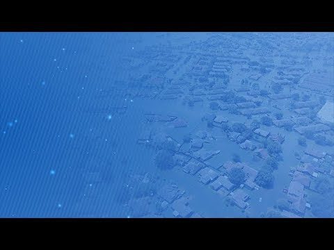
5_15 Asia-Pacific Broadcast (Sri Lanka Transit GIS, China World Map and More)
0 Views0 Comments0 Likes
This Asia-Pacific-focused GeoSpatial Stream broadcast discusses a train accident in Sri Lanka and how a new GIS may prevent future collisions; India's groundwater mapping; China's World Map online; Australia's 2014 Esri Young Scholars Award winner; industry headlines from Trimble, Tencent and NavInfo, and NZ Aerial Mapping; the World Under Water Web site; and more.

Fujisawa Sustainable Smart Town Goes Into Full-Scale Operation
0 Views0 Comments0 Likes
Fujisawa SST begins full-scale operation, following the completion of “Fujisawa SST SQUARE,” its core facility.

NASA and Agriculture: From Seeds to Satellites
0 Views0 Comments0 Likes
NASA satellites, data, missions and programs have been put to use for decades to strengthen food security, track droughts and flooding, determine plant and soil health, and otherwise support agriculture decision maki...

4_2 Infrastructure Broadcast (Landsat and Flood Risk, Cloud-Based Tools, and More)
0 Views0 Comments0 Likes
This infrastructure-focused GeoSpatial Stream broadcast discusses how Landsat is helping with flood risk to infrastructure; North Carolina using cloud-based property data; a Regional Road Construction Map in Spokane; industry news from Columbia Pipeline Group, Synergis, Cityworks and Bentley Systems; surveying in the British Virgin Islands; the Technology of Walking; and more.
Five Years of GPM Storms
0 Views0 Comments0 Likes
On Feb. 27, 2019, we celebrated five years in orbit for the NASA/JAXA Global Precipitation Measurement mission (GPM).
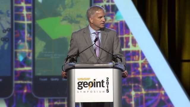
Robert Cardillo, NGA Director – Keynote Full Presentation | GEOINT 2015
0 Views0 Comments0 Likes
USGIF's Trajectory On Location published this video of the keynote presentation delivered by Robert Cardillo, director of the National Geospatial-Intelligence Agency, at the GEOINT Symposium 2015.
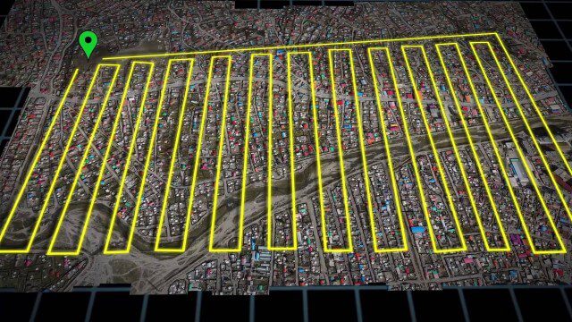
UAV-Based Aerial Mapping of Ulaanbaatar
0 Views0 Comments0 Likes
Working with the City of Ulaanbaatar, The Asia Foundation collected high-quality imagery and elevation data for the city using Unmanned Aerial Vehicles (UAVs) and earth-imaging satellites. These high-resolution images were used to create detailed maps complete with elevation data; labeled neighborhoods, roads, buildings, landmarks, and other features.

Interview with Esri President Jack Dangermond
0 Views0 Comments0 Likes
In November 2019, Informed Infrastructure Editorial Director Todd Danielson interviewed Esri President Jack Dangermond at the Autodesk University (AU) Conference in Las Vegas.
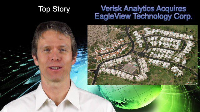
1_16 Acquisitions Broadcast (EagleView Acquired, Universe Explored, Shark Sensors and More)
0 Views0 Comments0 Likes
This GeoSpatial Stream broadcast examines Verisk Analytics' acquisition of EagleView Technology Corp., the size of the universe, Great White Shark sensors, contaminated water maps and more.

3_6 ILMF Broadcast (Conference Recap, USGS News, Aerial Imagery Market and More)
0 Views0 Comments0 Likes
This GeoSpatial Stream broadcast discusses the recent International LiDAR Mapping Forum, important USGS news, the future of the aerial imagery market, a map contest, and more.


