
Browse Archives

Autodesk and the Future of the Built Environment
0 Views0 Comments0 Likes
The V1 Video team interviewed Aaron Morris, General Manager of the Reality Solutions Group at Autodesk, at the 2016 SPAR 3D Expo and Conference, held April 11-14 in The Woodlands, Texas. He discusses several new developments at Autodesk, including the company's ReCap products and its new pricing model, new data services to make analysis easier, scan-to-mesh services for asset management, and how reality capture will replace existing methods of asset documentation.
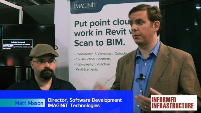
IMAGINiT Talks BIM and Lifecycle Management
0 Views0 Comments0 Likes
The V1 Video team was at Autodesk University 2015 in Las Vegas and interviewed Carl Storms, Senior Application Expert, and Matt Mason, Director of Software Development, both with IMAGINiT Technologies. They discussed BIM use throughout a project's lifecycle, the company's Clarity owner data portal and its benefits to users, and the latest updates for its Scan to BIM product for use with Revit.
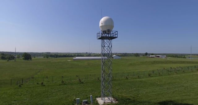
Radar Making Rainfall Forecasts More Accurate
0 Views0 Comments0 Likes
Researchers from the University of Missouri have developed a system that improves the precision of forecasts by accounting for evaporation in rainfall estimates, particularly for locations 30 miles or more from the nearest National Weather Service radar.
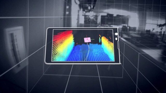
Google’s Project Tango
0 Views0 Comments0 Likes
Project Tango is an exploration into giving mobile devices a human-scale understanding of space and motion.

Hexagon Solutions CEO Discusses Growing Marketplace
0 Views0 Comments0 Likes
Todd Danielson interviews Claudio Simão, President and CEO, Hexagon Solutions, at the HxGN LIVE event in Las Vegas, Nevada. They discuss the goals of Hexagon Solutions in terms of market needs, this evolving division within Hexagon, the ripe environment for acquisitions, and more.
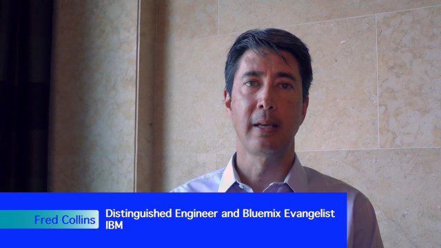
Geospatial as an Integral Part of Information Management
0 Views0 Comments0 Likes
The V1 Video team interviewed Fred C. Collins, Ph.D., Distinguished Engineer and Bluemix Evangelist at IBM, at the ENVI Analytics Symposium in Boulder, Colo. Bluemix is the company’s platform-as-a-service that supports geospatial as a key component of the architecture. We spoke about the growing awareness and reliance on geospatial capabilities for data management and analysis, and the flexibility of the Bluemix cloud-based tools that can be extended with hundreds of services.

How DARPA Is Planning Fast, Cheap Satellite Launches
0 Views0 Comments0 Likes
Called the Airborne Launch Assist Space Access or ALASA program, it would be able to send satellites weighing 100 pounds or less into low-Earth orbit within 24 hours for less than $1 million per launch.

NASA Earth at Night
0 Views0 Comments0 Likes
In daylight our big blue marble is all land, oceans and clouds. But the night - is electric. This view of Earth at night is a cloud-free view from space as acquired by the Suomi National Polar-orbiting Partnership Satellite (Suomi NPP).
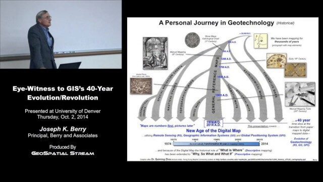
Joe Berry’s “Eye-Witness to GIS’s 40-Year Evolution/Revolution” Presentation
0 Views0 Comments0 Likes
In the 40 years since the development of the digital map, what a map is (and isn’t) has greatly evolved. This presentation describes Joe Berry’s personal journey in geotechnology as a student, professor, consultant, software developer and entrepreneur. The insight is as relevant for the next generation of GIS’ers as it is to GIS cohorts who moved beyond mapping to “thinking with maps” and the boundless opportunities for integrating the new spatial paradigm into science, workplaces and daily lives.
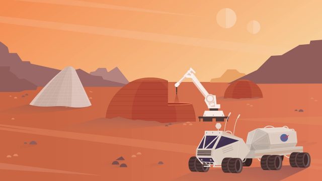
NASA’s 3-D Printed Habitat Challenge
0 Views0 Comments0 Likes
NASA Centennial Challenges wants YOUR help building a 3-D printed habitat on Mars. NASA and its partners are holding a $2.5 million competition to build a 3D printed habitat for deep space exploration, including the agency’s journey to Mars.


