
Browse Archives

2015 Geodesign Summit Rapidly Approaching, Highlights Discussed
0 Views0 Comments0 Likes
Shannon McElvaney, Esri's Community Development Manager, notes some of the speaker and event highlights for the upcoming 2015 Geodesign Summit to be held Jan. 22-23, 2015, in Redlands, Calif. This "transdisciplinary" event has a place for anyone looking to help create a better world through informed, collaborative design.

Elmer Bol Interview (Autodesk)
0 Views0 Comments0 Likes
Matt Ball interviews Elmer Bol, Director of Product Management, Autodesk, at SPAR International in Colorado Springs, Colo. They discuss Reality Capture solutions, evolution in the construction industry, laser scanning, Autodesk products, data capture and mining, change detection, and more.
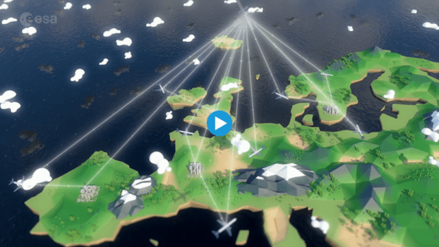
Iris: SATCOM for Aviation
0 Views0 Comments0 Likes
Iris will provide a safe and secure text-based data link between pilots and air-traffic control networks using satellite technology.

Australian Engineers Using BIM on Major Projects
0 Views0 Comments0 Likes
The V1 Video team was at Autodesk University 2015 in Las Vegas and interviewed Mark Patis, Technical Executive, Design, WSP Parsons Brinckerhoff. He discussed model-based design and how to gain project efficiencies, some major engineering projects in Australia, 3D modeling, and the power of visualization.

6_16 Infrastructure Broadcast (PDH Credit, HxGN Live and More)
0 Views0 Comments0 Likes
This Infrastructure-themed GeoSpatial Stream broadcast discusses the latest issue of Informed Infrastructure, including an article on Treasure Island bridge design, PDH credit for an Autodesk benchmark study, and new Web site features and interviews; video clips from the recent HxGN Live event covering Hexagon's latest technologies and direction; industry news from Hexagon, CINTEC America, Contech Engineered Solutions and CoreLogic; thoughts on an upcoming road trip across America's infrastructure; and more.

Mike Tully Interview (Aerial Services Inc.)
0 Views0 Comments0 Likes
Matt Ball interviews Mike Tully, President and CEO, Aerial Services Inc., at SPAR International in Colorado Springs, Colo. They discuss remote sensing and airborne LiDAR in a variety of industries, sensor diversity, streamlining data delivery, and industry disruption due to unmanned aerial systems.

The YEARS Project: Warming Oceans
0 Views0 Comments0 Likes
Scientists have discovered that the world's oceans are warming 40% faster than we thought. That has dire implications for sea creatures and people.
NASA Satellite Measures Human Impact in Water Storage
0 Views0 Comments0 Likes
To investigate humans’ impact on freshwater resources, scientists have now conducted the first global accounting of fluctuating water levels in Earth’s lakes and reservoirs–including ones previously too small to measu...

NOAA Debuts First Imagery from GOES-19
0 Views0 Comments0 Likes
On Sept. 18, 2024, NOAA shared the first images of the Western Hemisphere from its GOES-19 satellite. The satellite’s Advanced Baseline Imager (ABI) instrument recently captured stunning views of Earth. GOES-19, N...


