
Browse Archives
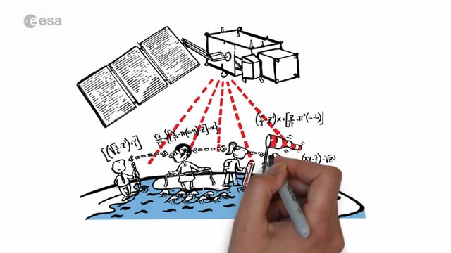
Sentinel-3 for Oceans
1.56K Views0 Comments0 Likes
In honor of the launch of Sentinel-3A on Feb. 16, 2016, here's a video about the satellite: Covering 70% of the planet, the oceans are directly linked to our weather and climate. They are also essential for global transport and provide a wealth of resources. What happens far out to sea has a direct effect on societies all over the world. Sentinel-3 provides crucial observations of our oceans, helping us to understand the overall health of our planet.
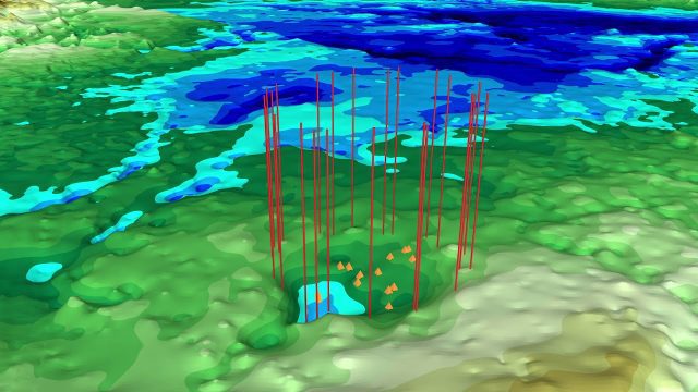
NASA Finds Second Massive Greenland Crater
872 Views0 Comments0 Likes
A NASA-led team discovered the feature using satellite data of the surface of the Greenland Ice Sheet as well as radar measurements from the airborne campaign Operation IceBridge.
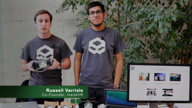
InsiteVR Takes Virtual Reality Beyond Gaming, into Design
9.03K Views0 Comments0 Likes
InsiteVR helps viewers better understand a variety of designs by experiencing them from a realistic perspective. On behalf of V1 Media, Informed Infrastructure and GeoSpatial Stream, Todd Danielson interviewed Angel Say and Russell Varriale, co-founders of InsiteVR, at the Geodesign Summit 2015 in Redlands, Calif.
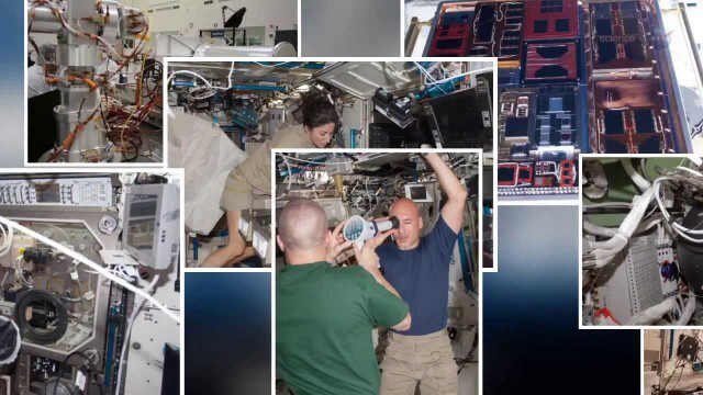
International Space Station Gets a Ten-Year Extension
2.49K Views0 Comments0 Likes
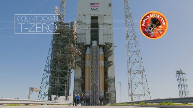
Flying Faster, Hotter and Closer Than Ever to the Sun
923 Views0 Comments0 Likes
NASA's Parker Solar Probe and its United Launch Alliance Delta IV Heavy launch vehicle prepare for an unprecedented mission to "kiss the Sun."
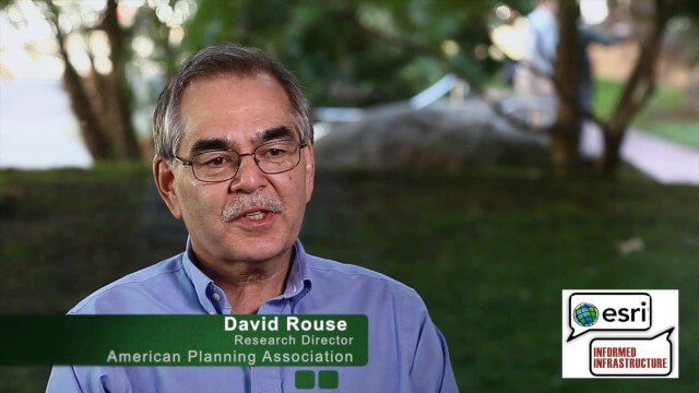
David Rouse Discusses Sustainable Places at the Geodesign Summit
5.46K Views0 Comments0 Likes
David Rouse, Research Director for the American Planning Association (APA), oversees the Planning Advisory Service and the three National Centers for Planning (Green Communities, Hazards Planning, and Planning and Community Health). On behalf of V1 Media, Informed Infrastructure and GeoSpatial Stream, Todd Danielson interviewed Rouse at the Geodesign Summit 2015 in Redlands, Calif.
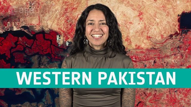
Earth from Space: Western Pakistan
798 Views0 Comments0 Likes
In this week's edition of the Earth from Space program, Copernicus Sentinel-2 takes us over western Pakistan and an important wetland area.
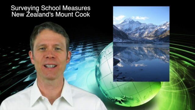
3_19 Asia Pacific Broadcast (Malaysia Airlines Search, India Water Tool and More)
3.86K Views0 Comments0 Likes
This Asia-Pacific-themed GeoSpatial Stream broadcast discusses Geoscience Australia's seafloor mapping efforts in the continued search for Malaysia Airlines Flight 370; India mapping schools and water; surveyors measuring the height of New Zealand's tallest peak, Mount Cook; industry news from Esri India, Locate15, ISRO and Google; powerful maps created by children in India of the slums they live in and how they'd like to see them rebuilt; and more.
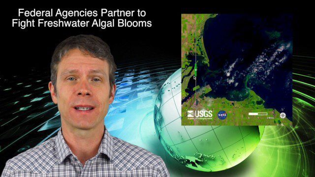
4_9 Earth Imaging Broadcast (3-D Data Capture, Drones and More)
3.77K Views0 Comments0 Likes
This GeoSpatial Stream broadcast discusses highlights from the recent SPAR International 3D measurement and imaging conference in Houston; federal agency partnerships to monitor and prevent dangerous algal blooms; a technology partnership to improve the efficiency of snow-grooming machines; industry news from Esri and rapidlasso; an impressive drone video; and more.

6_19 Asia-Pacific Broadcast (Toxic Sites, Bird Flu Maps and More)
5.44K Views0 Comments0 Likes
This Asia-Pacific-focused GeoSpatial Stream broadcast discusses an analysis from the Global Alliance on Health and Pollution; 3D images of the Fukushima Daiichi nuclear complex; an Indonesia forestry map; bird flu maps; China's Fengyun-3C satellite; India's Bhaskaracharya Institute for Space Applications and Geoinformatics; industry headlines from AAM and JTRS Registered Surveyor, Fugro, VisionMap and Acute3D, and Supergeo; the "Poisoned Poor"; and more.


