
Browse Archives
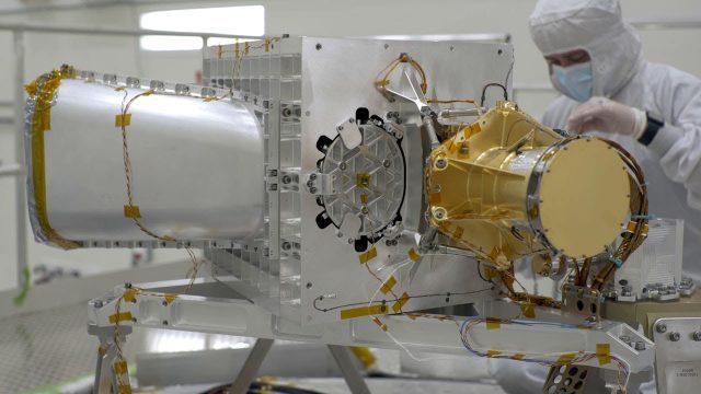
What Is NASA’s Earth Surface Mineral Dust Source Investigation (EMIT)? (Mission Overview)
0 Views0 Comments0 Likes
Soon to be operating from the International Space Station, NASA’s Earth Surface Mineral Dust Source Investigation (EMIT) mission will comprehensively measure the mineral composition of Earth’s mineral dust source reg...
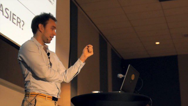
GeCo in the Rockies Keynote Discusses Power of Words for Location
0 Views0 Comments0 Likes
Chris Sheldrick from what3words delivered the keynote address at the GeCo in the Rockies event held Sept. 22-26, 2014, in Grand Junction, Colo. Sheldrick talked about how short combinations of words (three exactly) could be used to pinpoint every location in the world to within nine square meters.

Earth from Space: Glacier Bay, Alaska
0 Views0 Comments0 Likes
In this week's edition of the Earth from Space program, we explore part of the Glacier Bay National Park and Preserve, Alaska, with Copernicus Sentinel-2.
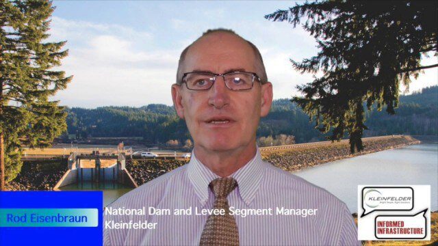
Kleinfelder Interview – Rod Eisenbraun, National Dam and Levee Segment Manager
0 Views2 Comments0 Likes
Informed Infrastructure spoke with Rod Eisenbraun, national dam and levee segment manager, at the opening of Kleinfelder’s new office in downtown Denver. The conversation covered dam creation and rehabilitation, the need for more storage with increasing droughts, the more environmentally friendly approaches these days, and hydro power as a clean power source.

NASA/JAXA GMI Sensor for Precipitation Measurement
0 Views0 Comments0 Likes
On March 10, the Core Observatory passed over an extra-tropical cyclone On March 10, the Core Observatory passed over an extra-tropical cyclone about 1055 miles (1700 kilometers) due east of Japan's Honshu Island. Satellite data shows the full range of precipitation in the storm.

5_12 Infrastructure Broadcast (Earthquakes, Streetcars and More)
0 Views0 Comments0 Likes
This Infrastructure-themed GeoSpatial Stream broadcast covers the devastating earthquake in Ecuador on April 16, 2016, and relief efforts from Miyamoto International to help rebuild the city's hard-hit infrastructure; a recently opened $100-million-dollar streetcar project in Kansas City; industry news from Trimble, Bentley Systems, Transoft Solutions and Autodesk; a video interview clip about Chicago's famed 150 N. Riverside Building; and more.

7_23 Infrastructure Broadcast (AEC Market Reports, Smart Cities and More)
0 Views0 Comments0 Likes
This Infrastructure-themed GeoSpatial Stream broadcast discusses an optimistic AEC market report; a $16 billion commitment from the state of Washington for transportation improvements; a new LADOT public Web map for smart communities; laser scanning in Mexico; industry news from SmarterBetterCities, Topcon Positioning Group and PaveXpress; thoughts on seeing Informed Infrastructure in action in Chicago; and more.

Elkhorn Slough Reserve Estuary Explorers
0 Views0 Comments0 Likes
Estuary Explorers allows a group of local students to visit the Elkhorn Slough Reserve once a week for four years. It is through this deep experience that new stewards of the Reserve emerge and grow.
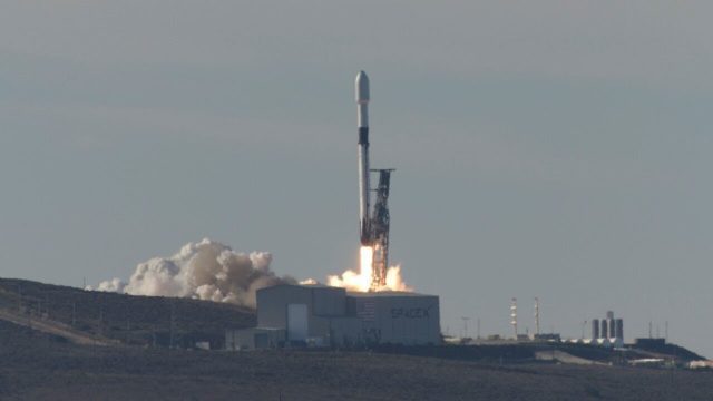
Copernicus Sentinel-6 Michael Freilich Liftoff Replay
0 Views0 Comments0 Likes
Watch the replay of Copernicus Sentinel-6 Michael Freilich lifting off from the Vandenberg Air Force Base, Calif., on Nov. 21, 2020. Copernicus Sentinel-6 Michael Freilich is the first of two identical satellites to provide critical measurements of sea-level change.
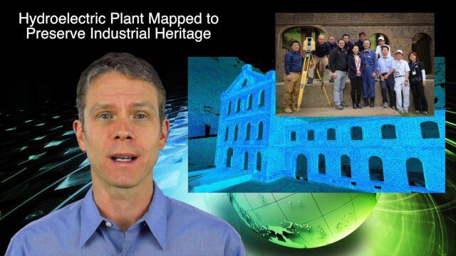
5_14 Infrastructure Broadcast (Nepal Update, 3-D Mapping and More)
0 Views0 Comments0 Likes
This Infrastructure-based GeoSpatial Stream broadcast provides an update from the latest earthquake in Nepal as well as related maps from Caltech and JPL concerning the area's geology and effects; 3-D mapping of an industrial heritage site in Japan; industry news from Trimble, Leica Geosystems and IMAGINiT; Nepal relief work geared toward rebuilding the area; and more.


