
Browse Archives

4_16 Drones/UAS Broadcast (Earth Day, Mysterious Methane and More)
0 Views0 Comments0 Likes
This GeoSpatial Stream broadcast discusses important FAA practices impacting drone/UAS use; an article that digs deeper into the many possible consequences of FAA's actions; a mysterious methane hotspot in the U.S. Four Corners area; industry news from Hexagon, Airbus Defence and Space, and SimActive; Earth Day; and more.
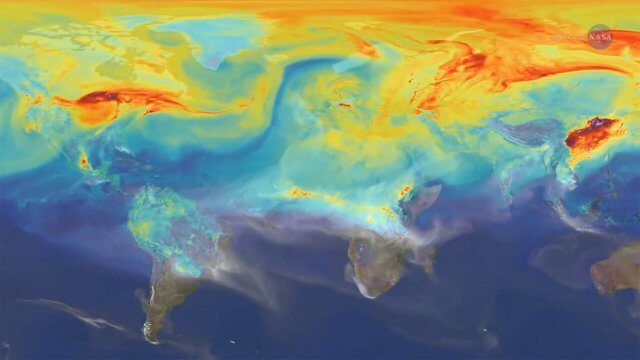
2023 Was the Hottest Year on Record
0 Views0 Comments0 Likes
2023 was Earth’s warmest year since 1880, and the last 10 consecutive years have been the warmest 10 on record. But why does NASA, a space agency, look at Earth’s temperature? And how do we even measure global tempera...
Reshuffling Heat on a Warming Planet
0 Views0 Comments0 Likes
Earth's oceans could be concealing a mystery about climate change. Researchers have recently found evidence of hidden heat hundreds of meters below the ocean's surface.
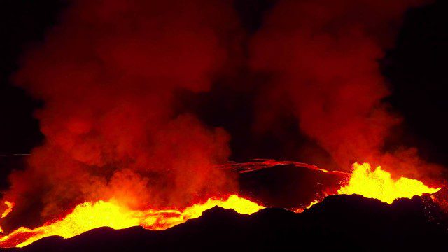
Drones Capture Images of Erupting Iceland Volcano, Part 2
0 Views0 Comments0 Likes
A companion piece to the first DJI Feat, which takes viewers on a journey close to the active lava eruptions of the Bardarbunga volcanic system in remote Iceland. Footage was captured with DJI Phantom 2 quadcopters using Lightbridge for wireless, high-definition remote video.
LiDAR – Introduction to Light Detection and Ranging
0 Views0 Comments0 Likes
This video presents LiDAR of light detection and ranging, an active remote sensing system that uses laser energy, to measure the heights of objects like trees and buildings and even the ground. This video was developed by the National Ecological Observatory Network (www.neoninc.org).
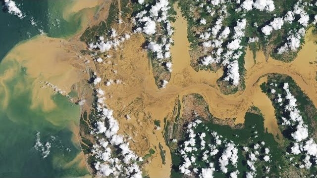
A Celebration of Clouds
0 Views0 Comments0 Likes
Clouds can be a nuisance when scientists are trying to observe features on Earth's surface. But at other times, clouds are exactly what they want to see. These images highlight some of the more unusual and beautiful...

The Global Sensor Network – University of South Australia
0 Views0 Comments0 Likes
Australia has a combined land and sea territory of more than 8 million square kilometers. Yet most of this is currently out of the reach of affordable communication. Now the University of South Australia's Institute for Telecommunications Research has turned this on its head, with the development of the Global Sensor Network. The Global Sensor Network is an innovative signal processing system which provides low cost, two-way, simultaeneous satellite communications to multiple users.
PEACE on Earth GPS Art
0 Views0 Comments0 Likes
I traveled over 65,700 miles to meet people from all around the world to help me create a GPS drawing that would express a simple message. This is my journey.
The Power of Geodesign
0 Views0 Comments0 Likes
GeoSpatial Stream created this fast-paced music video that quickly summarizes the power of geodesign, based on footage and ideas found at Esri's annual Geodesign Summit.
Skybox Imaging Captures World’s First High-Resolution, HD Video of Earth from Space
0 Views0 Comments0 Likes


