


Category: Found on the Internet
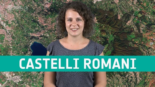
Earth from Space: Castelli Romani
676 Views0 Comments0 Likes
In this week's edition of the Earth from Space program, Copernicus Sentinel-2 takes us over a set of small towns, located around 20 km southeast of Rome, Italy and known collectively as Castelli Romani.

Software Aids Stormwater and Sewage Infrastructure Design
1.36K Views0 Comments0 Likes
Urbano software is used for the design of sewage and water distribution networks. Urbano Canalis is the module used for design of storm and sanitary sewage systems. You can create complete storm and sanitary sewage system designs, starting from the initial network definition to the analysis of hydraulic results.
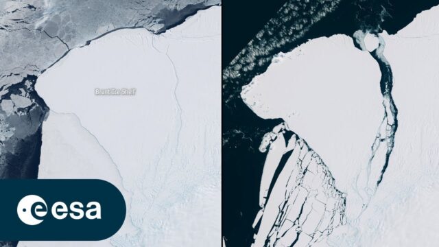
Iceberg Larger than London Breaks off Brunt
0 Views0 Comments0 Likes
An iceberg around the size of Greater London broke off Antarctica’s Brunt Ice Shelf due to a natural process called ‘calving.’ The iceberg, measuring 1550 square kilometers, detached from the 150-meter-thick ice shelf...

Toward the Next Generation of Air-Quality Monitoring
0 Views0 Comments0 Likes
Air pollution is the largest environmental health risk in Europe and significantly impacts the health of the European population, particularly in urban areas. Following on from the Sentinel-5P satellite – the first...
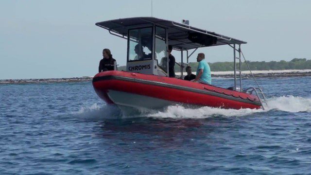
CORAL Probes Great Barrier Reef
1.58K Views0 Comments0 Likes
The three-year COral Reef Airborne Laboratory (CORAL) mission will survey a portion of the world's coral reefs to assess the condition of these threatened ecosystems and understand their relation to the environment, including physical, chemical and human factors.

Elkhorn Slough Reserve Estuary Explorers
4.61K Views0 Comments0 Likes
Estuary Explorers allows a group of local students to visit the Elkhorn Slough Reserve once a week for four years. It is through this deep experience that new stewards of the Reserve emerge and grow.

Happy GIS Day 2019: A Message from Jack Dangermond
837 Views0 Comments0 Likes
Jack Dangermond wishes the world a happy GIS Day 2019. Jack thanks all the event organizers and participants and explains the importance of their events in this 20th year celebration of GIS.
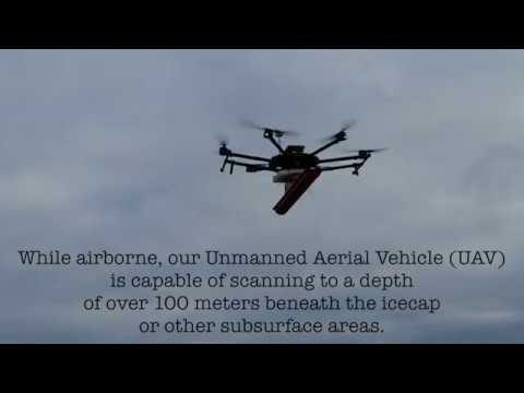
Drone with Ground Penetrating Radar (GPR)
1.67K Views0 Comments0 Likes
GPR Drone technology can be used in areas where deep ground penetration is required but high resolution is not very important.
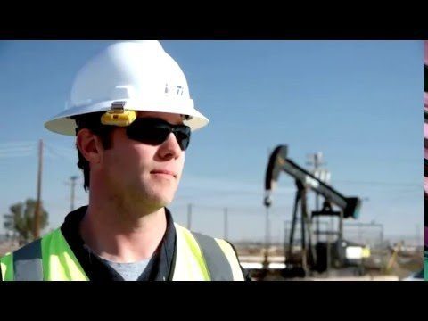
Unmanned Flights Take to San Joaquin Valley Skies
1.34K Views0 Comments0 Likes
In the San Joaquin Valley, Chevron launched unmanned aerial systems above its Coalinga Field to capture high-resolution and thermal imagery as part of a pilot project to incorporate the technology in its day-to-day field operations.
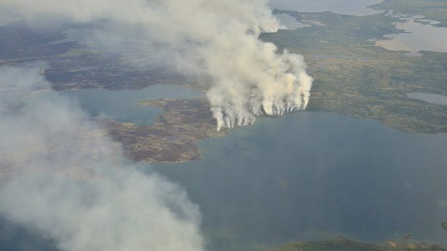
NASA Studies How Arctic Wildfires Change the World
892 Views0 Comments0 Likes
Wildfires in the Arctic often burn far away from population centers, but their impacts are felt around the globe. From field and laboratory work to airborne campaigns and satellites, NASA is studying how climate chang...


