
Browse Archives
Earth from Space: Ganges Delta
0 Views0 Comments0 Likes
This week's edition of the Earth from Space program explores the Ganges Delta, the world’s largest river delta, with Copernicus Sentinel-3.
4_28 Earth Imaging Broadcast (Sentinel, Drones and More)
0 Views0 Comments0 Likes
This Earth Imaging-themed GeoSpatial Stream broadcast discusses the recent successful launch of the European Space Agency's Sentinel 1-B satellite; UAS (or drone) news about a 3D-printed vehicle helping ships navigate Antarctic seas as well as the economic impact of the Micro Aerial Vehicle market; a NASA study on the greening of Earth caused by increased carbon dioxide; industry news from 5D Robotics, LizardTech, the U.S. Geospatial Intelligence Foundation and Teledyne Optech; a video about the Sentinel satellites capabilities; and more.
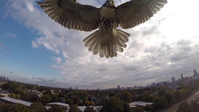
Hawk Attacks a Drone
0 Views0 Comments0 Likes
A hawk is recorded attacking (and defeating) an aerial drone.
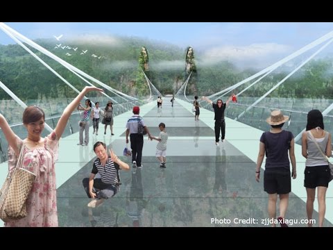
Safety Test of World’s Longest Glass Bridge
0 Views0 Comments0 Likes
The world's highest and longest glass bridge, Zhangjiajie Grand Canyon Glass Bridge, opened to the public on Aug. 20, 2016. It offers a way to enjoy a panoramic view of the stunning Zhangjiajie Grand Canyon — if you dare to walk on it!

Minnesota Solar Suitability Analysis
0 Views0 Comments0 Likes
This app enables users to identify the suitability of a location for solar panel installations by locating their home or current location and querying solar analysis data.
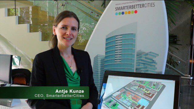
SmarterBetterCities Returns to Geodesign Summit
0 Views0 Comments0 Likes
SmarterBetterCities uses innovative Web-based tools, such as Cloud Cities and 3D Cities Libraries, that allow users to create 3D content and scenarios for urban planning. On behalf of V1 Media, Informed Infrastructure and GeoSpatial Stream, Todd Danielson interviewed Antje Kunze, CEO of SmarterBetterCities, at the Geodesign Summit 2015 in Redlands, Calif.

4_22 GEOINT Broadcast (Keynote Highlights, Major News and Developments, and More)
0 Views0 Comments0 Likes
This GeoSpatial Stream broadcast from the GEOINT Symposium in Tampa, Fla., recaps the major highlights and news from the event, including keynote addresses from James R. Clapper, Director of National Intelligence; Letitia A. Long, Director, National Geospatial-Intelligence Agency; and Lt. Gen. Michael T. Flynn, U.S. Army, Director of the Defense Intelligence Agency. The broadcast also covers major news announcements from the U.S. Geospatial Intelligence Foundation, Boeing, Surrey Satellite Technology U.S., Airbus Defense & Space, and more.
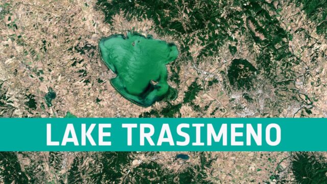
Earth from Space: Lake Trasimeno
0 Views0 Comments0 Likes
In this week's edition of the Earth from Space program, the Copernicus Sentinel-2 mission takes us over Lake Trasimeno, the fourth largest lake in Italy.
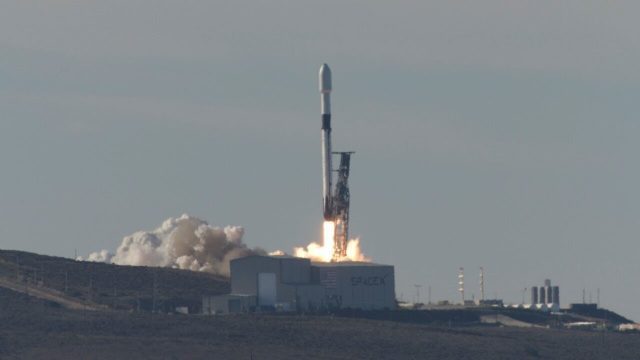
Copernicus Sentinel-6 Michael Freilich Liftoff Replay
0 Views0 Comments0 Likes
Watch the replay of Copernicus Sentinel-6 Michael Freilich lifting off from the Vandenberg Air Force Base, Calif., on Nov. 21, 2020. Copernicus Sentinel-6 Michael Freilich is the first of two identical satellites to provide critical measurements of sea-level change.

Creating 3D Models from Drone Imagery
0 Views0 Comments0 Likes
The V1 Video team interviewed Antoine Martin, Business Manager of Pix4D’s operations in the United States, at the 2015 Esri User Conference in San Diego. We spoke about the growing interest in creating useful data from drone platforms as well as the many use cases for Pix4Dmapper software for automated image processing. The company has focused on the simplification of photogrammetric science to enable users to create accurate maps and 3D models from this imagery.


