


Category: Found on the Internet
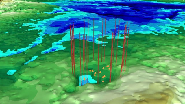
NASA Finds Second Massive Greenland Crater
0 Views0 Comments0 Likes
A NASA-led team discovered the feature using satellite data of the surface of the Greenland Ice Sheet as well as radar measurements from the airborne campaign Operation IceBridge.
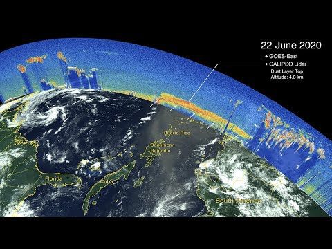
CALIPSO Observes Saharan Dust Transport
0 Views0 Comments0 Likes
The Cloud-Aerosol Lidar and Infrared Pathfinder Satellite Observations (CALIPSO) satellite—a joint venture between NASA and the French space agency, Centre National d'Etudes Spatiales (CNES)—observed the plume as it traveled across the ocean and eventually affected the mainland of the United States.
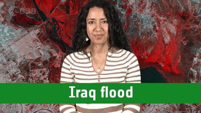
Earth from Space: Iraq Flood
0 Views0 Comments0 Likes
The Copernicus Sentinel-1 satellite takes us over one of the areas in Iraq that suffered flooding recently in this edition of the #EarthfromSpace program.
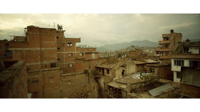
Crisis Mapping in Nepal
0 Views0 Comments0 Likes
On the 25th of April, Nepal was hit by the worst earthquake the small, mountainous country had ever seen. Leaving thousands dead and hundreds of thousands displaced, the Ghorka Earthquake as it would become known, uprooted not only cities and villages, but homes and families that had existed in the mountains for centuries. So what could we do to help? Teaming up with with Humanitarian UAV Network “UAViators”, Open Street Map specialists “Kathmandu Living Labs”, 3D Mapping organization, “Pix4D”, smartphone manufacturer “Smartisan” and Kathmandu University, DJI got to work on a plan, a plan that drew together some of the best and brightest of the UAV industry for a life-changing experience.

Unleashing the Power of Earth Observations
0 Views0 Comments0 Likes
What do we see when we look at the Earth, and what do these observations mean for the years ahead? Barbara Ryan, secretariat director of the Intergovernmental Group on Earth Observations (GEO), discusses this Geneva-based, voluntary partnership of governments and organizations dedicated to coordinated, comprehensive, and sustained Earth observations and information — sharing what scientific observers worldwide are learning about the state and health of planet Earth.

Prescribed Forest Fire Frequency Should Be Based on Land Management Goals
0 Views0 Comments0 Likes
Researchers at the University of Missouri have studied forests subjected to different frequencies of fires to determine what effects fire can have on oak forests over long periods of time.

Space Olympics
0 Views0 Comments0 Likes
The International Space Station Expedition 65 crew recorded themselves on a day off after a long week of work having some weightless fun. From Earth orbit, 400 km above our planet, the crew present the very first Spa...
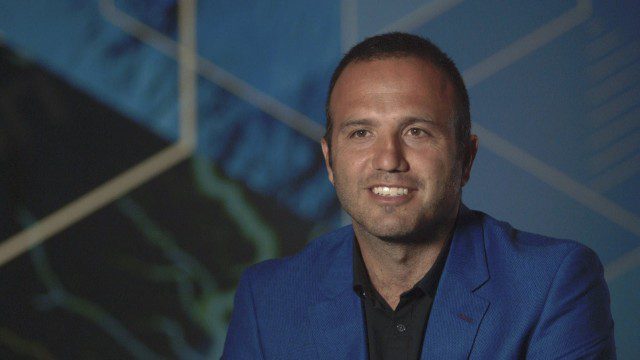
Esri Business Summit: Axel Bedikyan, Cirque du Soleil
0 Views0 Comments0 Likes
Cirque du Soleil turned to ArcGIS when they needed to drive business results. This vibrant company known for its high quality entertainment feels the same care and attention to detail they put into their business is mirrored in Esri’s solutions.
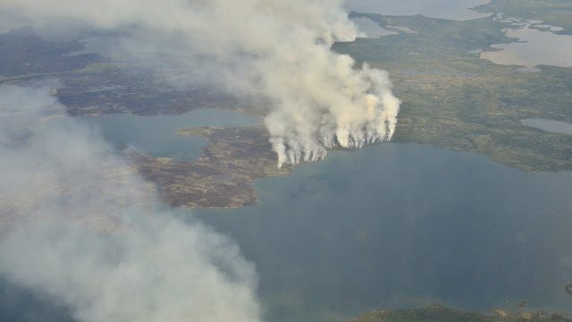
NASA Studies How Arctic Wildfires Change the World
0 Views0 Comments0 Likes
Wildfires in the Arctic often burn far away from population centers, but their impacts are felt around the globe. From field and laboratory work to airborne campaigns and satellites, NASA is studying how climate chang...
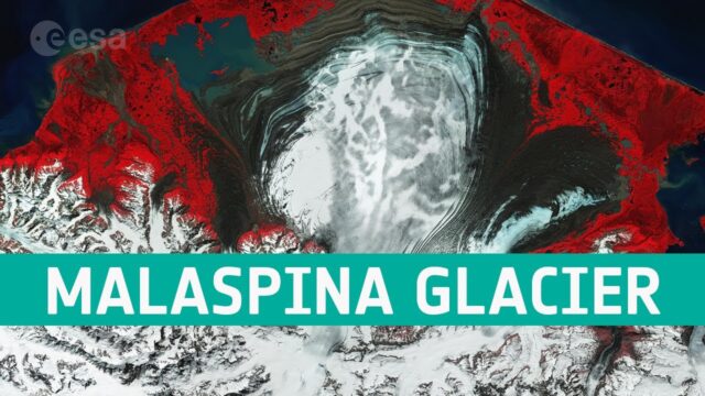
Earth from Space: The Moraines of Malaspina
0 Views0 Comments0 Likes
In this week’s edition of the Earth from Space program, we take a look at the remarkable moraine patterns of Malaspina Glacier – the largest piedmont glacier in the world – through the eyes of Copernicus Sentinel-...


