


Category: Found on the Internet
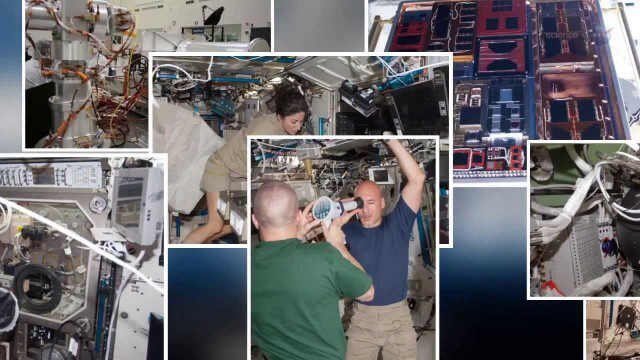
International Space Station Gets a Ten-Year Extension
0 Views0 Comments0 Likes

The Algorithm Marketplace
0 Views0 Comments0 Likes
The Algorithm Marketplace provides automated analysis of aerial data acquired by UAVs (Unmanned Aerial Vehicles). Using sophisticated algorithms, drone operators no longer need a background in geographic information system (GIS) or remote sensing to interpret their aerial data; instead, the marketplace provides an action-based report to improve management of assets.
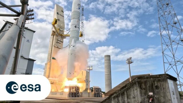
Up Close and Personal: Ariane 6 Liftoff From the Launchpad
0 Views0 Comments0 Likes
After years of preparations, the Vulcain main stage engine ignites, arms providing cryogenic fuels to the rocket until the very last moment retract and boosters fire – Ariane 6 is space-bound. As it lifts off, vast am...

The YEARS Project: Warming Oceans
0 Views0 Comments0 Likes
Scientists have discovered that the world's oceans are warming 40% faster than we thought. That has dire implications for sea creatures and people.
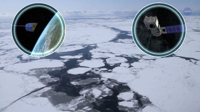
Cool Ways of Studying the Cryosphere
0 Views0 Comments0 Likes
NASA missions are helping scientists study the cryosphere: the many forms of ice found on Earth.
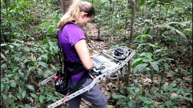
Measuring Forest Structure through a Lidar Lens
0 Views0 Comments0 Likes
Companion video of a New Phytologist paper "Seasonal and drought related changes in leaf area profiles depend on height and light environment in an Amazon forest."

NASA Intro to LIDAR
0 Views0 Comments0 Likes
Want to know the 3D shape of terrain on another planet? Want to study the height and density of Earth's forests? An amazing tool called LIDAR can help! Learn more in this video.

Prescribed Forest Fire Frequency Should Be Based on Land Management Goals
0 Views0 Comments0 Likes
Researchers at the University of Missouri have studied forests subjected to different frequencies of fires to determine what effects fire can have on oak forests over long periods of time.
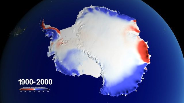
Snow over Antarctica Buffered Sea-Level Rise during Last Century
0 Views0 Comments0 Likes
A new NASA-led study has determined that an increase in snowfall accumulation over Antarctica during the 20th century mitigated sea level rise by 0.4 inches. However, Antarctica’s additional ice mass gained from snowfall only makes up for about a third of its current ice loss.
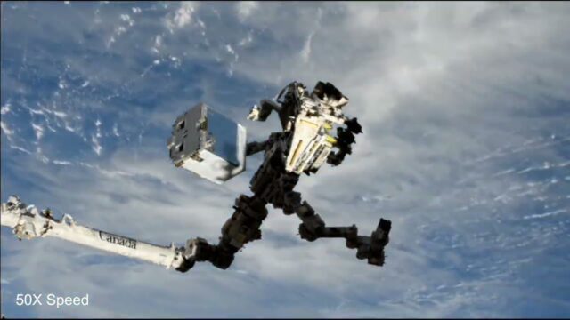
EMIT (Earth Surface Mineral Dust Source Investigation) Gets Installed on International Space Station
0 Views0 Comments0 Likes
This time-lapse video shows the Candarm2 robotic arm of the International Space Station maneuvering NASA’s EMIT mission onto the exterior of the station. Extraction from the SpaceX Dragon spacecraft began around 5:15 ...


