Category: Found on the Internet
Super Blue Blood Moon and Lunar Eclipse
0 Views0 Comments0 Likes
Jan. 31, 2018, brought a lunar trifecta: the super blue blood Moon! Starting at 5:30 a.m. Eastern, NASA TV offered a livestream of the Moon. This full moon is the third in a series of “supermoons,” when the Moon is closer to Earth in its orbit -- known as perigee -- and about 14 percent brighter than usual.
NASA 2020: Are You Ready?
0 Views0 Comments0 Likes
Launching Americans from U.S. soil, sending a new rover to Mars and continuing to prepare for human missions to the Moon are just a few of the things NASA has planned for 2020.
National Forest Monitoring and Assessment Program
0 Views0 Comments0 Likes
The National Forest Monitoring and Assessment program.
ACEC Colorado Award Winner: Data Fusion Predicts Habitat Quality
0 Views0 Comments0 Likes
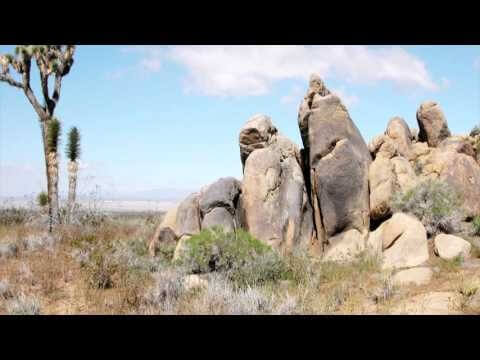
Edwards Air Force Base is located in California’s Mojave Desert, which is home to unique and threatened species such as the desert tortoise, the Joshua tree and desert springparsley. The Air Force monitors impacts of its operations on habitats using multispectral satellite imagery and traditional aerial and field approaches. Hyperspectral imagery and Light Detection and Ranging (LiDAR) remotesensing technologies are being used as more cost-effective methods to collect and analyze spatial data related to habitat quality. Merrick & Company, the primary mapping consultant, was responsible for overall technical implementation, aviation coordination, sensor integration, LiDAR acquisition and point cloud post-processing. Fusing and modeling discreet remotely sensed data from several digital sensors is used to assess habitat quality for inventory and preservation of unique desert species, enabling systematic comparisons to be made over time for effective management of the desert ecosystem. The data also helps to substantiate that operations on Edwards Air Force Base do not degrade habitat quality that may result in the loss of sensitive species in the region.
UAV-Based Aerial Mapping of Ulaanbaatar
0 Views0 Comments0 Likes
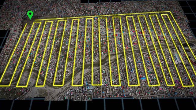
Working with the City of Ulaanbaatar, The Asia Foundation collected high-quality imagery and elevation data for the city using Unmanned Aerial Vehicles (UAVs) and earth-imaging satellites. These high-resolution images were used to create detailed maps complete with elevation data; labeled neighborhoods, roads, buildings, landmarks, and other features.
Earth from Space: Mount Makalu
0 Views0 Comments0 Likes
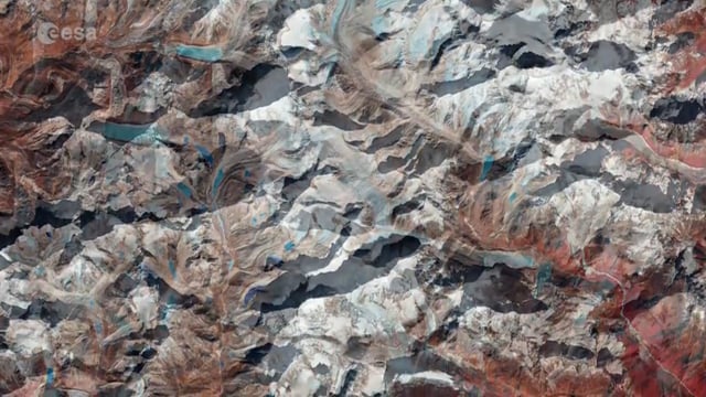
Sentinel-2 takes us over Mount Makalu in the Himalayas where Swedish explorer, mountaineer and climate campaigner, Carina Ahlqvist, led a climb this year.
Mission Possible: Women of the Hubble Space Telescope
0 Views0 Comments0 Likes
When they were growing up, six women couldn’t have imagined that their lives would take them on a journey to NASA to work with the Hubble Space Telescope.
Drone Mapping Haiti (French)
0 Views0 Comments0 Likes
Tracking Three Decades of Dramatic Glacial Lake Growth
0 Views0 Comments0 Likes
In the largest-ever study of glacial lakes, researchers using a 30-year satellite data record have found that the volume of these lakes worldwide has increased by about 50% since 1990 as glaciers melt and retreat due to climate change.
The Birth of a New Island
0 Views0 Comments0 Likes
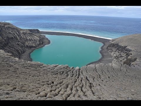
The newly formed Tongan island, unofficially known as Hunga Tonga-Hunga Ha'apai after its neighbors, was initially projected to last a few months. Now it has a 6- to 30-year lease on life, according to a new NASA study.


