
Browse Archives
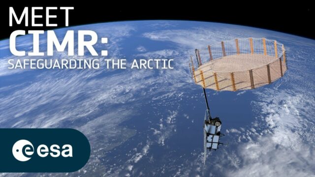
What Does a Warming Arctic Mean for the Future?
0 Views0 Comments0 Likes
The Arctic is experiencing disproportionately higher temperature increases compared to the rest of the planet, triggering a series of cascading effects. This rapid warming has profound implications for global climate ...

EveryDropLA
0 Views0 Comments0 Likes
Encouraging water conservation, the app allows users to identify and directly report water waste, view instances of water waste around them, receive alerts to conserve when essential, educate themselves on water conservation, and engage the water community through social media.
Everything that Happens, Happens Somewhere
0 Views0 Comments0 Likes
As our planet is becoming more crowded, the demand for diminishing natural resources is growing. Income gaps are widening,and people are being left behind. Geographic location -- and information about these locations – shows us where social, environmental and economic conditions occur. Reliable and authoritative geographic information provides the framework for measuring, monitoring and achieving the sustainable development goals, improving people’s lives and protecting the planet. The United Nations initiative on Global Geospatial Information Management (UN-GGIM) aims at playing a leading role in setting the agenda for the development of global geospatial information and to promote its use to address key global challenges. It provides a forum to liaise and coordinate among Member States, and between Member States and international organizations.
First Data from ESA’s Gaia Mission
0 Views0 Comments0 Likes
The first intermediate data release, containing, among other things, three-dimensional positions and two dimensional motions of a subset of two million stars, demonstrates that Gaia’s measurements are as precise as planned, paving the way to create the full map of one billion stars to be released towards the end of 2017.
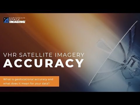
Why Geolocational Accuracy Matters
0 Views0 Comments0 Likes
Satellite imagery has revolutionised industries, all around the world. The resolution and clarity of these images keeps increasing and because of that, it is important to understand the geolocational and geospatial ac...
Melting Ice and Rising Seas
0 Views0 Comments0 Likes
As the planet warms and glaciers and polar ice caps melt, the icy world is fast disappearing, says Julian Dowdeswell from the University of Cambridge. He asks how do we deal with rising sea levels and a changing Arctic?

NASA: 2017 Takes Second Place for Hottest Year
0 Views0 Comments0 Likes
Earth's surface temperatures in 2017 were the second warmest since since 1880, when global estimates first become feasible, NASA scientists found. Global temperatures 2017 were second only to 2016, which still holds t...

OcuTech 360 Video Mapping
0 Views0 Comments0 Likes
OcuTech 360 is an inclusive provider of 360 degree visual technologies that are applied in geospatial mapping. Thanks to state of the art hardware and software, you can now digitize infrastructure and interact with data in 3D space, take 3D measurements, and annotate. For more info, please visit ocutech360.com or contact [email protected].
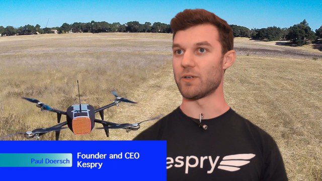
Building Drones for Construction, Surveying and Mining Applications
0 Views0 Comments0 Likes
The V1 Video team spoke to Paul Doersch, founder and CEO of Kespry. We talked about his company’s workflows specific to automating the collection of aerial survey information, including the measurement of aggregate stockpiles and mining resources.
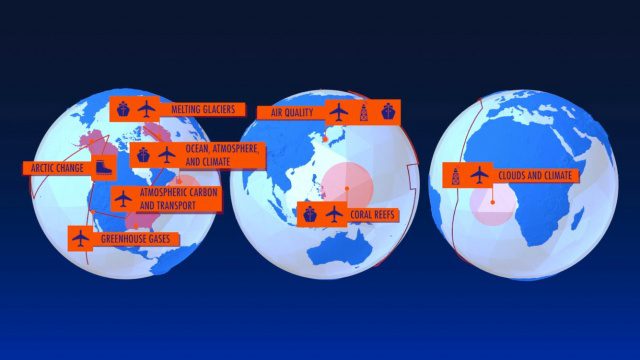
NASA Earth Expeditions: An Animated Tour
0 Views0 Comments0 Likes
NASA takes you on a world tour with this animation as we kick off major new field campaigns to study regions of critical change from land, sea and air.


