
Browse Archives
Greg Bentley Talks Reality Modeling and the Future of 3D Tech
4.74K Views0 Comments0 Likes
The V1 Video team interviewed Greg Bentley, CEO of Bentley Systems, at the 2016 SPAR 3D Expo and Conference, held April 11-14 in The Woodlands, Texas. In Part I, he provides his insight into reality modeling, the differences between a reality mesh and a point cloud, new tools for improved engineering and the future of 3D technology.
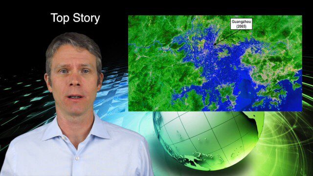
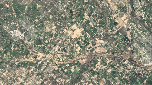
8_27 Asia-Pacific Broadcast (Rising Seas, Pollution, Drones and More)
3.49K Views0 Comments0 Likes
This Asia-Pacific-themed GeoSpatial Stream broadcast discusses rising sea levels in coastal cities; decreased air pollution in the Middle East; Australian researchers using drones to track wildlife; images of Typhoon Goni over Japan; industry news from Esri, Abu Dhabi, Korea Aerospace Research and Maptek; thoughts on urban population explosions in China and personal travel experiences; and more.
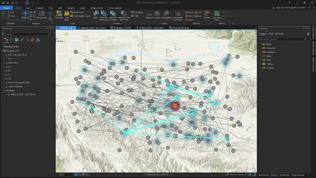
Community Contact Tracing Adds Power of Place to Contact Tracing for COVID-19
892 Views0 Comments0 Likes
By expanding the person-to-person approach, inherent in traditional contact tracing, to include person-to-person-to-place, public health analysts will be able to perform location analytics to illuminate the places where viral spread is happening outside of direct and prolonged contact between two individuals.
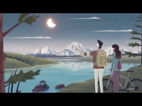
Get Ready for the 2017 Solar Eclipse
5.12K Views0 Comments0 Likes
On Monday, August 21, 2017, our nation will be treated to a total eclipse of the sun.
NASA | Earth from Orbit 2013
1.57K Views0 Comments0 Likes
A fleet of orbiting satellites monitors Earth constantly. The satellites from NASA and other space agencies give us a fresh, wide perspective on things that we can see from the ground -- and things that we can't.
The 2018 World Monuments Watch
3.77K Views0 Comments0 Likes
Every two years, the World Monuments Watch issues a call to action for treasured cultural sites around the globe. Since 1996, when the Watch was founded with support from American Express, it has recognized 790 sites that face daunting threats or present compelling conservation opportunities, and it has catalyzed over $240 million of investment in their protection and conservation. The 2018 Watch brings attention to 25 sites facing diverse threats.
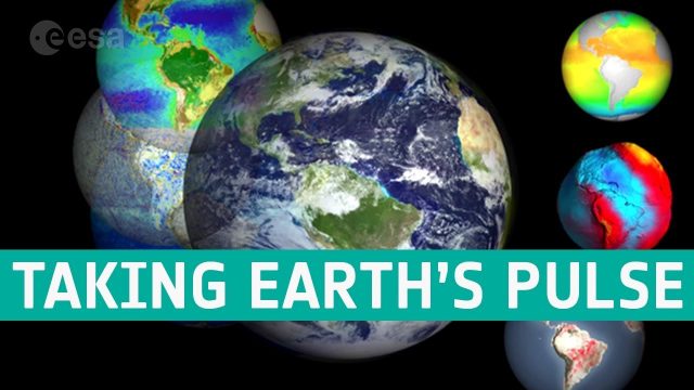
Taking the Pulse of Our Planet
719 Views0 Comments0 Likes
We are all facing the consequences of a rapidly changing world, but thanks to the satellite era we are better placed to understand the complexities of our planet, particularly with respect to global change.

Space Olympics
188 Views0 Comments0 Likes
The International Space Station Expedition 65 crew recorded themselves on a day off after a long week of work having some weightless fun. From Earth orbit, 400 km above our planet, the crew present the very first Spa...

GEO Looking to Increase Partnerships with the Private Sector
4.58K Views0 Comments0 Likes
Matt Ball interviews Barbara Ryan, Director, Group on Earth Observations (GEO) Secretariat, at the 2014 Esri User Conference in San Diego. Ryan discusses her role at GEO; a key meeting in Geneva, Switzerland; the next 10 years at the organization; and its growth in partnering with the private sector.
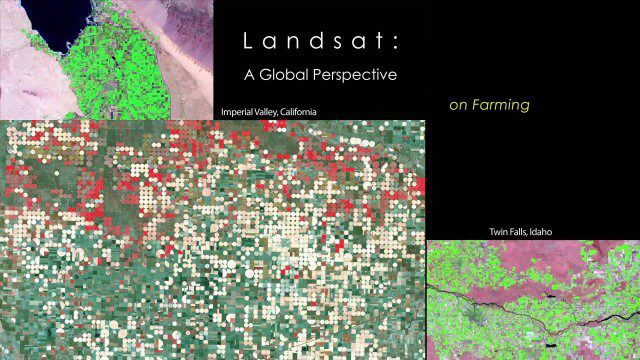
NASA | Landsat’s Global Perspective
2.14K Views0 Comments0 Likes
On July 23rd, 1972, the first Landsat spacecraft launched into orbit. At the time, it was called "Earth Resources Technology Satellite," or ERTS, and was the first satellite to use a scanning spectrophotometer. Previous satellites relied on film cameras (ejecting the exposed film to be caught by planes) or transmitted the signal from television cameras. The scanning sensor and its successor sensors on subsequent Landsat satellites revolutionized how we study our home planet. Celebrating this anniversary, this video is a "greatest hits" montage of Landsat data. Throughout the decades, Landsat satellites have given us a detailed view of the changes to Earth's land surface. By collecting data in multiple wavelength regions, including thermal infrared wavelengths, the Landsat fleet has allowed us to study natural disasters, urban change, water quality and water usage, agriculture development, glaciers and ice sheets, and forest health.


