
Browse Archives
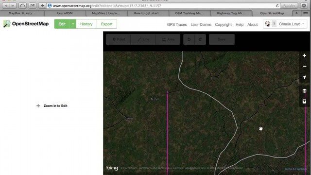
Tracing Demonstration for the Humanitarian OpenStreetMap Team (HOT)
0 Views0 Comments0 Likes
This is a simple demonstration of what it looks like to trace for the Humanitarian OpenStreetMap Team (HOT). It’s not meant as a full guide, just an example. If I’m too mumbly, please turn on the captions – the CC button below the video.
Tracking California Rains During El Niño
0 Views0 Comments0 Likes
This winter, areas across the globe experienced a shift in rain patterns due to the natural weather phenomenon known as El Niño. New NASA visualizations of rainfall data show the various changes to California. According to the National Oceanic and Atmospheric Administration, El Niño was expected to produce wetter-than-average conditions from December 2015 to February 2016. Scientists refer to historical weather patterns and to look at trends of where precipitation normally occurs during El Niño events. Also, several factors—not just El Niño—can contribute to unusual weather pattern.
Tracking Carbon from Wildfires to Ocean Blooms
0 Views0 Comments0 Likes
Between September 2019 and March 2020, wildfires killed billions of animals and decimated more than 200 thousand square kilometers of Australian forest, an area larger than Nebraska. Later, thousands of kilometers awa...
Tracking Carbon from Wildfires to Ocean Blooms
0 Views0 Comments0 Likes
Between September 2019 and March 2020, wildfires killed billions of animals and decimated more than 200 thousand square kilometers of Australian forest, an area larger than Nebraska. Later, thousands of kilometers awa...
Tracking Ocean Heat with Magnetic Fields
0 Views0 Comments0 Likes
Scientists at NASA’s Goddard Space Flight Center are developing a new way to use satellite observations of magnetic fields to measure heat stored in the ocean.
Tracking Three Decades of Dramatic Glacial Lake Growth
0 Views0 Comments0 Likes
In the largest-ever study of glacial lakes, researchers using a 30-year satellite data record have found that the volume of these lakes worldwide has increased by about 50% since 1990 as glaciers melt and retreat due to climate change.

Traisr Makes Asset Management Simple, Safe and Secure
0 Views0 Comments0 Likes
Todd Danielson interviews John DePalma, Principal, and Brian Berdel, Chief Information Officer, McMahon Associates Inc., at the 2014 Esri User Conference in San Diego. They discuss the company's new product, Traisr, which integrates with multiple platforms to monitor fixed and mobile assets as well as deliver consumer Web portals.
Translating Airborne Electromagnetic Data into Geological Understanding
0 Views0 Comments0 Likes
In this Geoscience Australia Snapshot video, Dr Ian Roach from Geoscience Australia gives an overview of the benefits of using airborne electromagnetic (AEM) survey data. This survey technique is a key tool for mapping geology undercover and has potential implications for understanding the energy, minerals and regional geology of the survey area.
Transportation Asset Management
0 Views0 Comments0 Likes
Asset management is a strategic and systematic approach for managing transportation assets over their whole life. Asset management helps ensure that available funding addresses our highest priorities.
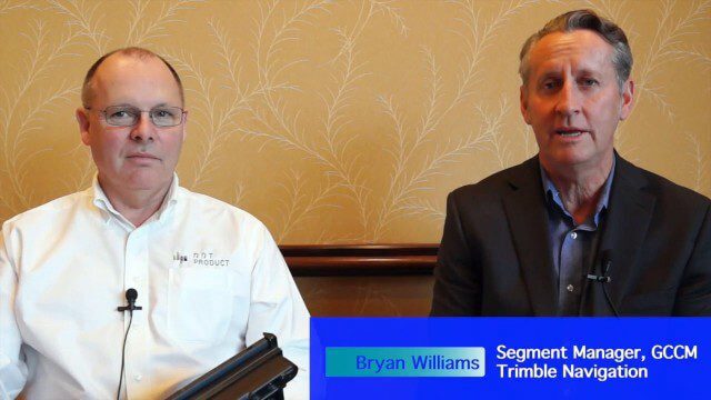
Trimble Announces Partnership with DotProduct
0 Views0 Comments0 Likes
Bryan Williams, Segment Manager, GCCM, Trimble Navigation, joined Tom Greaves, Chief Marketing Officer, DotProduct, to discuss a recent partnership between the two companies. In an interview with V1 Media's Todd Danielson at SPAR International, which was held March 30-April 2, 2015, in Houston, Texas, they discussed DotProduct and its products as well as how they fit into Trimble's plans. Williams also discusses vertical construction and additional new Trimble technologies.


