
Browse Archives
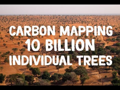
NASA Maps Carbon of 10 Billion Individual Trees
0 Views0 Comments0 Likes
Using commercial, high-resolution satellite images and artificial intelligence, a team of NASA-funded scientists mapped almost 10 billion individual trees in Africa’s drylands in order to assess the amount of carbon s...

NASA NIMBUS: Recovering the Past
0 Views0 Comments0 Likes
50 years ago, NASA launched Nimbus to study Earth from space. Now, experts at the National Snow and Ice Data Center (part of CIRES), are recovering valuable data and images from old, long-lost film, and expanding their understanding of sea ice in the Arctic and Antarctic. Learn more from CIRES on the 1-year anniversary of Nimbus' first image:
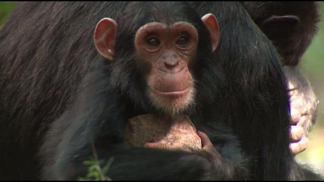
NASA Partners with Jane Goodall Institute to Protect Chimpanzees
0 Views0 Comments0 Likes
Data from Landsat satellites, a joint mission of NASA and the U.S. Geological Survey, have been critical to helping the Jane Goodall Institute in their work to protect chimpanzees and their habitat. In this video, Goodall and JGI scientist Lilian Pintea discuss the transformational role of seeing changing habitats from above.
NASA Rainfall Data and Global Fire Weather
0 Views0 Comments0 Likes
The Global Fire WEather Database (GFWED) integrates different weather factors influencing the likelihood of a vegetation fire starting and spreading.
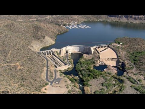
NASA Satellite Measures Human Impact in Water Storage
0 Views0 Comments0 Likes
To investigate humans’ impact on freshwater resources, scientists have now conducted the first global accounting of fluctuating water levels in Earth’s lakes and reservoirs–including ones previously too small to measu...
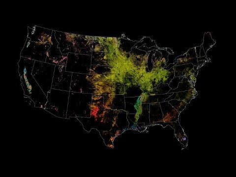
NASA Satellites Keep Watch on U.S. Food Supply
0 Views0 Comments0 Likes
The Cropland Data layer uses Landsat and similar sensors to identify what crop is growing where in the country.
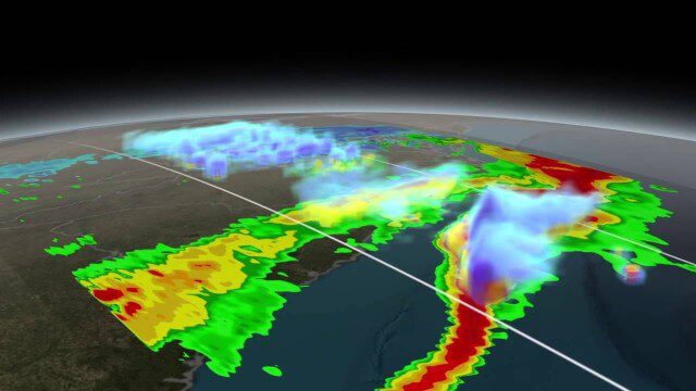
NASA Scanning a Snow Storm
0 Views0 Comments0 Likes
On March 17, 2014, the Global Precipitation Measurement (GPM) mission's Core Observatory flew over the East coast's last snow storm of the 2013-2014 winter season.

NASA Sees Intense Fires around the World
0 Views0 Comments0 Likes
This year’s wildfire season is off to a blazing start. The United States had an early start to the season, with more than 29,000 wildfires burning more than 2.6 million acres of land. The driest season in 14 years has left the southern Amazon primed for heavy wildfire activity as well.
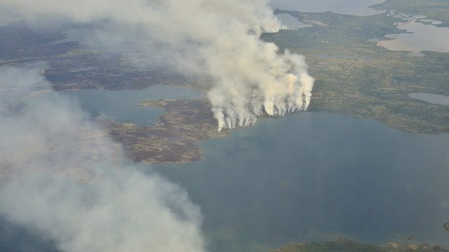
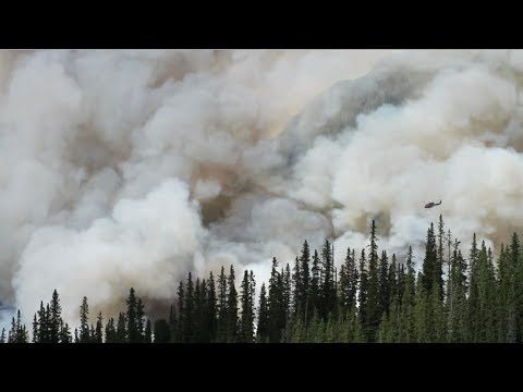
NASA Studies How Arctic Wildfires Change the World
0 Views0 Comments0 Likes
Wildfires in the Arctic often burn far away from population centers, but their impacts are felt around the globe. From field and laboratory work to airborne campaigns and satellites, NASA is studying how climate chang...

NASA Tech’s Supporting Role at the Oscars
0 Views0 Comments0 Likes
It's all about the gold. NASA uses gold on satellites and telescopes to see in infrared and block heat absorption. We needed a coating that was ulta-reflective and super durable—and thanks to a family-owned business i...


