
Browse Archives
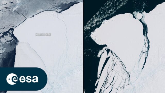
Iceberg Larger than London Breaks off Brunt
0 Views0 Comments0 Likes
An iceberg around the size of Greater London broke off Antarctica’s Brunt Ice Shelf due to a natural process called ‘calving.’ The iceberg, measuring 1550 square kilometers, detached from the 150-meter-thick ice shelf...

IceBridge Flies 300 Hours of Antarctic Science Flights
0 Views0 Comments0 Likes
Operation IceBridge is wrapping up its eighth consecutive field season of mapping the ice sheet and glaciers of Antarctica as well as the surrounding sea ice.
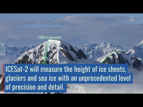
ICESat-2 Adds Third Dimension to Earth
0 Views0 Comments0 Likes
ICESat-2 will provide scientists with height measurements that create a global portrait of Earth's third dimension, gathering data that can precisely track changes of terrain including glaciers, sea ice, forests and more.

ikeGPS Demonstrates New Spike Device at Esri UC
0 Views0 Comments0 Likes
Brian Soliday, Senior VP of Sales, ikeGPS, demonstrates the company's new Spike measurement device at the 2014 Esri User Conference in San Diego. Featuring a laser, accelerometer and 3-D compass, combined with a camera and GPS, Spike provides and quick and easy way to "measure the world around you."

illUmiNations: Protecting our Planet
0 Views0 Comments0 Likes
United Nations General Assembly and Secretariat buildings lit up on Saturday night in a revolutionary call for climate action in connection with the Secretary-General's climate Summit. #climate2014. "illUmiNations: Protecting Our Planet" was collaboratively designed and produced for UNDPI by the Oceanic Preservation Society, Obscura Digital and Insurgent Media.

IMAGINiT Helps Clients through Entire Workflow
0 Views0 Comments0 Likes
Todd Danielson interviews Dan Chapek, Manager, Infrastructure Solutions Team, IMAGINiT, and Jeff Bowers, Consultant, Business Solutions, IMAGINiT, at the HxGN LIVE event in Las Vegas, Nevada. They discuss how to integrate scanning data into design applications to create client deliverables, how the company partners with Leica Geosystems and Autodesk products, "field to finish" workflows, and more.
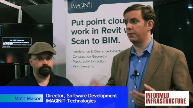
IMAGINiT Talks BIM and Lifecycle Management
0 Views0 Comments0 Likes
The V1 Video team was at Autodesk University 2015 in Las Vegas and interviewed Carl Storms, Senior Application Expert, and Matt Mason, Director of Software Development, both with IMAGINiT Technologies. They discussed BIM use throughout a project's lifecycle, the company's Clarity owner data portal and its benefits to users, and the latest updates for its Scan to BIM product for use with Revit.

Improving the Economics of Space through Greater Access
0 Views0 Comments0 Likes
Surrey Satellite Technology U.S. (SST-US) is an offshoot of the UK-based company that has now begun manufacturing satellites in its Denver-based offices to more efficiently address the U.S. market. Earth Imaging Journal spoke with John Paffett, CEO of Surrey Satellite U.S., about its continued mission to change the economics of space. Their recent development of the FeatherCraft platform, alongside partners NanoRacks and Aerojet Rocketdyne, takes advantage of the ease of deploying satellites from the International Space Station, adding propellant to increase the utility and life expectancy of a 100-kilogram-class satellite platform.


Indicators for sustainable cities — how do you score?
0 Views0 Comments0 Likes
By 2050, 70% of people will live in cities... are you ready? City indicators help city managers, politicians, researchers and other professionals to focus on what's important and put in place policies for more livable, tolerant, sustainable, economically attractive and prosperous cities.


