
Browse Archives

Dr. Joachim Rix – INTERGEO Opinion Leader Talk
0 Views0 Comments0 Likes
Dr. Joachim Rix, Competence Center Spatial Information Management at Fraunhofer IGD, speaks about the project “Smarticipiate” and his congress block at INTERGEO in Hamburg.

Doug Smith Interview (Avenza Systems)
0 Views0 Comments0 Likes
Todd Danielson interviews Doug Smith, Director, Sales & Marketing, Avenza Systems, at the GEOINT Symposium in Tampa, Florida. They discuss Avenza's key products, including MAPublisher, Geographic Imager and its new PDF Maps app. All the products work with Adobe products for increased design functionality while maintaing location integrity.

12_18 Asia-Pacific Broadcast (Cultural Heritage, APAC LBS Market and More)
0 Views0 Comments0 Likes
This Asia-Pacific-focused GeoSpatial Stream broadcast discusses a Cultural Preservation survey project in LaoSiCheng, China; a market-research report on the APAC region's LBS market; a V1 Media interview with a Bentley Systems Year in Infrastructure award winner from China; industry headlines from Paragon Software Systems, SkyTraq Technology Inc., Supergeo Technologies and Hamon Thermal Co.; and more.

IceBridge Flies 300 Hours of Antarctic Science Flights
0 Views0 Comments0 Likes
Operation IceBridge is wrapping up its eighth consecutive field season of mapping the ice sheet and glaciers of Antarctica as well as the surrounding sea ice.
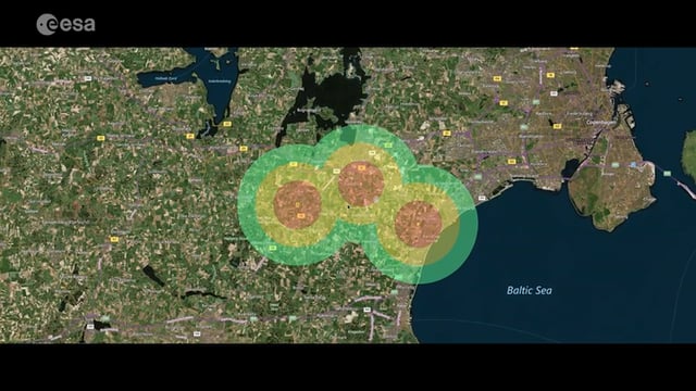
Satellite-Based Wildlife-Monitoring Tool for Airports
0 Views0 Comments0 Likes
Wildlife habitats close to airports pose a serious risk to safety at takeoff and landing. A new service lets airports use Earth-observation satellites to identify and manage these areas.
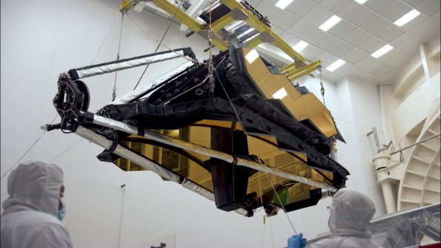
NASA’s James Webb Space Telescope Arrives
0 Views0 Comments0 Likes
The optical telescope and integrated science instrument module (OTIS) of NASA's James Webb Space Telescope arrived at Northrop Grumman Aerospace Systems in Redondo Beach, California, on Friday, Feb. 2.
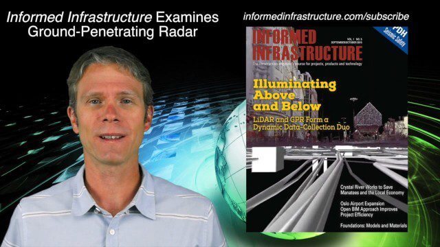
9_24 Infrastructure Broadcast (Federal Initiatives, Ground-Penetrating Radar and More)
0 Views0 Comments0 Likes
This Infrastructure-themed GeoSpatial Stream broadcast discusses U.S. federal government action to accelerate infrastructure projects; ground-penetrating radar featured in Informed Infrastructure magazine; industry news from Autodesk, Topcon Positioning Group, Esri, 3D Laser Mapping and RIEGL; a video showing how UAVs are being used to map Mongolian infrastructure; and more.

4_22 GEOINT Broadcast (Keynote Highlights, Major News and Developments, and More)
0 Views0 Comments0 Likes
This GeoSpatial Stream broadcast from the GEOINT Symposium in Tampa, Fla., recaps the major highlights and news from the event, including keynote addresses from James R. Clapper, Director of National Intelligence; Letitia A. Long, Director, National Geospatial-Intelligence Agency; and Lt. Gen. Michael T. Flynn, U.S. Army, Director of the Defense Intelligence Agency. The broadcast also covers major news announcements from the U.S. Geospatial Intelligence Foundation, Boeing, Surrey Satellite Technology U.S., Airbus Defense & Space, and more.

Airbus Defence and Space Launches WorldDEM DTM
0 Views0 Comments0 Likes
Airbus Defence and Space released its global elevation model that was captured by the twin TerraSAR-X and TanDEM-X radar satellites in 2014 and now is producing Digital Terrain Models based on this dataset. The 12-meter-resolution pole-to-pole elevation data are a major improvement upon the commonly used 30-meter USGS SRTM data. Earth Imaging Journal spoke with Gertrud Riegler, WorldDEM Product Manager, Airbus Defence and Space, at the International Space Symposium about this new dataset and its many uses.

2017 Be Inspired Awards Project Highlights
0 Views0 Comments0 Likes
Several members of the Bentley Systems team discuss the Be Inspired Awards projects from the 2017 Year In Infrastructure event held Oct. 10-12, 2017, in Singapore.


