
Browse Archives

Delivering Very-High-Resolution Imagery for Densely Populated Areas
3.10K Views0 Comments0 Likes
The V1 Video team interviewed Paul Peterson, senior vice president, Product & Engineering, nearmap, at the 2015 Esri User Conference in San Diego. The aerial imagery and visual analytics company provides timely, high-resolution and historic imagery that they recently imported to the United States from Australia. The unique sensing capacity and frequent revisits of major cities is accompanied by online analysis tools.

Valarm Interview at GeoDesign Summit
3.09K Views0 Comments0 Likes
Todd Danielson interviews a team from Valarm, including Lorenzo Gonzalez, CEO and Software Architect, and Edward Pultar, President and Spatial Scientist. They discuss the company's vision, its clients and how its software assimilates sensor information.

“National Geographic” Time Scanners Jerusalem
3.09K Views0 Comments0 Likes
NPMap Pioneers Open and Flexible Platform
3.09K Views0 Comments0 Likes
The V1 Video team interviewed Nate Irwin, head of the NPMap team for the National Park Service, at the USFWS/USNPS Geospatial Training Workshop. NPMap is an innovative online mapping platform that helps park visitors navigate the details of national parks as well as providing a platform for parks to customize and share maps for park management.
Introducing a Completely New Civil Conceptual Design Tool
3.08K Views0 Comments0 Likes
The V1 Video team interviewed Francois Valois at the 2015 Bentley Year in Infrastructure Conference in London in early November. Valois is director of product management at Bentley Systems, working on their new OpenRoads ConceptStation software, and he spoke about the workflow and the software's capabilities with its new easy-to-use interface, rules-based design tools, cost-based analysis and rich visualization.
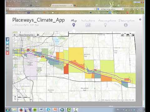
CommunityViz Web App
3.08K Views0 Comments0 Likes
Providing users with the ability to open new opportunities for education, citizen engagement, and policy change, the app enables users to quickly share their analysis results—such as energy and greenhouse gas generation and possible energy futures—with their ArcGIS Online organization, select groups, or the general public.

Doug Smith Interview (Avenza Systems)
3.07K Views0 Comments0 Likes
Todd Danielson interviews Doug Smith, Director, Sales & Marketing, Avenza Systems, at the GEOINT Symposium in Tampa, Florida. They discuss Avenza's key products, including MAPublisher, Geographic Imager and its new PDF Maps app. All the products work with Adobe products for increased design functionality while maintaing location integrity.

Earth Images from ESA Astronaut Alexander Gerst
3.07K Views0 Comments0 Likes
This timelapse video was made from images taken by ESA astronaut Alexander Gerst orbiting Earth on the International Space Station. The video is offered in Ultra High Definition, the highest available to consumers. Be sure to change the settings in YouTube if your computer or television can handle it for the full effect. The montage is made from a long sequence of still photographs taken at a resolution of 4256 x 2832 pixels at a rate of one every second. The high resolution allowed the ESA production team to create a 3840 x 2160 pixel movie, also known as Ultra HD or 4K. Playing these sequences at 25 frames per second, the film runs 25 times faster than it looks for the astronauts in space. The artistic effects of the light trails from stars and cities at night are created by superimposing the individual images and fading them out slowly. Alexander Gerst is a member of the International Space Station Expedition 40 crew. He is spending five and a half months living and working on the ISS for his Blue Dot mission.
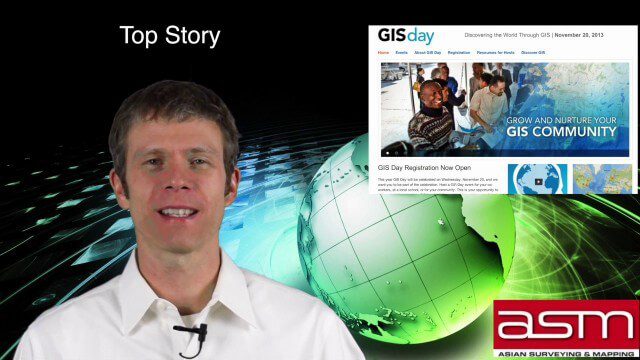
GIS Day Broadcast 11_20 (Free Sentinel imagery, Czech Cadastre, Google Explore and more)
3.05K Views0 Comments0 Likes
This GeoSpatial Stream celebrates GIS Day, discusses U.S. government initiatives, the decision to release free Sentinel satellite imagery, Czech Cadastre news, Google Explore and more.
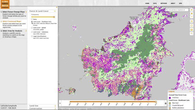
Global Forest Watch Commodities—Geospatial Tools to Help Reduce Greenhouse Gas Emissions from Land-Use Change
3.02K Views0 Comments0 Likes
This app provides three tools for businesses interested in good forest management: Suitability Mapper, which enables businesses to identify degraded areas best suited for commodity development as an alternative to clearing new forest areas; Forest Analyzer, which provides information on land cover and land use to monitor and evaluate change to forests on commodity concessions; and Roundtable on Sustainable Palm Oil (RSPO) Support tool, which users can complete for an analysis of forest change on certified areas and use the analysis for the compensation procedure required by RSPO while also enabling commodity buyers to make informed sourcing decisions.


