
Browse Archives
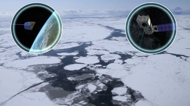
Cool Ways of Studying the Cryosphere
0 Views0 Comments0 Likes
NASA missions are helping scientists study the cryosphere: the many forms of ice found on Earth.
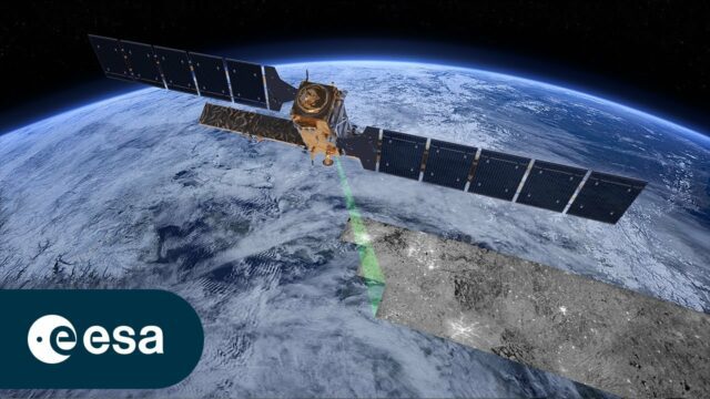
Copernicus Sentinel-1: Radar Vision for Copernicus
0 Views0 Comments0 Likes
Meet Copernicus Sentinel-1. This ground-breaking mission delivers continuous, all-weather, day-and-night imaging for land, ice and maritime monitoring. Equipped with state-of-the-art C-band synthetic aperture radar...
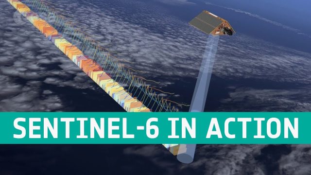
Copernicus Sentinel-6 In Action
0 Views0 Comments0 Likes
The Copernicus Sentinel-6 Poseidon-4 dual-frequency (C- and Ku-band) radar altimeter uses an innovative interleaved mode that has improved performance compared to previous satellite altimeter designs. The Sentinel...
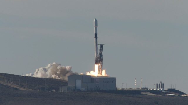
Copernicus Sentinel-6 Michael Freilich Liftoff Replay
0 Views0 Comments0 Likes
Watch the replay of Copernicus Sentinel-6 Michael Freilich lifting off from the Vandenberg Air Force Base, Calif., on Nov. 21, 2020. Copernicus Sentinel-6 Michael Freilich is the first of two identical satellites to provide critical measurements of sea-level change.
CORAL Probes Great Barrier Reef
0 Views0 Comments0 Likes
The three-year COral Reef Airborne Laboratory (CORAL) mission will survey a portion of the world's coral reefs to assess the condition of these threatened ecosystems and understand their relation to the environment, including physical, chemical and human factors.
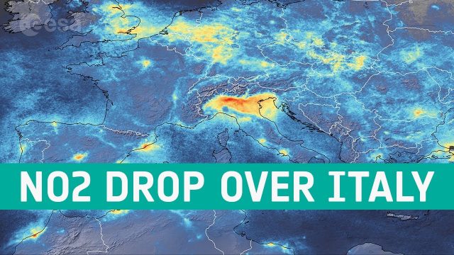
Coronavirus: Nitrogen Dioxide Emissions Drop over Italy
0 Views0 Comments0 Likes
New data from the Copernicus Sentinel-5P satellite reveal the decline of air pollution, specifically nitrogen dioxide emissions, over Italy. This reduction is particularly visible in northern Italy which coincides with its nationwide lockdown to prevent the spread of the coronavirus.
Corridor Mapping in Germany
0 Views0 Comments0 Likes
Above Highway A33, the mdMapper1000DG was tasked with creating a point cloud and orthophoto of a 12 kilometer stretch of the Autobahn.
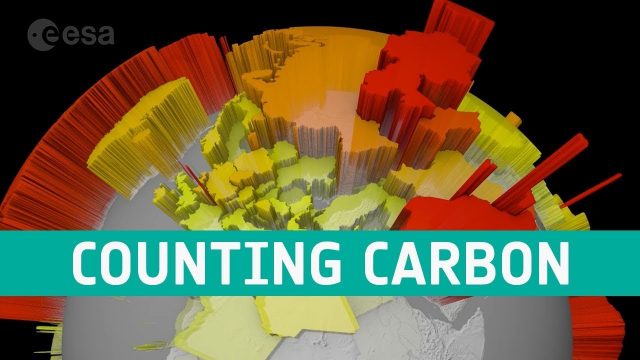
Counting Carbon
0 Views0 Comments0 Likes
As well as tracking atmospheric carbon, ESA’s Climate Change Initiative is using satellite observations to track other carbon stocks on land and sea.

Creating 3D Models from Drone Imagery
0 Views0 Comments0 Likes
The V1 Video team interviewed Antoine Martin, Business Manager of Pix4D’s operations in the United States, at the 2015 Esri User Conference in San Diego. We spoke about the growing interest in creating useful data from drone platforms as well as the many use cases for Pix4Dmapper software for automated image processing. The company has focused on the simplification of photogrammetric science to enable users to create accurate maps and 3D models from this imagery.
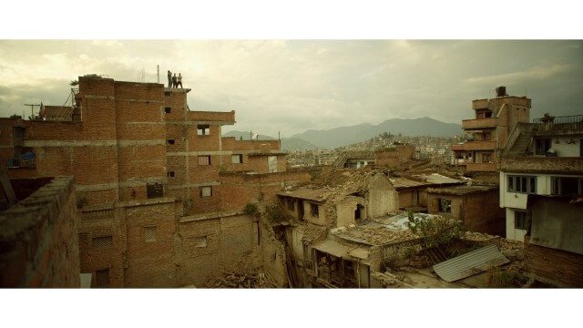
Crisis Mapping in Nepal
0 Views0 Comments0 Likes
On the 25th of April, Nepal was hit by the worst earthquake the small, mountainous country had ever seen. Leaving thousands dead and hundreds of thousands displaced, the Ghorka Earthquake as it would become known, uprooted not only cities and villages, but homes and families that had existed in the mountains for centuries. So what could we do to help? Teaming up with with Humanitarian UAV Network “UAViators”, Open Street Map specialists “Kathmandu Living Labs”, 3D Mapping organization, “Pix4D”, smartphone manufacturer “Smartisan” and Kathmandu University, DJI got to work on a plan, a plan that drew together some of the best and brightest of the UAV industry for a life-changing experience.


