
Browse Archives
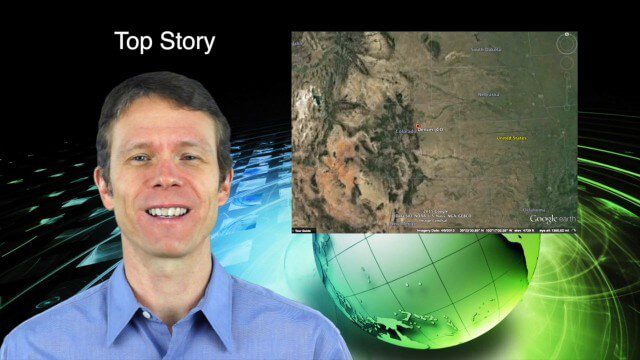
2_12 Maps and Drones Broadcast (Google Maps, Drones for Good and More)
0 Views0 Comments0 Likes
This GeoSpatial Stream broadcast discusses the 10-year anniversary of Google Maps; the Drones for Good contest and drone privacy issues; industry news from Esri, Cadcorp and LizardTech; an unintentionally funny video from Ordnance Survey in 1965; and more.
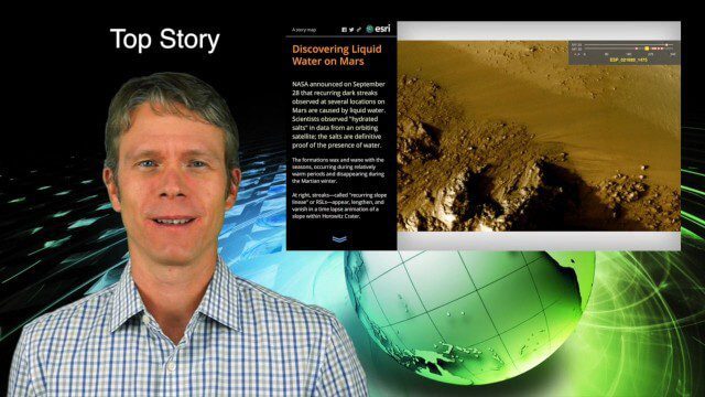
10_1 Science Broadcast (Mars Water, Neutrino and Tree Maps, and More)
0 Views0 Comments0 Likes
This GeoSpatial Stream broadcast discusses several intersections of science and geospatial technology, including NASA's announcement that Mars has liquid water; a map showing Earth's neutrinos; a video showing how scientists estimated the number of trees on Earth; industry news from exactEarth, US Topo maps, Teledyne Optech and Intergraph Government Solutions; opinions on the impact of the news from Mars; and more.
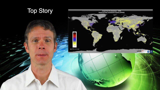
9_18 Climate Change Broadcast (CO2 Mapping, Open Data and More)
0 Views0 Comments0 Likes
This GeoSpatial Stream broadcast discusses new research on greenhouse gas emissions worldwide; open data and sustainability innovation; a lost Russian satellite; a geospatial search engine from the U.S. Library of Congress; industry news from Cadcorp, Bentley Systems, Esri and Innovyze; opinions on the recent URISA GIS-Pro conference; and more.
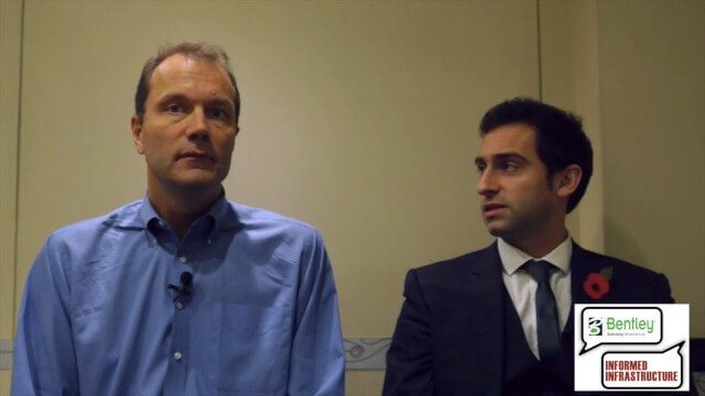
3D City Modeling Coming of Age through Innovation
0 Views0 Comments0 Likes
The V1 Video team interviewed Bob Mankowski and Aidan Mercer at the 2015 Bentley Year in Infrastructure Conference in London in early November. Mankowski is vice president of Bentley Software, and Mercer is senior marketing manager for Bentley Systems, and they discussed 3D city modeling, reality meshes, ContextCapture and their thoughts on the Year In Infrastructure 2015 event.
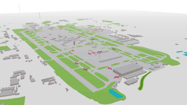
Live Planes in ViziCities using Plane Finder
0 Views0 Comments0 Likes

First Interstellar Asteroid Wows Scientists
0 Views0 Comments0 Likes
Scientists were surprised and delighted to detect--for the first time--an interstellar asteroid passing through our solar system.
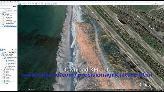
Santa Barbara Refugio Oil Spill in 3D Using Canon Camera
0 Views0 Comments0 Likes
Santa Barbara Refugio Beach Oil Spill, May 20-21, 2015. While flying precision agriculture grapes Sky Imaging Mapping Data diverted to Santa Barbara. On arrival the entire area was imaged from 12-1500 feet above the ocean. Post flight the imagery was processed into 3D models and overlaid on Google Earth for easy browsing (waves look jagged).
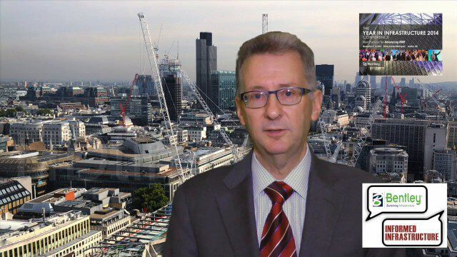
A CEO’s Perspective on the Year in Infrastructure: Greg Bentley, CEO, Bentley Systems
0 Views0 Comments0 Likes
The Year in Infrastructure event, which includes the Be Inspired Awards, is a unique event that brings together leading infrastructure companies from around the globe to showcase projects and process improvement. Informed Infrastructure spoke with Greg Bentley, CEO of Bentley Systems, about the evolving role of "software at your service." We spoke about engineering as an outcome-based service, the Chinese adoption of BIM technology, the UK government's commitment to BIM, and improved process outcomes.
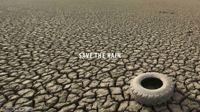
Save the Rain
0 Views0 Comments0 Likes
Users are able to make smarter choices and save water when it is available. The next time it rains, users can capture rainwater that lands on their homes and use it again to water plants, trees, and lawns; wash cars; and even flush toilets.
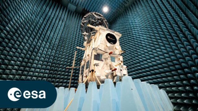
Meet the Team Behind EarthCARE
0 Views0 Comments0 Likes
As we approach the launch of ESA’s EarthCARE mission, we caught up with some of the scientists, engineers and experts behind the mission. With the climate crisis increasingly tightening its grip, ESA’s Earth Cloud Aer...


