
Tag: video
Soyuz Rocket Deploys 73 Satellites
0 Views0 Comments0 Likes
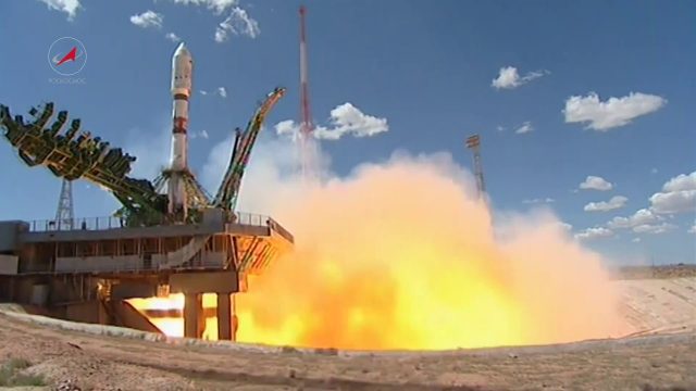
On July 14, 2017, a Russian Soyuz booster lifted off from Kazakhstan on a complex mission to deploy 73 satellites into three different orbits, including a Russian spacecraft to locate forest fires, 48 CubeSats for Planet’s global Earth observation fleet, and eight nanosatellites for Spire Global’s commercial weather network.
Destination Low Earth Orbit
0 Views0 Comments0 Likes
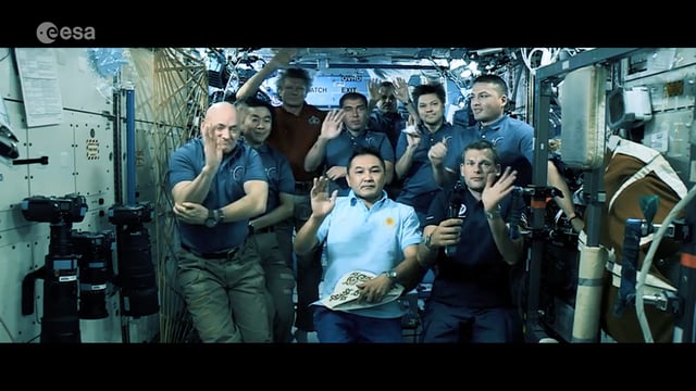
ESA astronaut Andreas Mogensen narrates this video on the inspiring endeavours of human spaceflight and how it changes our daily lives.

Autodesk and the Future of the Built Environment
0 Views0 Comments0 Likes
The V1 Video team interviewed Aaron Morris, General Manager of the Reality Solutions Group at Autodesk, at the 2016 SPAR 3D Expo and Conference, held April 11-14 in The Woodlands, Texas. He discusses several new developments at Autodesk, including the company's ReCap products and its new pricing model, new data services to make analysis easier, scan-to-mesh services for asset management, and how reality capture will replace existing methods of asset documentation.
5_26 Asia Pacific Broadcast (DIWATA-1, Apple Maps and More)
0 Views0 Comments0 Likes
This Asia Pacific-themed GeoSpatial Stream broadcast covers the recent launch of DIWATA-1, The Philippines' first microsatellite; Australia's move toward more-accurate GNSS navigation at its airports; Apple opening a technical and support center in Hyderabad, India, for its Maps and navigation services; industry news from NTT Data, LizardTech, BJ Open Tide BoGan, Ozius Spatial and U-blox; a video clip from JAXA (in Japanese) about weather monitoring; and more.

Understanding GIS – An Overview
0 Views0 Comments0 Likes
Geographic Information Systems are used by professionals and academics all over the world to investigate problems ranging from the spread of disease to the damage caused by hurricanes. Learn more about the University of Michigan-Flint's GIS Certificate by visiting umflint.edu/gis/gis-center
The 2018 World Monuments Watch
0 Views0 Comments0 Likes
Every two years, the World Monuments Watch issues a call to action for treasured cultural sites around the globe. Since 1996, when the Watch was founded with support from American Express, it has recognized 790 sites that face daunting threats or present compelling conservation opportunities, and it has catalyzed over $240 million of investment in their protection and conservation. The 2018 Watch brings attention to 25 sites facing diverse threats.

The Future of Making Things at Autodesk and Industrywide
0 Views0 Comments0 Likes
The V1 Video team interviewed Curtis Chan, Technical Evangelist at Autodesk, at the 2016 SPAR 3D Expo and Conference, held April 11-14 in The Woodlands, Texas. A keynote speaker at the event, he discusses "the future of making things" at Autodesk and through the industry; Autodesk's creative platforms such as Fusion, Spark and Forge; interesting use cases that have caught his attention; and how 3D printing can be scaled up into construction projects.
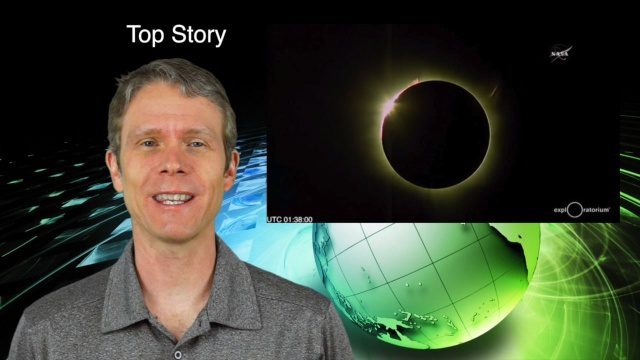
3_10 Asia Pacific Broadcast (Solar Eclipse, Groundwater Monitoring and More)
0 Views0 Comments0 Likes
This Asia-Pacific-themed GeoSpatial Stream broadcast discusses the recent solar eclipse across Indonesia and Micronesia; Japanese Universities collaborating to help build The Philippines' first microsatellite; satellite data monitoring groundwater in Pakistan; Tropical Cyclone Winston observed over Fiji; industry news from Baidu, IndoorAtlas, Yahoo! Japan, Supergeo, and German and Japanese space agencies; a video showing the excitement of a full solar eclipse; and more.

6_30 Drones and GIS Broadcast (FAA Rule, Esri UC and More)
0 Views0 Comments0 Likes
This GeoSpatial Stream broadcast discusses the landmark FAA Rule Part 107 for small UASs/UAVs/drones and its effect on the U.S. economy; highlights from the 37th Esri User Conference in San Diego; industry news from SmarterBetterCities, Trimble, Cadcorp and Esri; an Esri video that opened the recent UC; and more.

Software Aids Stormwater and Sewage Infrastructure Design
0 Views0 Comments0 Likes
Urbano software is used for the design of sewage and water distribution networks. Urbano Canalis is the module used for design of storm and sanitary sewage systems. You can create complete storm and sanitary sewage system designs, starting from the initial network definition to the analysis of hydraulic results.


