
Tag: video
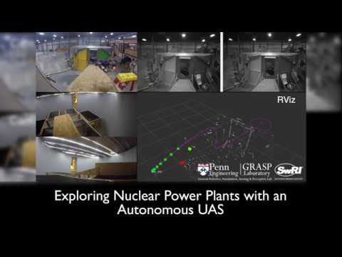
Exploring Nuclear Power Plants via UAS
0 Views0 Comments0 Likes
Southwest Research Institute and the University of Pennsylvania are developing UAS technology to fly into the containment vessels of the damaged units at Japan’s Fukushima Daiichi nuclear power station and assess conditions.

Get Ready for the 2017 Solar Eclipse
0 Views0 Comments0 Likes
On Monday, August 21, 2017, our nation will be treated to a total eclipse of the sun.
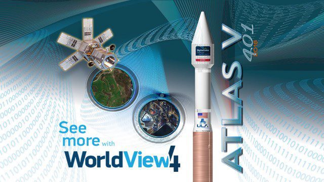
Atlas V WorldView Launch Broadcast Replay
0 Views0 Comments0 Likes
Watch a replay as the ULA's Atlas V launches the WorldView-4 launch for DigitalGlobe.

2_25 Earth Imaging Broadcast (Sentinel Launch, Smallsats and More)
0 Views0 Comments0 Likes
This Earth Imaging-themed GeoSpatial Stream broadcast discusses the recently launched Sentinel-3A Earth-monitoring satellite; a smallsat/cubesat video created by the European Space Agency; NASA UAS/drone news; industry news from Esri, SimActive, Teledyne Optech and Riegl; a funny mapping video from the University of Kentucky's New Maps Plus online education program; and more.

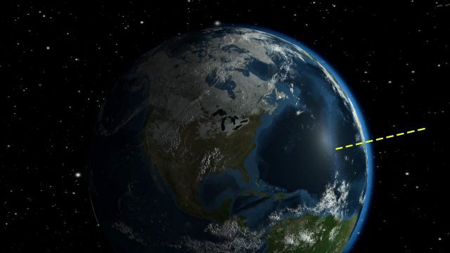
Ultra High Definition (4K) View of Planet Earth
0 Views0 Comments0 Likes
NASA monitors Earth's vital signs from land, air and space with a fleet of satellites and ambitious airborne and ground-based observation campaigns.

The 2018 World Monuments Watch
0 Views0 Comments0 Likes
Every two years, the World Monuments Watch issues a call to action for treasured cultural sites around the globe. Since 1996, when the Watch was founded with support from American Express, it has recognized 790 sites that face daunting threats or present compelling conservation opportunities, and it has catalyzed over $240 million of investment in their protection and conservation. The 2018 Watch brings attention to 25 sites facing diverse threats.
NASA Looks to Solar Eclipse to Help Understand Earth’s Energy System
0 Views0 Comments0 Likes
During the August 21, 2017 total solar eclipse, scientists will use the Earth Polychromatic Imaging Camera (EPIC) on the Deep Space Climate Observatory satellite (DSCOVR), along with measurements taken from within the moon's shadow on the ground, to test a new model of Earth's energy budget.

8_4 Infrastructure Broadcast (TIGER Grants, Transit Tech and More)
0 Views0 Comments0 Likes
This Infrastructure-themed GeoSpatial Stream broadcast discusses $500 million in grants from the USDOT's TIGER program; highlights from the latest issue of Informed Infrastructure magazine; new virtual reality technology to promote transit; industry news from Pix4D, Thinkbox Software and the Global Infrastructure Hub; a video from the Mississippi Watershed Management Organization about a stormwater filtration system recently installed near Minneapolis; and more.
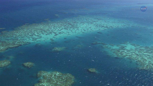
A New View of Coral Reefs
0 Views0 Comments0 Likes
A three-year NASA field expedition to examine Earth’s coral reefs is now underway, giving scientists the opportunity to study reef ecology and conditions.

Structural Engineering of Chicago’s 150 N. Riverside Building
0 Views0 Comments0 Likes
The V1 Video team interviewed Robert Chmielowski, Structural Engineer and Principal at Magnusson Klemencic Associates (MKA), at the 2016 NASCC: The Steel Conference, held April 13-15 in Orlando, Fla. He discusses the complexities of the unique building being developed at 150 N. Riverside along the Chicago River, which include the site's strong and narrow core, the steel used to make it possible, and the software used to design and analyze the building.


