


Category: Daily Digests
GeoSpatial Stream 11_18 (protected areas, geolocated tweets, infrastructure investment and more)
0 Views0 Comments0 Likes
This Daily Digest was published on 11/18/2013. Topics covered include identifying protected habitat areas, satellite imagery legislation, geolocated Tweets to reveal travel patterns, Indonesian infrastructure investment, and more.
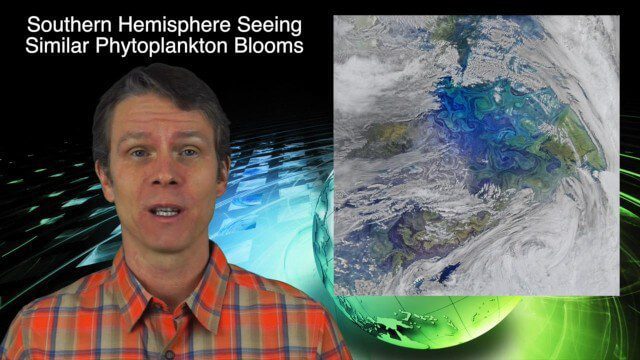
12_10 Earth Imaging Broadcast (Satellite News, Space Station Videos and More)
0 Views0 Comments0 Likes
This Earth Imaging-based GeoSpatial Stream broadcast discusses several stories related to satellites, including a video about the International Space Station's Servir Project; spring phytoplankton blooms imaged in the southern hemisphere; the anniversary of the Solar and Heliospheric Observatory (SOHO); industry news from Descartes Labs, exactEarth, Orbit Logic and SimActive; a video of satellites making the seas safer for humans; and more.
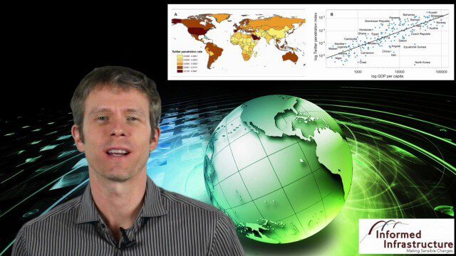
9_10 Location Surveillance Broadcast (Phone Tracking, Global Road Map and More)
0 Views0 Comments0 Likes
This GeoSpatial Stream broadcast discusses location surveillance and how portals are providing cellphone locations as a paid service; the Global Road Map and its quest to limit environmental impact; Canada's investment in a global survey of surface water; NATO's Joint Intelligence, Surveillance and Reconnaissance capability; industry news from Esri, Ocean Optics and PCI Geomatics; opinions on location surveillance; and more.
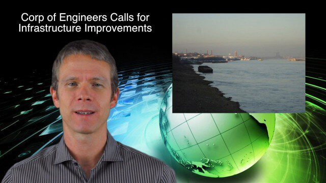
8_21 Climate Change Broadcast (New NASA Instruments, Ice Sheets and More)
0 Views0 Comments0 Likes
This GeoSpatial Stream broadcast discusses the latest news on climate change, including new NASA monitoring instruments for the International Space Station and ESA's CryoSat mission to measure ice-sheet loss; a U.S. Army Corps of Engineers call for infrastructure improvements in the Mississippi River Watershed; Maps.com and its new Field Trip Library educational series; industry news from American Sentinel University, Nokia HERE and Apple; a LiDAR video from the National Ecological Observatory Network on monitoring trees; and more.

8_20 Infrastructure Broadcast (Smart Cities, Nepal Recovery and More)
0 Views0 Comments0 Likes
This Infrastructure-themed GeoSpatial Stream broadcast discusses Smart Cities initiatives and reports to help urban areas become more sustainable and livable; updates from engineers concerning Nepal's earthquake recovery; industry news from Topcon Positioning Group, Woolpert, gViz and IMAGINiT; thoughts on the growing Smart Cities industry; and more.

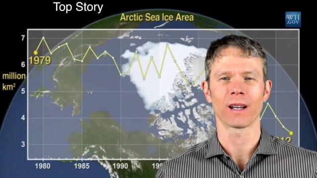
3_26 Climate Broadcast (Melting Ice, Deadly Air Pollution, Food Maps and More)
0 Views0 Comments0 Likes
This GeoSpatial Stream broadcast discusses the world's melting ice and rising seas, a WHO report stating that air pollution kills one in eight worldwide, "Cash for Clunker Maps," Food Maps, a GIS rap, and more.
1_8 New Year Broadcast (10 Predictions for 2015, AirAsia Flight and More)
0 Views0 Comments0 Likes
This GeoSpatial Stream broadcast looks back at 2014 and ahead to 2015, including the Top Ten Predictions for 2015; the tragic Indonesia AirAsia Flight 8501; industry news from Cadcorp, the Space Foundation and Elsevier; a roundup of important milestones from 2014; and more.

6_9 Earth Imaging Broadcast (Satellite Success, Asteroid Mining and More)
0 Views0 Comments0 Likes
This Earth Imaging-themed GeoSpatial Stream broadcast discusses the recent streak of success at the European Space Agency, including its Sentinel and Galileo launches as well as a demonstration of the SpaceDataHighway; a NASA video about its North Atlantic Aerosols and Marine Ecosystems Study (NAAMES) mission; industry news from Merrick-Surdex Joint Venture, TerraGo, Earth-i, Teledyne Optech and Siteco Informatica; thoughts on asteroid mining and related benefits to Earth sensing; and more.
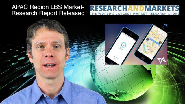
12_18 Asia-Pacific Broadcast (Cultural Heritage, APAC LBS Market and More)
0 Views0 Comments0 Likes
This Asia-Pacific-focused GeoSpatial Stream broadcast discusses a Cultural Preservation survey project in LaoSiCheng, China; a market-research report on the APAC region's LBS market; a V1 Media interview with a Bentley Systems Year in Infrastructure award winner from China; industry headlines from Paragon Software Systems, SkyTraq Technology Inc., Supergeo Technologies and Hamon Thermal Co.; and more.
1_28 Climate Change Broadcast (Polar Vortex, China’s Pollution Plumes, Broadband Mapping and More)
0 Views0 Comments0 Likes
This GeoSpatial Stream broadcast examines the latest effects of Climate Change on the Polar Vortex; China's pollution plumes monitored from space; Kids Making Sense; broadband mapping; the latest announcements from Boundless, Cityworks, Fugro Pelagos and Blue Marble Geographics; and more.


