Category: Vendor Videos
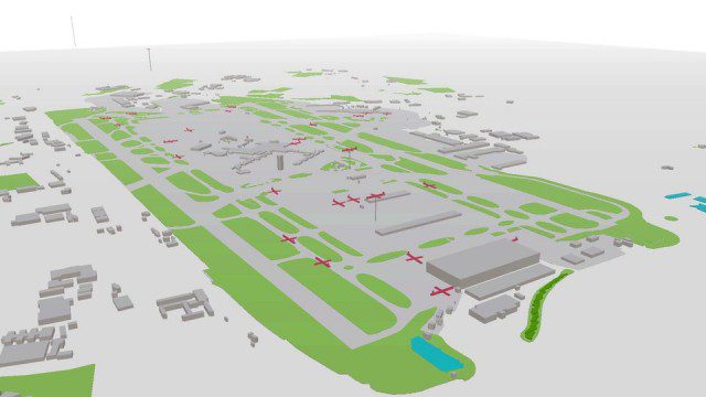
Live Planes in ViziCities using Plane Finder
3.17K Views0 Comments0 Likes
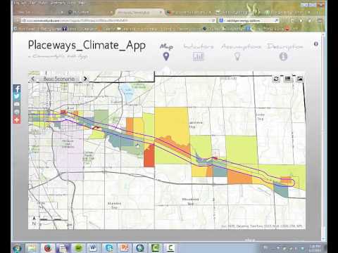
CommunityViz Web App
3.08K Views0 Comments0 Likes
Providing users with the ability to open new opportunities for education, citizen engagement, and policy change, the app enables users to quickly share their analysis results—such as energy and greenhouse gas generation and possible energy futures—with their ArcGIS Online organization, select groups, or the general public.
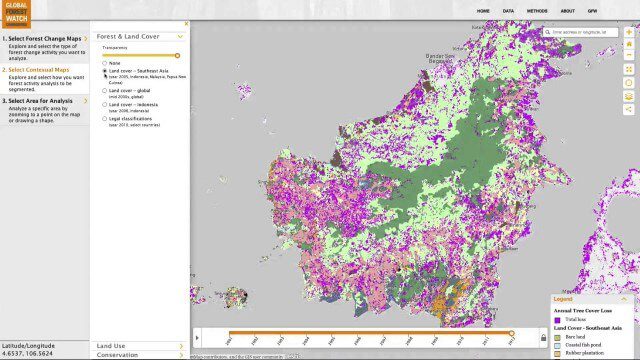
Global Forest Watch Commodities—Geospatial Tools to Help Reduce Greenhouse Gas Emissions from Land-Use Change
3.02K Views0 Comments0 Likes
This app provides three tools for businesses interested in good forest management: Suitability Mapper, which enables businesses to identify degraded areas best suited for commodity development as an alternative to clearing new forest areas; Forest Analyzer, which provides information on land cover and land use to monitor and evaluate change to forests on commodity concessions; and Roundtable on Sustainable Palm Oil (RSPO) Support tool, which users can complete for an analysis of forest change on certified areas and use the analysis for the compensation procedure required by RSPO while also enabling commodity buyers to make informed sourcing decisions.

Autodesk LIVE Brings Interactive Storytelling to Life
2.67K Views0 Comments0 Likes
Autodesk Inc. recently launched Autodesk LIVE, a new interactive visualization service that offers Revit users in the architecture, engineering and construction industries (AEC) the ability to transform their designs into fully interactive 3D models. This video provides a demo of the new technology.

Google’s Project Tango
2.62K Views0 Comments0 Likes
Project Tango is an exploration into giving mobile devices a human-scale understanding of space and motion.
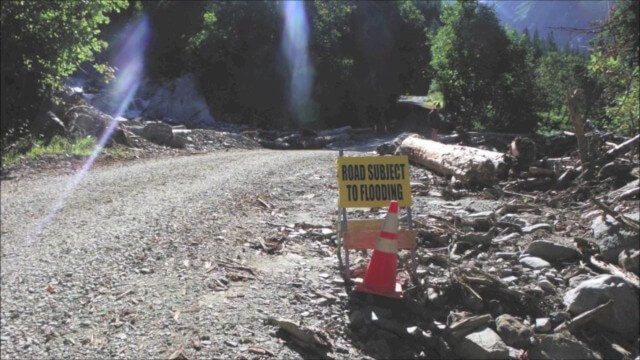
Culvert Inventory for Climate Resilience
2.60K Views0 Comments0 Likes
Designed to meet the challenge of limited information on culverts throughout the transportation network, the app provides a user-friendly culvert inventory template, online video instructions, and support for citizen scientists to help transportation management agencies expand their knowledge of the culverts in their network.
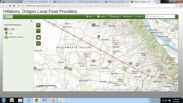
Local Food Alternatives in Washington County
2.59K Views0 Comments0 Likes
The app provides information on the availability of local and seasonal produce from nearby farms, markets, and vendors to empower Washington County consumers to reduce their carbon footprint and support their local community.

Google Glass Explorer Story: WWF’s Sabita Malla
2.58K Views0 Comments0 Likes
WWF's Sabita Malla is exploring how Glass can help protect rhinos.

The Algorithm Marketplace
2.55K Views0 Comments0 Likes
The Algorithm Marketplace provides automated analysis of aerial data acquired by UAVs (Unmanned Aerial Vehicles). Using sophisticated algorithms, drone operators no longer need a background in geographic information system (GIS) or remote sensing to interpret their aerial data; instead, the marketplace provides an action-based report to improve management of assets.