


Category: Vendor Videos

OcuTech 360 Video Mapping
3.65K Views0 Comments0 Likes
OcuTech 360 is an inclusive provider of 360 degree visual technologies that are applied in geospatial mapping. Thanks to state of the art hardware and software, you can now digitize infrastructure and interact with data in 3D space, take 3D measurements, and annotate. For more info, please visit ocutech360.com or contact [email protected].
Skybox Imaging Captures World’s First High-Resolution, HD Video of Earth from Space
3.60K Views0 Comments0 Likes

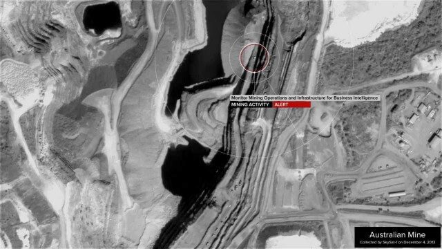
SpaceCurve Introduces Spatial at the Speed of Reality
3.59K Views0 Comments0 Likes
GeoSpatial Stream's Todd Danielson conducted an Internet Interview with SpaceCurve's CEO Dane Coyer and Founder Andrew Rogers. They spoke about the company's inception, Big Data, spatial indexing and business applications as well as how SpaceCurve created new technologies to integrate these varied components.

Urban Heat Risk Explorer
3.58K Views0 Comments0 Likes
Helping cities prepare for, respond to, and recover from extreme heat events, the app provides users with a better understanding of heat risks in cities and communicates with users on ways they can protect themselves during extreme heat events.
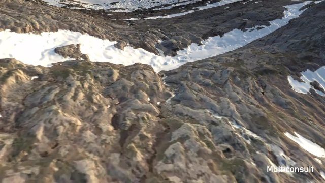
Use of InfraWorks and the Infrastructure Design Suite for a Hydropower Project in Norway
3.35K Views0 Comments0 Likes
Designing successful infrastructure projects is one thing. Communicating and demonstrating those designs to clients and other stakeholders before construction is another. Bringing a design to life for people without a civil engineering background is always a challenge, whether your goal is to sell the design or communicate its impact. - See more at: https://informedinfrastructure.com/20253/creating-real-time-navigable-3d-infrastructure-models/

Microsoft’s Nancy Li Talks about Mixed Reality in Construction
3.33K Views0 Comments0 Likes
Todd Danielson, the editorial director of Informed Infrastructure, interviewed Nancy Li, Microsoft's global head of partnerships and industry solutions for its Mixed Reality and AI Perception Group.

Flood Forecast
3.33K Views0 Comments0 Likes
When users register their address, they receive push alerts notifying them when that address is in danger of flooding. This app analyzes National Oceanic and Atmospheric Administration (NOAA) flood advisories, identifies specific properties affected by floods, consumes forecast information to provide accurate weather reports based on the user's location, and sends flood alerts via Twilio and the location of the nearest Disaster Assistance Center.
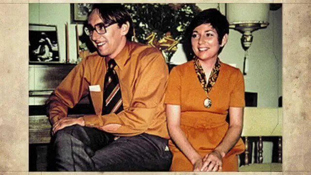
2015 Audubon Medal Awardees: Jack and Laura Dangermond
3.29K Views0 Comments0 Likes
Jack and Laura Dangermond launched Environmental Systems Research Institute (Esri) in 1969 with a vision of how maps and geographic sciences could promote deeper understanding of our world and enable us to design a better future. The Dangermonds have since donated more than a billion dollars in geo-spatial, analytical, and visualization technology to research institutions, schools, and nonprofit organizations, equipping these groups with the same GIS tools that drive the strategies of Fortune 500 companies.

Fully Integrated RiCOPTER UAV in Flight
3.19K Views0 Comments0 Likes
RiCOPTER is a high-performance UAV which can be equipped with the RIEGL VUX-1 survey-grade LiDAR sensor to offer a fully integrated turnkey solution and marks the first complete UAS LiDAR solution from one manufacturer.

Smart Mapping from Esri
3.18K Views0 Comments0 Likes
Smart Mapping is an exciting new capability in ArcGIS Online that will change how you make maps.


