


Category: Vendor Videos
How to get your Vendor Video added to the catalog
1.85K Views0 Comments0 Likes
If you'd like your Vendor Video added to the GeoSpatial Stream catalog, simply email your video or link to [email protected]. If approved, we'll add it to the collection.

Minnesota Solar Suitability Analysis
1.67K Views0 Comments0 Likes
This app enables users to identify the suitability of a location for solar panel installations by locating their home or current location and querying solar analysis data.
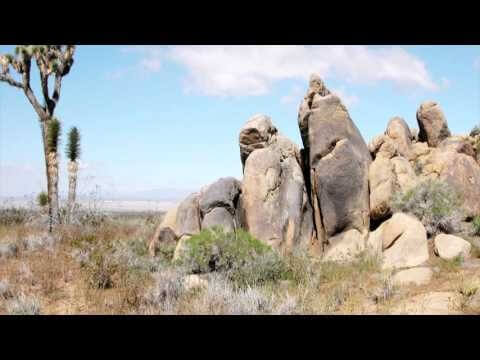
ACEC Colorado Award Winner: Data Fusion Predicts Habitat Quality
1.65K Views0 Comments0 Likes
Edwards Air Force Base is located in California’s Mojave Desert, which is home to unique and threatened species such as the desert tortoise, the Joshua tree and desert springparsley. The Air Force monitors impacts of its operations on habitats using multispectral satellite imagery and traditional aerial and field approaches. Hyperspectral imagery and Light Detection and Ranging (LiDAR) remotesensing technologies are being used as more cost-effective methods to collect and analyze spatial data related to habitat quality. Merrick & Company, the primary mapping consultant, was responsible for overall technical implementation, aviation coordination, sensor integration, LiDAR acquisition and point cloud post-processing. Fusing and modeling discreet remotely sensed data from several digital sensors is used to assess habitat quality for inventory and preservation of unique desert species, enabling systematic comparisons to be made over time for effective management of the desert ecosystem. The data also helps to substantiate that operations on Edwards Air Force Base do not degrade habitat quality that may result in the loss of sensitive species in the region.
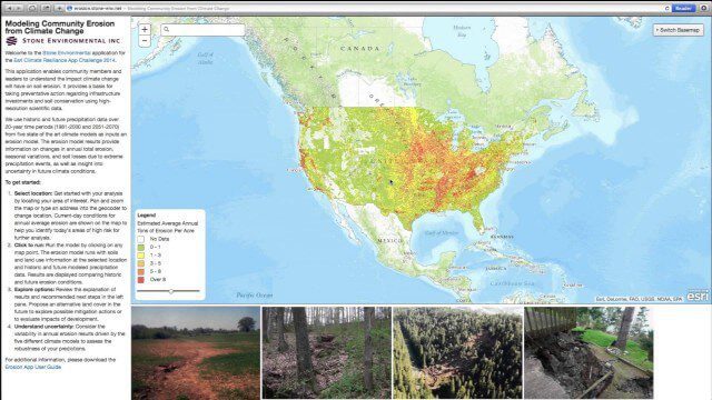
Modeling Community Erosion from Climate Change
1.53K Views0 Comments0 Likes
Based on modeling current and future soil erosion with high-resolution scientific data, the app allows users to locate sites that are vulnerable to erosion, predicts soil loss driven by climate change, and enables users to investigate erosion risks for future land covers.

Interview with Theo Agelopoulos, Autodesk
1.49K Views0 Comments0 Likes
In November 2019, Informed Infrastructure Editorial Director Todd Danielson interviewed Theo Agelopoulos, the senior director of Infrastructure Strategy and Marketing at Autodesk, at the Autodesk University (AU) Confe...

Interview with CEOs of Bentley Systems and Topcon Positioning Systems
1.26K Views0 Comments0 Likes
In October 2019, Informed Infrastructure Editorial Director Todd Danielson went to Bentley Systems’ Year In Infrastructure conference in Singapore. While there as an award juror for the Buildings and Campuses category, he was able to interview Greg Bentley and Ray O'Connor, the CEOs of Bentley Systems and Topcon Positioning Systems, respectively, about their companies and the joint venture they launched at the event: Digital Construction Works Incorporated (DCW).

Simulating Spaces for Social Distancing
797 Views0 Comments0 Likes
Todd Danielson, Informed Infrastructure's editorial director, interviewed Eduardo Lazzarotto, Bentley Systems’ director of Product Management for Facilities Engineering, via webcam.


