


Category: Vendor Videos
Introducing Google’s Project Wing
0 Views0 Comments0 Likes
Project Wing is a Google[x] project that is developing a delivery system that uses self-flying vehicles. As part of our research, we built a vehicle and traveled to Queensland, Australia for some test flights. There, we successfully delivered a first aid kit, candy bars, dog treats, and water to a couple of Australian farmers. We’re only just beginning to develop the technology to make a safe delivery system possible, but we think that there’s tremendous potential to transport goods more quickly, safely and efficiently.
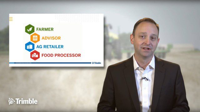
Launch of Trimble Ag Software
0 Views0 Comments0 Likes
Ben Allen, enterprise solutions lead for Trimble Agriculture, explains how Trimble’s new farm data management platform—Trimble Ag Software—simplifies management of data and helps farmers make informed, timely decisions.
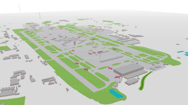
Live Planes in ViziCities using Plane Finder
0 Views0 Comments0 Likes
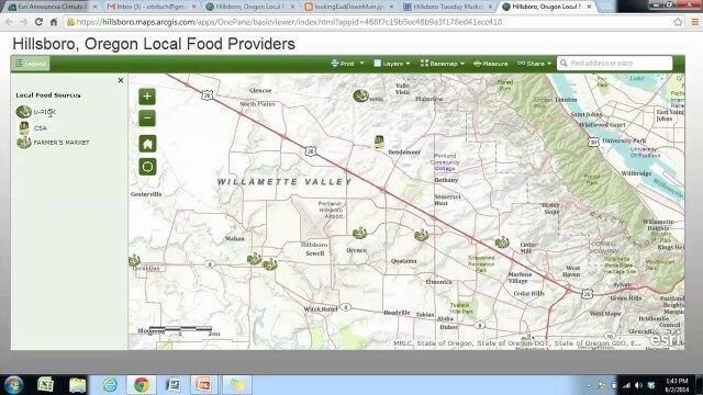
Local Food Alternatives in Washington County
0 Views0 Comments0 Likes
The app provides information on the availability of local and seasonal produce from nearby farms, markets, and vendors to empower Washington County consumers to reduce their carbon footprint and support their local community.

Microsoft’s Nancy Li Talks about Mixed Reality in Construction
0 Views0 Comments0 Likes
Todd Danielson, the editorial director of Informed Infrastructure, interviewed Nancy Li, Microsoft's global head of partnerships and industry solutions for its Mixed Reality and AI Perception Group.

Minnesota Solar Suitability Analysis
0 Views0 Comments0 Likes
This app enables users to identify the suitability of a location for solar panel installations by locating their home or current location and querying solar analysis data.
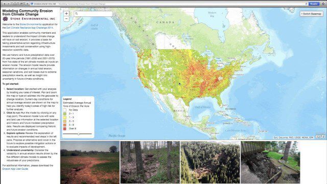
Modeling Community Erosion from Climate Change
0 Views0 Comments0 Likes
Based on modeling current and future soil erosion with high-resolution scientific data, the app allows users to locate sites that are vulnerable to erosion, predicts soil loss driven by climate change, and enables users to investigate erosion risks for future land covers.

OcuTech 360 Video Mapping
0 Views0 Comments0 Likes
OcuTech 360 is an inclusive provider of 360 degree visual technologies that are applied in geospatial mapping. Thanks to state of the art hardware and software, you can now digitize infrastructure and interact with data in 3D space, take 3D measurements, and annotate. For more info, please visit ocutech360.com or contact [email protected].
Project Tango: NASA SPHERES
0 Views0 Comments0 Likes
Since the summer of 2013, the Project Tango team has been working closely with a team at the NASA Ames Research Center. The goal: to integrate a Project Tango prototype onto a robotic platform, called SPHERES, that flies inside the International Space Station.
QuestUAV Parachute Landing
0 Views0 Comments0 Likes


