


Category: Found on the Internet
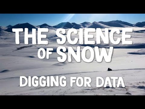
The Science of Snow: Digging for Data
0 Views0 Comments0 Likes
It takes a lot of field work in challenging conditions to gather important snow data. This is the story of NASA’s last SnowEx campaign and those who participated in it. In March, scientists traveled to research sites ...
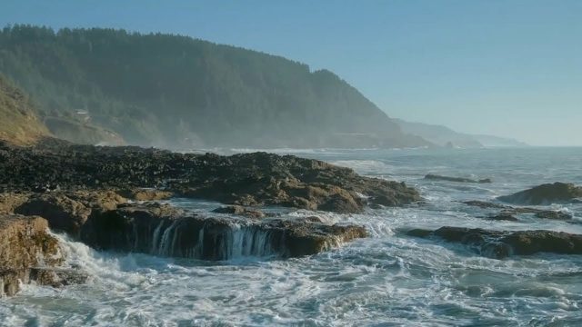
The YEARS Project: Warming Oceans
0 Views0 Comments0 Likes
Scientists have discovered that the world's oceans are warming 40% faster than we thought. That has dire implications for sea creatures and people.

Tom Zelibor State of Space 2022 Abbreviated Remarks
0 Views0 Comments0 Likes
In an annual State of Space 2022 commentary and video, Thomas Zelibor, CEO of Space Foundation, a nonprofit advocate organization founded in 1983 for the global space ecosystem, speaks to business and government lead...

TOPEX/JASON Sees 22-Year Sea Level Rise
0 Views0 Comments0 Likes
This visualization shows total sea level change between 1992 and 2014, based on data collected from the TOPEX/Poseidon, Jason-1, and Jason-2 satellites. Blue regions are where sea level has gone down, and orange/red regions are where sea level has gone up. Since 1992, seas around the world have risen an average of nearly 3 inches. The color range for this visualization is -7 cm to +7 cm (-2.76 inches to +2.76 inches), though measured data extends above and below 7cm(2.76 inches). This particular range was chosen to highlight variations in sea level change. Download the visualization: http://svs.gsfc.nasa.gov/cgi-bin/deta....

Toward the Next Generation of Air-Quality Monitoring
0 Views0 Comments0 Likes
Air pollution is the largest environmental health risk in Europe and significantly impacts the health of the European population, particularly in urban areas. Following on from the Sentinel-5P satellite – the first...
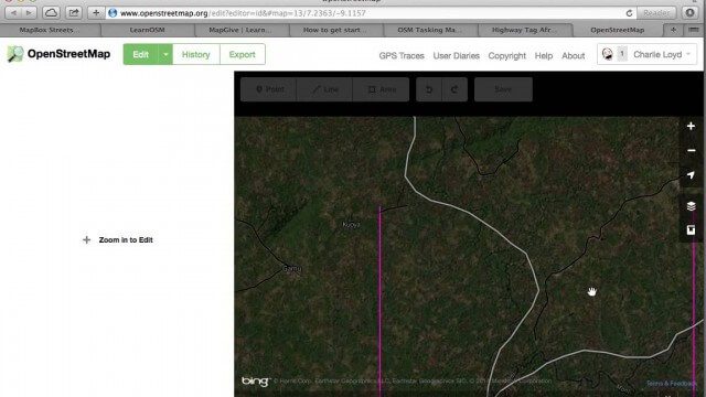
Tracing Demonstration for the Humanitarian OpenStreetMap Team (HOT)
0 Views0 Comments0 Likes
This is a simple demonstration of what it looks like to trace for the Humanitarian OpenStreetMap Team (HOT). It’s not meant as a full guide, just an example. If I’m too mumbly, please turn on the captions – the CC button below the video.
Tracking California Rains During El Niño
0 Views0 Comments0 Likes
This winter, areas across the globe experienced a shift in rain patterns due to the natural weather phenomenon known as El Niño. New NASA visualizations of rainfall data show the various changes to California. According to the National Oceanic and Atmospheric Administration, El Niño was expected to produce wetter-than-average conditions from December 2015 to February 2016. Scientists refer to historical weather patterns and to look at trends of where precipitation normally occurs during El Niño events. Also, several factors—not just El Niño—can contribute to unusual weather pattern.
Tracking Carbon from Wildfires to Ocean Blooms
0 Views0 Comments0 Likes
Between September 2019 and March 2020, wildfires killed billions of animals and decimated more than 200 thousand square kilometers of Australian forest, an area larger than Nebraska. Later, thousands of kilometers awa...
Tracking Carbon from Wildfires to Ocean Blooms
0 Views0 Comments0 Likes
Between September 2019 and March 2020, wildfires killed billions of animals and decimated more than 200 thousand square kilometers of Australian forest, an area larger than Nebraska. Later, thousands of kilometers awa...
Tracking Ocean Heat with Magnetic Fields
0 Views0 Comments0 Likes
Scientists at NASA’s Goddard Space Flight Center are developing a new way to use satellite observations of magnetic fields to measure heat stored in the ocean.


