
Browse Archives
2_5 Earth Imaging Broadcast (Rosetta Mission, QuickBird Retires and More)
0 Views0 Comments0 Likes
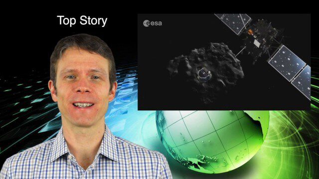
This Earth Imaging-themed GeoSpatial Stream broadcast discusses the Rosetta Space Mission that landed on a comet; a new instrument on the International Space Station; a new UAS endurance record; DigitalGlobe's retiring of its QuickBird satellite after 13 years; industry news from Scene Sharp Technologies, Sokkia, NGA, BAE Systems and Google Earth Pro; new videos posted to GeoSpatial Stream; and more.

2015 Audubon Medal Awardees: Jack and Laura Dangermond
0 Views0 Comments0 Likes
Jack and Laura Dangermond launched Environmental Systems Research Institute (Esri) in 1969 with a vision of how maps and geographic sciences could promote deeper understanding of our world and enable us to design a better future. The Dangermonds have since donated more than a billion dollars in geo-spatial, analytical, and visualization technology to research institutions, schools, and nonprofit organizations, equipping these groups with the same GIS tools that drive the strategies of Fortune 500 companies.

2015 Geodesign Summit Rapidly Approaching, Highlights Discussed
0 Views0 Comments0 Likes
Shannon McElvaney, Esri's Community Development Manager, notes some of the speaker and event highlights for the upcoming 2015 Geodesign Summit to be held Jan. 22-23, 2015, in Redlands, Calif. This "transdisciplinary" event has a place for anyone looking to help create a better world through informed, collaborative design.

2017 Be Inspired Awards Project Highlights
0 Views0 Comments0 Likes
Several members of the Bentley Systems team discuss the Be Inspired Awards projects from the 2017 Year In Infrastructure event held Oct. 10-12, 2017, in Singapore.
2017 Drone Data Race
0 Views0 Comments0 Likes
On April 22, 2017, the Aerial and Aquatic Robot Research group (AARR) of the California State University Channel Islands hosted the first Drone Data Race in Camarillo, CA.
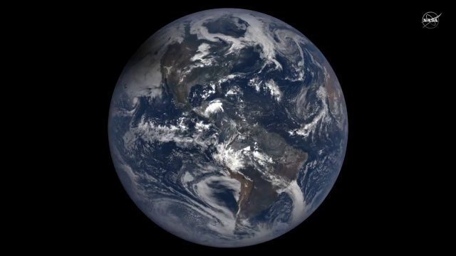
2017 Solar Eclipse Shadow Seen from Million Miles Away
0 Views0 Comments0 Likes
The moon's shadow (umbra) crossed the continental United States on Aug. 21, 2017 and NASA's DSCOVR satellite's Earth Polychromatic Imaging Camera (EPIC) captured imagery.
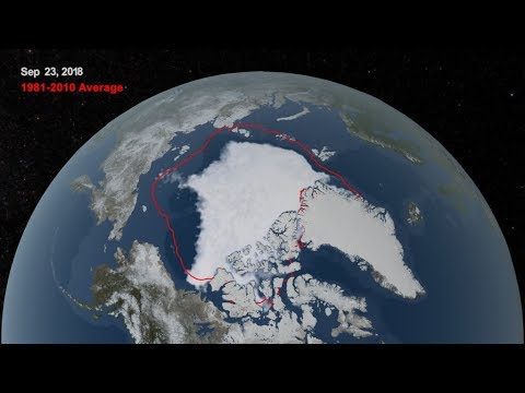
2018 Arctic Sea Ice Ties for Sixth Lowest Minimum Extent on NASA Record
0 Views0 Comments0 Likes
Arctic sea ice reached its annual minimum extent Sept. 19, and then again on Sept. 23, 2018. NASA works with the National Snow and Ice Data Center to track sea ice in the Arctic as it grows to a maximum extent thro...
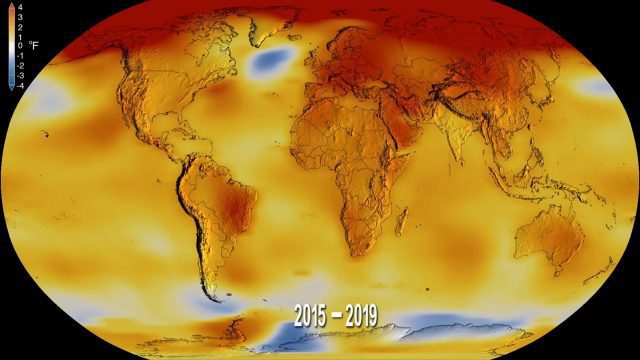
2019 Was the Second-Hottest Year on Record
0 Views0 Comments0 Likes
Earth's global surface temperatures in 2019 ranked second-warmest since 1880, according to independent analyses by NASA and the National Oceanic and Atmospheric Administration (NOAA).
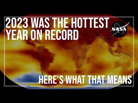
2023 Was the Hottest Year on Record
0 Views0 Comments0 Likes
2023 was Earth’s warmest year since 1880, and the last 10 consecutive years have been the warmest 10 on record. But why does NASA, a space agency, look at Earth’s temperature? And how do we even measure global tempera...
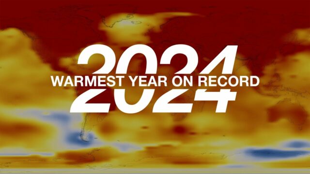
2024 Is the Warmest Year on Record
0 Views0 Comments0 Likes
Earth's average surface temperature in 2024 was the warmest on record, according to an analysis led by NASA scientists. Credit: NASA's Goddard Space Flight Center Grace Weikert (GSFC AMA): Lead Producer Mark ...


