


Category: Vendor Videos
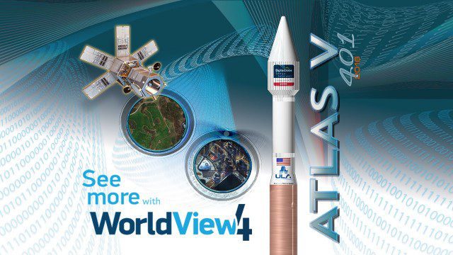
Atlas V WorldView Launch Broadcast Replay
0 Views0 Comments0 Likes
Watch a replay as the ULA's Atlas V launches the WorldView-4 launch for DigitalGlobe.
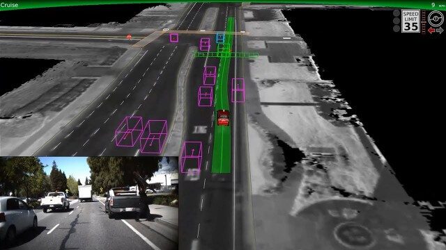
Google Self-Driving Car on City Streets
0 Views0 Comments0 Likes
The Google self-driving car navigates some common scenarios on city streets near the Googleplex.
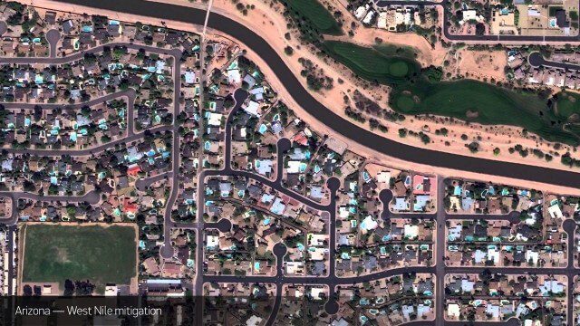
Satellite Imagery to Catch Environmental Changes
0 Views0 Comments0 Likes
How governments are using high-resolution satellite imagery to catch environmental issues before they become health hazards - and EPA fines.
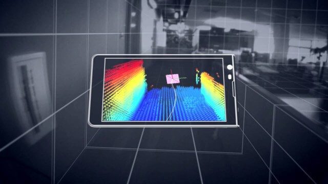
Google’s Project Tango
0 Views0 Comments0 Likes
Project Tango is an exploration into giving mobile devices a human-scale understanding of space and motion.
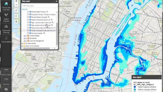
Coastal Resilience 2.0
0 Views0 Comments0 Likes
Providing tools to reduce ecological and socioeconomic risks of coastal hazards, the app enables users to assess such risks, including those to current and future storms, as well as sea level rise scenarios; identify solutions to reduce risks across socio-ecological systems; take action to help communities develop nature-based solutions; and measure effectiveness to ensure efforts are successful.

The Algorithm Marketplace
0 Views0 Comments0 Likes
The Algorithm Marketplace provides automated analysis of aerial data acquired by UAVs (Unmanned Aerial Vehicles). Using sophisticated algorithms, drone operators no longer need a background in geographic information system (GIS) or remote sensing to interpret their aerial data; instead, the marketplace provides an action-based report to improve management of assets.

Exploring InfraWorks Vegas Style! Event (Short Version)
0 Views0 Comments0 Likes
This video is a short trailer of the full video recapping the Exploring InfraWorks (Vegas Style!) event that took place during Autodesk University 2013. A bus trip explored the use of Autodesk technology to model the infrastructure of the city of Las Vegas. VTN Consulting is the main contractor on the project.

600 km Above Earth’s Surface with HD Video (Skybox Imaging)
0 Views0 Comments0 Likes

OcuTech 360 Video Mapping
0 Views0 Comments0 Likes
OcuTech 360 is an inclusive provider of 360 degree visual technologies that are applied in geospatial mapping. Thanks to state of the art hardware and software, you can now digitize infrastructure and interact with data in 3D space, take 3D measurements, and annotate. For more info, please visit ocutech360.com or contact [email protected].
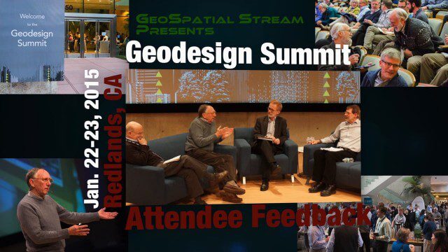
Geodesign Summit 2015: Attendee Feedback
0 Views0 Comments0 Likes
The Geodesign Summit 2015 featured a variety of speakers and topics focused on designing a better and smarter built environment. This video produced by GeoSpatial Stream presents immediate feedback from attendees describing what geodesign means to them and how they plan to apply what they learned at the event to their jobs and lives.


