


Category: Vendor Videos
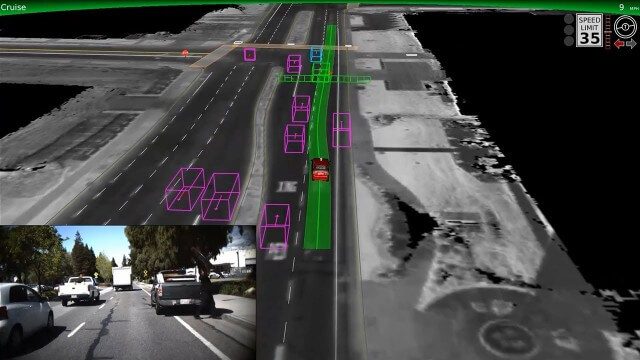
Google Self-Driving Car on City Streets
0 Views0 Comments0 Likes
The Google self-driving car navigates some common scenarios on city streets near the Googleplex.

600 km Above Earth’s Surface with HD Video (Skybox Imaging)
0 Views0 Comments0 Likes

SpaceCurve Introduces Spatial at the Speed of Reality
0 Views0 Comments0 Likes
GeoSpatial Stream's Todd Danielson conducted an Internet Interview with SpaceCurve's CEO Dane Coyer and Founder Andrew Rogers. They spoke about the company's inception, Big Data, spatial indexing and business applications as well as how SpaceCurve created new technologies to integrate these varied components.
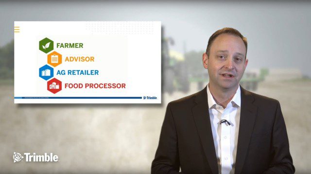
Launch of Trimble Ag Software
0 Views0 Comments0 Likes
Ben Allen, enterprise solutions lead for Trimble Agriculture, explains how Trimble’s new farm data management platform—Trimble Ag Software—simplifies management of data and helps farmers make informed, timely decisions.

Esri’s Geotrigger Service Explained
0 Views1 Comments0 Likes
Matt Ball spoke with Amber Case, director of Esri's R&D Center in Portland, at the Local Data Summit in Denver on Feb. 25, 2014. The conversation ranges from accessible geospatial technology, the ubiquity of mobile devices, and the connections that are made with location awareness and location-based alerts.

Year in Infrastructure 2017
0 Views0 Comments0 Likes
See presentations that inspire, including what’s next in Bentley software, thought-provoking guest keynotes, and this year’s industry advancements.

RideAmigos UNITY
0 Views0 Comments0 Likes
Uniting entities that create the data needed to provide rich visualizations and insights into commuter habits globally, Unity enables unlimited public and private networks within a region to create behavioral changes and eliminate traffic by allowing users to sync data to Esri ArcGIS software for modal analysis. Users can also explore how each mode contributes to greenhouse gas emissions and climate change.

Esri App Challenge Winners Create Actionable Tools to Strengthen Resilience Efforts
0 Views0 Comments0 Likes
Esri App Challenge Winners Create Actionable Tools to Strengthen Resilience Efforts Hundreds of Apps Submitted in Response to White House Climate Data Initiative Redlands, California—July 15, 2014—Esri...

Interview with Theo Agelopoulos, Autodesk
0 Views0 Comments0 Likes
In November 2019, Informed Infrastructure Editorial Director Todd Danielson interviewed Theo Agelopoulos, the senior director of Infrastructure Strategy and Marketing at Autodesk, at the Autodesk University (AU) Confe...
Flood Forecast
0 Views0 Comments0 Likes
When users register their address, they receive push alerts notifying them when that address is in danger of flooding. This app analyzes National Oceanic and Atmospheric Administration (NOAA) flood advisories, identifies specific properties affected by floods, consumes forecast information to provide accurate weather reports based on the user's location, and sends flood alerts via Twilio and the location of the nearest Disaster Assistance Center.


