


Category: Found on the Internet

PEACE on Earth GPS Art
0 Views0 Comments0 Likes
I traveled over 65,700 miles to meet people from all around the world to help me create a GPS drawing that would express a simple message. This is my journey.
Tracking California Rains During El Niño
0 Views0 Comments0 Likes
This winter, areas across the globe experienced a shift in rain patterns due to the natural weather phenomenon known as El Niño. New NASA visualizations of rainfall data show the various changes to California. According to the National Oceanic and Atmospheric Administration, El Niño was expected to produce wetter-than-average conditions from December 2015 to February 2016. Scientists refer to historical weather patterns and to look at trends of where precipitation normally occurs during El Niño events. Also, several factors—not just El Niño—can contribute to unusual weather pattern.

TOPEX/JASON Sees 22-Year Sea Level Rise
0 Views0 Comments0 Likes
This visualization shows total sea level change between 1992 and 2014, based on data collected from the TOPEX/Poseidon, Jason-1, and Jason-2 satellites. Blue regions are where sea level has gone down, and orange/red regions are where sea level has gone up. Since 1992, seas around the world have risen an average of nearly 3 inches. The color range for this visualization is -7 cm to +7 cm (-2.76 inches to +2.76 inches), though measured data extends above and below 7cm(2.76 inches). This particular range was chosen to highlight variations in sea level change. Download the visualization: http://svs.gsfc.nasa.gov/cgi-bin/deta....
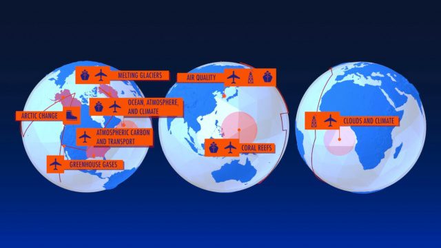
NASA Earth Expeditions: An Animated Tour
0 Views0 Comments0 Likes
NASA takes you on a world tour with this animation as we kick off major new field campaigns to study regions of critical change from land, sea and air.
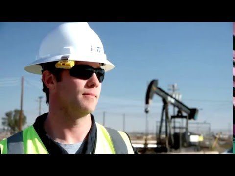
Unmanned Flights Take to San Joaquin Valley Skies
0 Views0 Comments0 Likes
In the San Joaquin Valley, Chevron launched unmanned aerial systems above its Coalinga Field to capture high-resolution and thermal imagery as part of a pilot project to incorporate the technology in its day-to-day field operations.
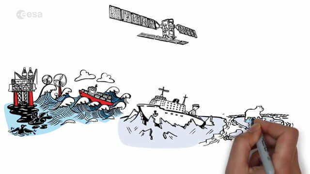
Satellite Radar Vision Whiteboard
0 Views0 Comments0 Likes
Discover how the European Space Agency Sentinel-1 mission uses its radar to provide an all-weather, day-and-night supply of imagery of Earth’s surface to make our lives safer.
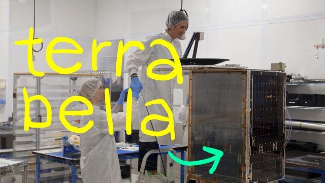
Terra Bella, Google’s Satellite Startup
0 Views0 Comments0 Likes
We both grew up on a healthy diet of sci-fi shows and LOVE space, so ever since a couple of years ago when we heard that a satellite company had joined Google...we’ve been wanting to visit it. Which we finally did in this episode! Get ready for lots of cool satellite imagery + info. Want to learn more about Terra Bella? → https://terrabella.google.com/

Willis Tower: Windy City Challenge
0 Views0 Comments0 Likes
Wind blowing off Lake Michigan is a common challenge to architects and engineers building in Chicago. Here's how Fazlur Kahn, structural engineer of Willis (Sears) Tower, developed a system capable of distributing the load of the building's 110 stories in the face of even the strongest gusts.

Hurricane Forecasts Rely on Modeling the Past
0 Views0 Comments0 Likes
Improving hurricane forecasts means testing historical storms with today's sophisticated models and supercomputers. NASA and NOAA work together in gathering ground and satellite observations, as well as experimenting with research forecast models. As a result of this collaboration, model resolution has increased, and scientists are discovering more about the processes that occur within these powerful storms. The Global Precipitation Measurement (GPM) Mission is a joint NASA and Japan Aerospace Exploration Agency (JAXA) mission that measures all forms of precipitation around the globe. GPMs Microwave Imager, or GMI, has proven useful in seeing beneath the swirling clouds and into the structure of tropical cyclones. The information gathered by GPM and other missions will be used to improve forecast models.
GEOINT Keynote: Robert Cardillo, Director, NGA
0 Views0 Comments0 Likes
The U.S. Geospatial Intelligence Foundation (USGIF) recorded the keynote speech of Robert Cardillo, Director of the National Geospatial-Intelligence Agency (NGA), at the 2016 GEOINT Symposium on May 16, 2016, in Orlando, Fla.


