


Category: Found on the Internet

Achim Steiner – Eye on Earth Summit 2015
0 Views0 Comments0 Likes
Over 650 delegates from government, UN bodies, the non-governmental sector, private sector, academia and civil society will gather in Abu Dhabi between 6 and 8 October for the Eye on Earth Summit 2015. Learn more here: www.eoesummit.org

After Quake, Engineer in Khatmandu Describes What Fell Down, or Didn’t, and Why
0 Views0 Comments0 Likes
Kit Miyamoto, a structural engineer fresh from five years rebuilding Haiti, spoke with Andy Revkin of The New York Times Dot Earth blog after a day inspecting Kathmandu damage zones.

The Algorithm Marketplace
0 Views0 Comments0 Likes
The Algorithm Marketplace provides automated analysis of aerial data acquired by UAVs (Unmanned Aerial Vehicles). Using sophisticated algorithms, drone operators no longer need a background in geographic information system (GIS) or remote sensing to interpret their aerial data; instead, the marketplace provides an action-based report to improve management of assets.
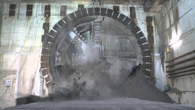
Crossrail Tunnelling: Drone’s Eye View of Crossrail’s Completed Rail Tunnels
0 Views0 Comments0 Likes
The Prime Minister and Mayor of London Boris Johnson celebrated the completion of Crossrail’s tunnels by going 40 metres below the capital to thank the men and women who are constructing the new £14.8 billion east-west railway.

Everything that Happens, Happens Somewhere
0 Views0 Comments0 Likes
As our planet is becoming more crowded, the demand for diminishing natural resources is growing. Income gaps are widening,and people are being left behind. Geographic location -- and information about these locations – shows us where social, environmental and economic conditions occur. Reliable and authoritative geographic information provides the framework for measuring, monitoring and achieving the sustainable development goals, improving people’s lives and protecting the planet. The United Nations initiative on Global Geospatial Information Management (UN-GGIM) aims at playing a leading role in setting the agenda for the development of global geospatial information and to promote its use to address key global challenges. It provides a forum to liaise and coordinate among Member States, and between Member States and international organizations.
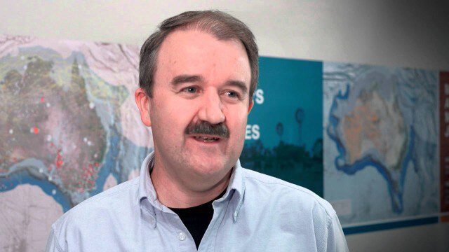
Translating Airborne Electromagnetic Data into Geological Understanding
0 Views0 Comments0 Likes
In this Geoscience Australia Snapshot video, Dr Ian Roach from Geoscience Australia gives an overview of the benefits of using airborne electromagnetic (AEM) survey data. This survey technique is a key tool for mapping geology undercover and has potential implications for understanding the energy, minerals and regional geology of the survey area.
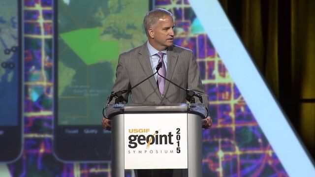
Robert Cardillo, NGA Director – Keynote Full Presentation | GEOINT 2015
0 Views0 Comments0 Likes
USGIF's Trajectory On Location published this video of the keynote presentation delivered by Robert Cardillo, director of the National Geospatial-Intelligence Agency, at the GEOINT Symposium 2015.
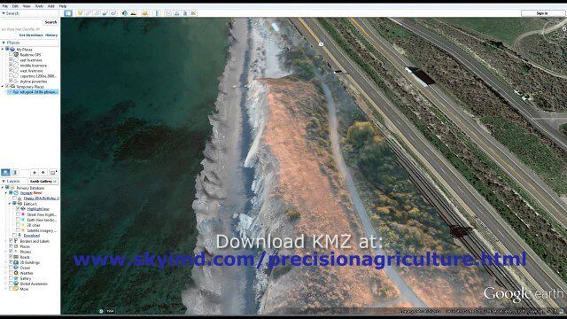
Santa Barbara Refugio Oil Spill in 3D Using Canon Camera
0 Views0 Comments0 Likes
Santa Barbara Refugio Beach Oil Spill, May 20-21, 2015. While flying precision agriculture grapes Sky Imaging Mapping Data diverted to Santa Barbara. On arrival the entire area was imaged from 12-1500 feet above the ocean. Post flight the imagery was processed into 3D models and overlaid on Google Earth for easy browsing (waves look jagged).
ASPECT: Flying for First Responders
0 Views0 Comments0 Likes
EPA's Airborne Spectral Photometric Environmental Collection Technology (ASPECT) provides infrared and photographic images with geospatial, chemical and radiological information within minutes to the first responder.
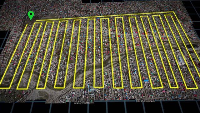
UAV-Based Aerial Mapping of Ulaanbaatar
0 Views0 Comments0 Likes
Working with the City of Ulaanbaatar, The Asia Foundation collected high-quality imagery and elevation data for the city using Unmanned Aerial Vehicles (UAVs) and earth-imaging satellites. These high-resolution images were used to create detailed maps complete with elevation data; labeled neighborhoods, roads, buildings, landmarks, and other features.


