


Category: Found on the Internet
GEOINT Keynote: James R. Clapper, Director of National Intelligence
0 Views0 Comments0 Likes
The U.S. Geospatial Intelligence Foundation (USGIF) recorded the keynote speech of James Clapper, director of National Intelligence, at the 2016 GEOINT Symposium on May 16, 2016, in Orlando, Fla.
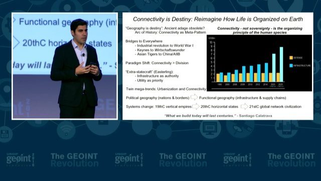
GEOINT Keynote: Parag Khanna, Author on Mapping
0 Views0 Comments0 Likes
The U.S. Geospatial Intelligence Foundation (USGIF) recorded the keynote speech of Parag Khanna, author, “Connectography: Mapping the Future of Global Civilization," at the 2016 GEOINT Symposium on May 16, 2016, in Orlando, Fla.
GEOINT Keynote: Betty J. Sapp, Director, NRO
0 Views0 Comments0 Likes
The U.S. Geospatial Intelligence Foundation (USGIF) recorded the keynote speech of Betty J. Sapp, director, National Reconnaissance Office, at the 2016 GEOINT Symposium on May 16, 2016, in Orlando, Fla.

GEOINT Keynote: Marcel Lettre, Under Secretary of Defense for Intelligence
0 Views0 Comments0 Likes
The U.S. Geospatial Intelligence Foundation (USGIF) recorded the keynote speech of Marcel Lettre, Under Secretary of Defense for Intelligence, at the 2016 GEOINT Symposium on May 16, 2016, in Orlando, Fla.
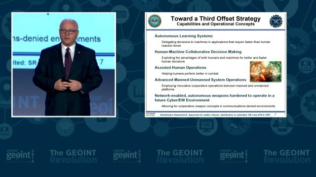
GEOINT Keynote: Stephen P. Welby, Assistant Secretary of Defense for Research and Engineering
0 Views0 Comments0 Likes
The U.S. Geospatial Intelligence Foundation (USGIF) recorded the keynote speech of Stephen P. Welby, Assistant Secretary of Defense for Research and Engineering, at the 2016 GEOINT Symposium on May 16, 2016, in Orlando, Fla.

OcuTech 360 Video Mapping
0 Views0 Comments0 Likes
OcuTech 360 is an inclusive provider of 360 degree visual technologies that are applied in geospatial mapping. Thanks to state of the art hardware and software, you can now digitize infrastructure and interact with data in 3D space, take 3D measurements, and annotate. For more info, please visit ocutech360.com or contact [email protected].
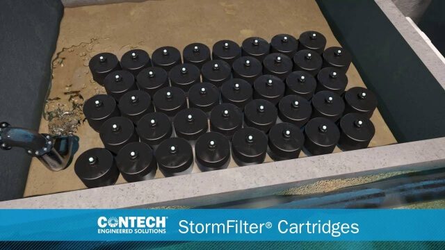
St. Anthony Regional Stormwater Treatment and Research System
0 Views0 Comments0 Likes
An estimated 169 million gallons of polluted stormwater runoff will be captured and treated each year by this underground facility on the border of Minneapolis and St. Anthony Village. It is projected to cut pollution levels by more than half for stormwater runoff flowing from the southern half of St. Anthony Village to the Mississippi River. Learn more at http://mwmo.org/sav
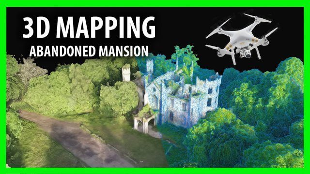
3D Drone Mapping of Scotland’s Cambusncethan Priory Mansion
0 Views0 Comments0 Likes
Abandoned Scotland created this video of a project to create 3D mapping from drones of the Cambusncethan Priory mansion. http://www.abandonedscotland.com

Autodesk LIVE Brings Interactive Storytelling to Life
0 Views0 Comments0 Likes
Autodesk Inc. recently launched Autodesk LIVE, a new interactive visualization service that offers Revit users in the architecture, engineering and construction industries (AEC) the ability to transform their designs into fully interactive 3D models. This video provides a demo of the new technology.

NASA Sees Intense Fires around the World
0 Views0 Comments0 Likes
This year’s wildfire season is off to a blazing start. The United States had an early start to the season, with more than 29,000 wildfires burning more than 2.6 million acres of land. The driest season in 14 years has left the southern Amazon primed for heavy wildfire activity as well.


