


Category: Daily Digests

2_25 Earth Imaging Broadcast (Sentinel Launch, Smallsats and More)
0 Views0 Comments0 Likes
This Earth Imaging-themed GeoSpatial Stream broadcast discusses the recently launched Sentinel-3A Earth-monitoring satellite; a smallsat/cubesat video created by the European Space Agency; NASA UAS/drone news; industry news from Esri, SimActive, Teledyne Optech and Riegl; a funny mapping video from the University of Kentucky's New Maps Plus online education program; and more.

3_6 ILMF Broadcast (Conference Recap, USGS News, Aerial Imagery Market and More)
0 Views0 Comments0 Likes
This GeoSpatial Stream broadcast discusses the recent International LiDAR Mapping Forum, important USGS news, the future of the aerial imagery market, a map contest, and more.

7_23 Esri UC Broadcast (Video Recap, Exhibitor News and More)
0 Views0 Comments0 Likes
This GeoSpatial Stream broadcast covers news and events from the recent Esri User Conference in San Diego, including a video recap of speakers and topics; news from Esri on the Special Achievement in GIS Awards, its Tapestry Segmentation system and a partnership with European Schoolnet; exhibitor news from Topcon Positioning Group, Airbus Defense and Space, LizardTech and Scene Sharp; a clip from an interview with Jack Dangermond, Esri's president and founder; and more.

6_25 Hurricane Broadcast (Infrastructure Spending, Iraq and More)
0 Views0 Comments0 Likes
This GeoSpatial Stream broadcast discusses the 2014 hurricane season; infrastructure spending predicted to increase to $9 trillion by 2025; a Landsat image of Iraq; the Dutch Water System; industry news from Eagle Mapping, Riegl, E-Capture R&D, Esri, Blue Marble Geographics and URISA; and more.

6_16 Infrastructure Broadcast (PDH Credit, HxGN Live and More)
0 Views0 Comments0 Likes
This Infrastructure-themed GeoSpatial Stream broadcast discusses the latest issue of Informed Infrastructure, including an article on Treasure Island bridge design, PDH credit for an Autodesk benchmark study, and new Web site features and interviews; video clips from the recent HxGN Live event covering Hexagon's latest technologies and direction; industry news from Hexagon, CINTEC America, Contech Engineered Solutions and CoreLogic; thoughts on an upcoming road trip across America's infrastructure; and more.

2_12 Roger Tomlinson Broadcast (GeoDesign Summit, Tomlinson Tribute, Landsat 8 and More)
0 Views1 Comments0 Likes
This GeoSpatial Stream broadcast discusses Esri's GeoDesign Summit; the recent passing of Roger Tomlinson, "The Father of GIS"; Landsat 8's birthday; climate change and national security; woodland conservation; geospatial gaming technology; and more.
10_8 Asia Pacific Broadcast (New Satellites and Rockets, Mumbai Mapping and More)
0 Views0 Comments0 Likes
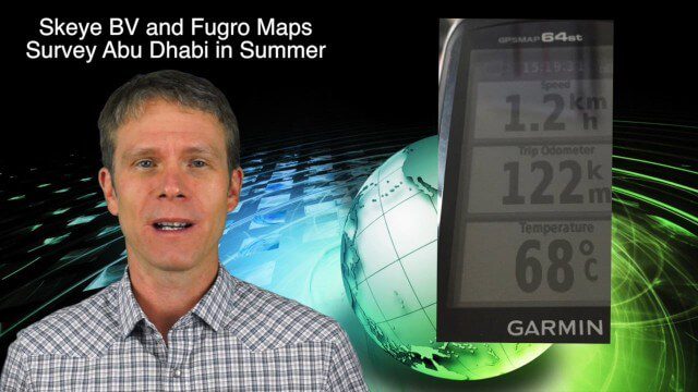
This Asia Pacific-themed GeoSpatial Stream broadcast covers several new satellites and rockets launched from Asia, including China's Pujian-1 and 20th Beidou satellites, a new Chinese Long March-6 rocket, imagery from China's TripleSat Constellation, and the Indian Space Research Organization launching another PSLV rocket carrying ASTRONAUT and six foreign satellites; Mumbai students mapping the Mithi River; Japanese scientists using laser scanning to study ancient tombs; industry news from Esri, Miyamoto International, Intergraph, Skeye BV and Fugro Maps; clips from a video about Ushahidi mapping in Semarang, Indonesia; and more.
2_18 Asia-Pacific Broadcast (China’s Ecological Infrastructure, TeLEOS-1 Satellite, Alibaba Mapping Offer and More)
0 Views0 Comments0 Likes
This Asia-Pacific-focused GeoSpatial Stream broadcast discusses Kongjian Yu's efforts in China's ecological infrastructure; the TeLEOS-1 Earth-imaging satellite; the Geological Survey of India; Alibaba's offer for AutoNavi; the "other" Great Wall of China mapping; Skybox Imaging in Australasia; and more.

5_12 Infrastructure Broadcast (Earthquakes, Streetcars and More)
0 Views0 Comments0 Likes
This Infrastructure-themed GeoSpatial Stream broadcast covers the devastating earthquake in Ecuador on April 16, 2016, and relief efforts from Miyamoto International to help rebuild the city's hard-hit infrastructure; a recently opened $100-million-dollar streetcar project in Kansas City; industry news from Trimble, Bentley Systems, Transoft Solutions and Autodesk; a video interview clip about Chicago's famed 150 N. Riverside Building; and more.
10_30 Infrastructure Broadcast (Green Buildings, Bridge Construction and More)
0 Views0 Comments0 Likes
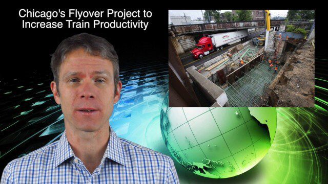
This GeoSpatial Stream broadcast discusses infrastructure news and videos, including a report on Green Buildings; the new Englewood Flyover train project in Chicago; a smart traffic-light network; accelerated bridge construction in Rhode Island; industry news from Esri Canada, Innovyze, Maptek and Autodesk; the upcoming Trimble Dimensions conference in Las Vegas; and more.


