
Browse Archives

Patrick Collins Interview
3.55K Views0 Comments0 Likes
Matt Ball interviews Patrick Collins, Technical Solutions Engineer, Exelis Visual Information Solutions. They discuss the increasing size of LiDAR data and the tools to handle such volume as well as the variety of ways image data can be analyzed, including automated feature extraction.
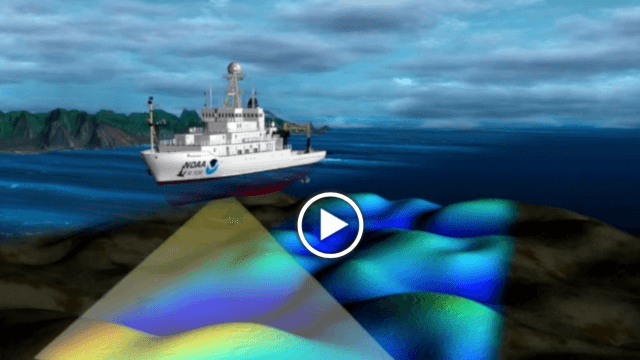
NOAA’s SoundScapes
2.04K Views0 Comments0 Likes
In this episode: in less than three minutes, this video presents the basics about multibeam and side scan sonar, including a visualization that shows how sonar data is used to make products like nautical charts.
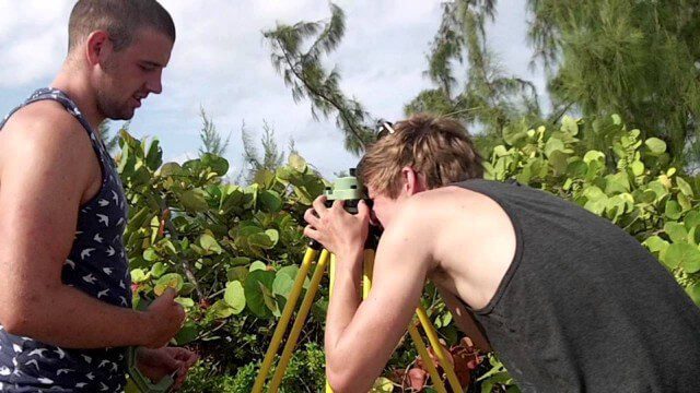
Surveying, Mapping and GIS Expedition to British Virgin Islands
2.61K Views0 Comments0 Likes
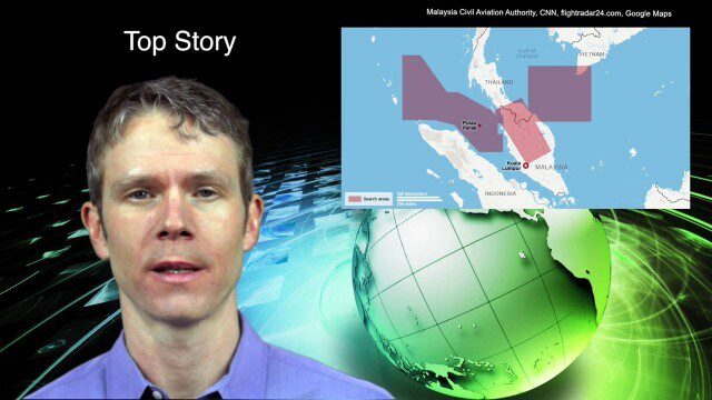
3_18 Asia-Pacific Broadcast (Malaysia Flight 370, “Smog-Busting Drones,” Shark Cameras and More)
7.43K Views0 Comments0 Likes
This Asia-Pacific-focused GeoSpatial Stream broadcast discusses the mysteries of Malaysia Flight 370 and geospatial technology’s role, China’s “War on Pollution” enlisting drone smog fighters, Afghanistan resource maps, a youth GIS contest, and more.

3_19 Infrastructure Broadcast (NYC Gas Explosion, Canada vs. U.S. Infrastructure and More)
3.42K Views0 Comments0 Likes
This infrastructure-focused GeoSpatial Stream broadcast discusses the gas-leak explosion in New York City; the state of the U.S. infrastructure; Canadian investment; announcements from the Smart Grid Innovation Hub, Bentley Systems, Esri, Oracle and Topcon Positioning Group; and more.
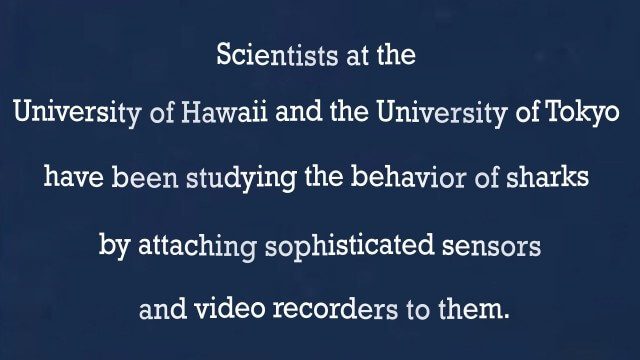
A “shark’s eye” view: Witnessing the life of a top predator
3.97K Views0 Comments0 Likes
White House Climate Data Initiative
2.15K Views0 Comments0 Likes
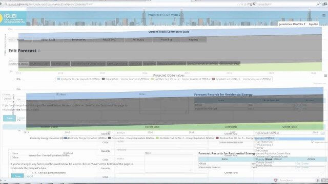
ClearPath Emissions-Management Software
2.33K Views0 Comments0 Likes
ClearPath is the next generation of ICLEI's online software suite for local governments managing energy, resources, and GHG emissions. ClearPath offers a powerful and integrated cloud-based platform that allows you to visualize your current and future emissions, and easily carry out sophisticated analysis to determine the right mix of policies to meet your emissions reduction goals.

3_26 Climate Broadcast (Melting Ice, Deadly Air Pollution, Food Maps and More)
4.12K Views0 Comments0 Likes
This GeoSpatial Stream broadcast discusses the world's melting ice and rising seas, a WHO report stating that air pollution kills one in eight worldwide, "Cash for Clunker Maps," Food Maps, a GIS rap, and more.
Melting Ice and Rising Seas
1.94K Views0 Comments0 Likes
As the planet warms and glaciers and polar ice caps melt, the icy world is fast disappearing, says Julian Dowdeswell from the University of Cambridge. He asks how do we deal with rising sea levels and a changing Arctic?


