
Browse Archives
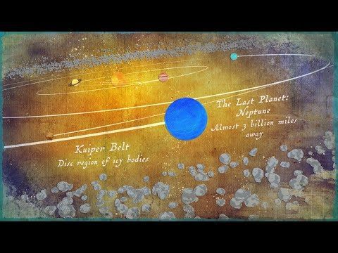
Where Is the Edge of the Solar System?
5.05K Views0 Comments0 Likes
Where does the solar system end? It all depends on the criteria you are using.
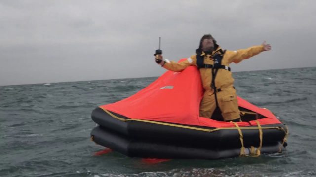
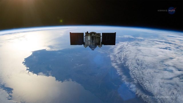
Satellite-Based Search and Rescue
5.04K Views0 Comments0 Likes
With the launch of Initial Services, Galileo will help search and rescue operators respond to distress signals faster and more effectively while also lowering their own exposure to risk.

Prescribed Forest Fire Frequency Should Be Based on Land Management Goals
5.00K Views0 Comments0 Likes
Researchers at the University of Missouri have studied forests subjected to different frequencies of fires to determine what effects fire can have on oak forests over long periods of time.
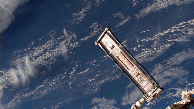
ROSA Deploys on International Space Station
4.99K Views0 Comments0 Likes
The Roll-Out Solar Array (ROSA) was deployed from the end of the Canadarm2 robotic arm Sunday, June 18 outside the International Space Station.
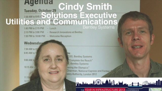
Cyndi Smith Interview
4.95K Views0 Comments0 Likes
Todd Danielson interviews Cyndi Smith, solutions executive, Utilities and Communications, Bentley Systems. They talk about new innovations for Electric Utilities as well as the Bentley Substation product.
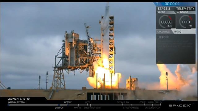
Liftoff of SpaceX CRS-10
4.88K Views0 Comments0 Likes
The SpaceX Falcon 9 rocket launches from Launch Complex 39A at Kennedy Space Center in Florida. The launch vehicle is carrying a Dragon spacecraft on SpaceX CRS-10, the company's tenth commercial resupply services mission to deliver cargo to the International Space Station.
ScienceCasts: Riding the Slingshot to Bennu
4.85K Views0 Comments0 Likes
Gravity’s pull is being used to help propel a small spacecraft known as OSIRIS-REx to a near-Earth asteroid called Bennu.
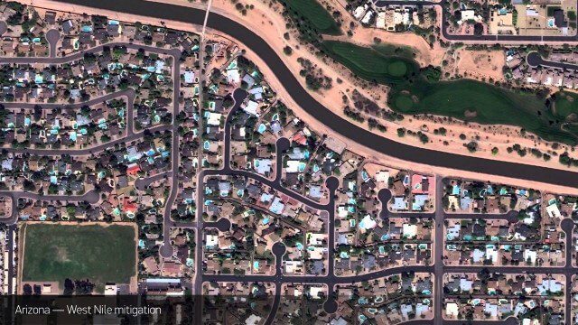
Satellite Imagery to Catch Environmental Changes
4.84K Views0 Comments0 Likes
How governments are using high-resolution satellite imagery to catch environmental issues before they become health hazards - and EPA fines.
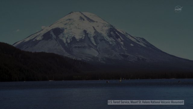
Landsat Tracks Mount St. Helens Recovery
4.83K Views0 Comments0 Likes
By observing different wavelengths of light reflected off the surface, Landsat data can identify different types of land cover.
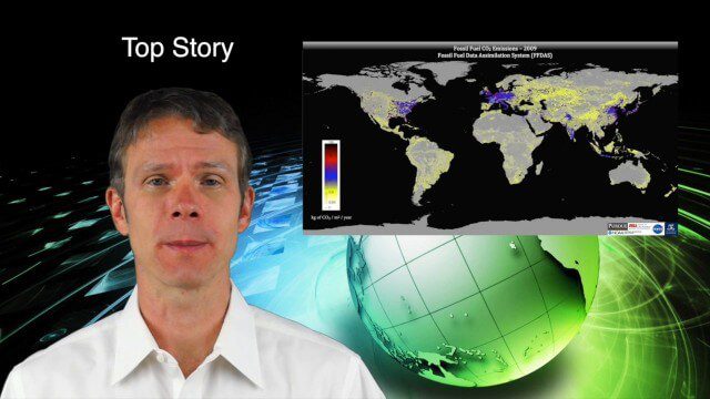
9_18 Climate Change Broadcast (CO2 Mapping, Open Data and More)
4.83K Views0 Comments0 Likes
This GeoSpatial Stream broadcast discusses new research on greenhouse gas emissions worldwide; open data and sustainability innovation; a lost Russian satellite; a geospatial search engine from the U.S. Library of Congress; industry news from Cadcorp, Bentley Systems, Esri and Innovyze; opinions on the recent URISA GIS-Pro conference; and more.


