
Tag: Todd Danielson

6_30 Drones and GIS Broadcast (FAA Rule, Esri UC and More)
0 Views0 Comments0 Likes
This GeoSpatial Stream broadcast discusses the landmark FAA Rule Part 107 for small UASs/UAVs/drones and its effect on the U.S. economy; highlights from the 37th Esri User Conference in San Diego; industry news from SmarterBetterCities, Trimble, Cadcorp and Esri; an Esri video that opened the recent UC; and more.

6_16 Infrastructure Broadcast (PDH Credit, HxGN Live and More)
0 Views0 Comments0 Likes
This Infrastructure-themed GeoSpatial Stream broadcast discusses the latest issue of Informed Infrastructure, including an article on Treasure Island bridge design, PDH credit for an Autodesk benchmark study, and new Web site features and interviews; video clips from the recent HxGN Live event covering Hexagon's latest technologies and direction; industry news from Hexagon, CINTEC America, Contech Engineered Solutions and CoreLogic; thoughts on an upcoming road trip across America's infrastructure; and more.

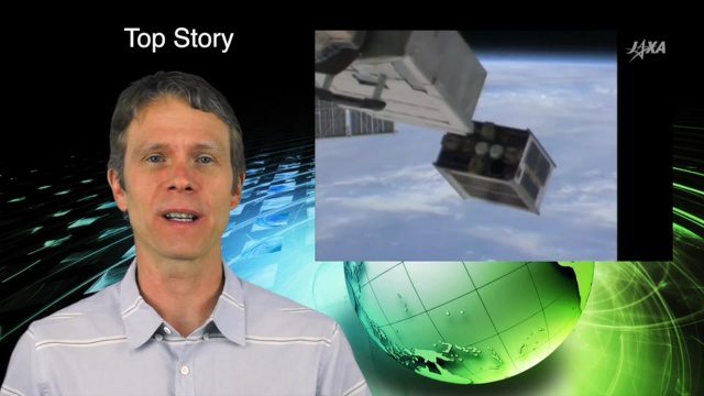
6_9 Earth Imaging Broadcast (Satellite Success, Asteroid Mining and More)
0 Views0 Comments0 Likes
This Earth Imaging-themed GeoSpatial Stream broadcast discusses the recent streak of success at the European Space Agency, including its Sentinel and Galileo launches as well as a demonstration of the SpaceDataHighway; a NASA video about its North Atlantic Aerosols and Marine Ecosystems Study (NAAMES) mission; industry news from Merrick-Surdex Joint Venture, TerraGo, Earth-i, Teledyne Optech and Siteco Informatica; thoughts on asteroid mining and related benefits to Earth sensing; and more.
5_26 Asia Pacific Broadcast (DIWATA-1, Apple Maps and More)
0 Views0 Comments0 Likes
This Asia Pacific-themed GeoSpatial Stream broadcast covers the recent launch of DIWATA-1, The Philippines' first microsatellite; Australia's move toward more-accurate GNSS navigation at its airports; Apple opening a technical and support center in Hyderabad, India, for its Maps and navigation services; industry news from NTT Data, LizardTech, BJ Open Tide BoGan, Ozius Spatial and U-blox; a video clip from JAXA (in Japanese) about weather monitoring; and more.

5_12 Infrastructure Broadcast (Earthquakes, Streetcars and More)
0 Views0 Comments0 Likes
This Infrastructure-themed GeoSpatial Stream broadcast covers the devastating earthquake in Ecuador on April 16, 2016, and relief efforts from Miyamoto International to help rebuild the city's hard-hit infrastructure; a recently opened $100-million-dollar streetcar project in Kansas City; industry news from Trimble, Bentley Systems, Transoft Solutions and Autodesk; a video interview clip about Chicago's famed 150 N. Riverside Building; and more.

What Is the Geodesign Summit?
0 Views6 Comments0 Likes
Esri's annual Geodesign Summit has been a key element in moving the geodesign movement forward. This video from GeoSpatial Stream summarizes some of the important geodesign concepts as well as how Esri's conference informs and motivates those interested in designing a better and smarter built environment.

Traisr Makes Asset Management Simple, Safe and Secure
0 Views0 Comments0 Likes
Todd Danielson interviews John DePalma, Principal, and Brian Berdel, Chief Information Officer, McMahon Associates Inc., at the 2014 Esri User Conference in San Diego. They discuss the company's new product, Traisr, which integrates with multiple platforms to monitor fixed and mobile assets as well as deliver consumer Web portals.

Jon Skiffington Interview (LizardTech)
0 Views0 Comments0 Likes
Todd Danielson interviews Jon Skiffington, Director, Product Management, LizardTech, at the GEOINT Symposium in Tampa, Florida. They discuss LizardTech's MrSID product and how it compresses imagery and other large datasets, GEOINT imagery users, GeoExpress and Express Server 9, and the company Web site.

Spike Kickstarter Video from ikeGPS
0 Views0 Comments0 Likes
Spike is the world’s first laser accurate Smartphone measurement solution enabling you to safely and accurately measure an object up to 600 feet (200 m) away. With a simple snap from your Smartphone, you can measure height, width, and area from a photo, and capture target location. Measurement and location are saved with the picture, and can be easily shared via email as a PDF or Spike File (XML).

ikeGPS Demonstrates New Spike Device at Esri UC
0 Views0 Comments0 Likes
Brian Soliday, Senior VP of Sales, ikeGPS, demonstrates the company's new Spike measurement device at the 2014 Esri User Conference in San Diego. Featuring a laser, accelerometer and 3-D compass, combined with a camera and GPS, Spike provides and quick and easy way to "measure the world around you."


