
Tag: satellites

1_6 New Year Broadcast (2014 Predictions, National Map Corps, Gaofen-1 Satellite and More)
0 Views0 Comments0 Likes
This GeoSpatial Stream broadcast looks at predictions for 2014, the USGS National Map Corps, China's Gaofen-1 satellite, LiDAR "capturing" Billy the Elephant and more.

2_25 Earth Imaging Broadcast (Sentinel Launch, Smallsats and More)
0 Views0 Comments0 Likes
This Earth Imaging-themed GeoSpatial Stream broadcast discusses the recently launched Sentinel-3A Earth-monitoring satellite; a smallsat/cubesat video created by the European Space Agency; NASA UAS/drone news; industry news from Esri, SimActive, Teledyne Optech and Riegl; a funny mapping video from the University of Kentucky's New Maps Plus online education program; and more.

3_31 Remote-Sensing Broadcast (Melting Ice, Deadly Air Pollution, Food Maps and More)
0 Views0 Comments0 Likes
This GeoSpatial Stream broadcast discusses the devastating flooding throughout Europe and how satellites are helping; the 2015 NOAA satellite budget; a new NASA imager for global precipitation; commercial remote-sensing distributors; Airbus Defense and Space and its involvement with Sentinel-5; satellites observing the formation of black holes; and more.

7_10 Remote-Sensing Broadcast (NASA, UN and More)
0 Views0 Comments0 Likes
This remote-sensing themed GeoSpatial Stream broadcast discusses NASA's recently launched Orbiting Carbon Observatory-2 satellite as well as its upcoming ISS-RapidScat instrument; The Satellite Project created at New York University; UN Peacekeeping missions using unarmed UAVs; industry news from Fugro, exactEarth, SimActive and EOMAP; the upcoming Esri User Conference; the Climate Resilience App Challenge; and more.
Ascend – Obstacle management solution
0 Views0 Comments0 Likes
Ascend XYZ in Denmark has developed a service to help airports to comply with airside safety regulations. The service uses satellites and aircraft combined with smart web-based software to record and monitor potential obstacles that encroach on restricted zones at airports and therefore pose a risk to flight safety. This project was supported within ESA's ARTES Applications programme.
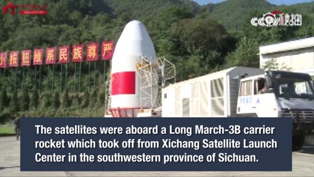
China Launches Two BeiDou-3 Navigation Satellites
0 Views0 Comments0 Likes
China launched two BeiDou-3 satellites into space via a single carrier rocket to support its global navigation and positioning network at 7:45 p.m. on Nov. 5, 2017.
CubeSat to Test Miniaturized Weather Satellite
0 Views0 Comments0 Likes
Behind every weather forecast—from your local, five-day prediction to a late-breaking hurricane track update—are the satellites that make them possible.
EPIC Observations of Ice in Earth’s Atmosphere
0 Views0 Comments0 Likes
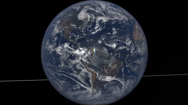
Parked in space a million miles from Earth, the Earth Polychromatic Imaging Camera (EPIC) onboard the Deep Space Climate Observatory (DSCOVR) captures glimmers of reflected sunlight, evidence of ice crystals in the atmosphere.

Exelis Discusses Climate Instrument Specialization and Demand
0 Views0 Comments0 Likes
Matt Ball spoke with Eric Webster, VP and Director, Environmental Intelligence, Geospatial Systems, Exelis, at the recent International Space Symposium. The conversation covered some recent sensor contract wins with NASA and JAXA as well as discussion about the evolution of sensors from hardware- to software-based, affording much greater on-orbit flexibility.
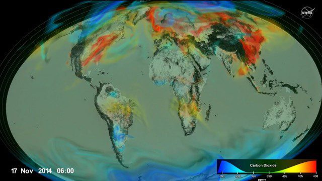
Following Carbon Dioxide Through the Atmosphere
0 Views0 Comments0 Likes
Using observations from NASA's Orbiting Carbon Observatory (OCO-2) satellite, scientists developed a model of the behavior of carbon in the atmosphere.


