
Tag: satellites
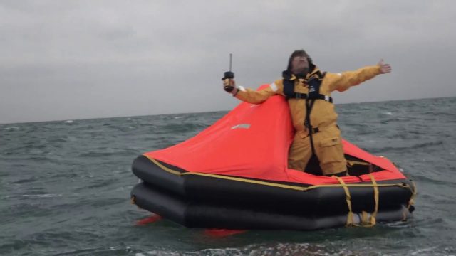
Satellite-Based Search and Rescue
0 Views0 Comments0 Likes
With the launch of Initial Services, Galileo will help search and rescue operators respond to distress signals faster and more effectively while also lowering their own exposure to risk.
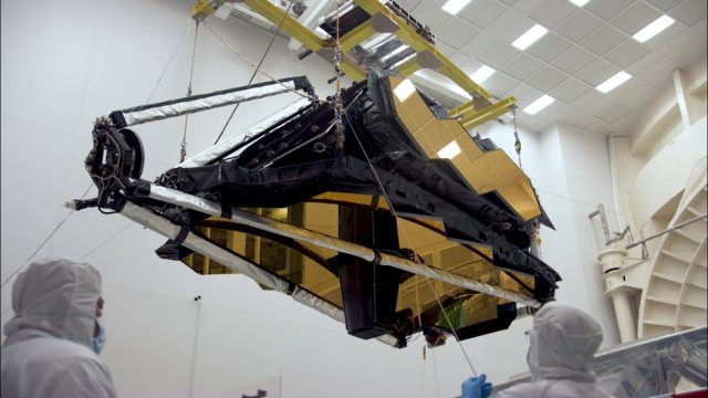
NASA’s James Webb Space Telescope Arrives
0 Views0 Comments0 Likes
The optical telescope and integrated science instrument module (OTIS) of NASA's James Webb Space Telescope arrived at Northrop Grumman Aerospace Systems in Redondo Beach, California, on Friday, Feb. 2.

Super Blue Blood Moon and Lunar Eclipse
0 Views0 Comments0 Likes
Jan. 31, 2018, brought a lunar trifecta: the super blue blood Moon! Starting at 5:30 a.m. Eastern, NASA TV offered a livestream of the Moon. This full moon is the third in a series of “supermoons,” when the Moon is closer to Earth in its orbit -- known as perigee -- and about 14 percent brighter than usual.

NASA: 2017 Takes Second Place for Hottest Year
0 Views0 Comments0 Likes
Earth's surface temperatures in 2017 were the second warmest since since 1880, when global estimates first become feasible, NASA scientists found. Global temperatures 2017 were second only to 2016, which still holds t...
CubeSat to Test Miniaturized Weather Satellite
0 Views0 Comments0 Likes
Behind every weather forecast—from your local, five-day prediction to a late-breaking hurricane track update—are the satellites that make them possible.
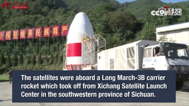
China Launches Two BeiDou-3 Navigation Satellites
0 Views0 Comments0 Likes
China launched two BeiDou-3 satellites into space via a single carrier rocket to support its global navigation and positioning network at 7:45 p.m. on Nov. 5, 2017.
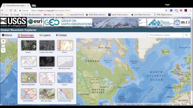
Global Mountain Explorer Video Tutorial
0 Views0 Comments0 Likes
This video contains a narrated introduction to the Global Mountain Explorer (GME), a web-based tool for visualizing and exploring three well known global mountain data layers.
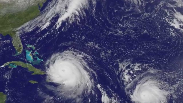
Satellite Animation Sees Hurricanes Katia, Irma and Jose
0 Views0 Comments0 Likes
This animation of NOAA's GOES East satellite imagery from Sept. 5 at 7:45 a.m. EDT (1145 UTC) to Sept. 8 ending at 7:45 a.m. EDT (1145 UTC) shows Category 4 Hurricane Irma approach the Bahamas, followed by Hurricane Jose approaching the Leeward Islands. Hurricane Katia continues to spin in the southwestern Gulf of Mexico.

Hello, Darmstadt?
0 Views0 Comments0 Likes
The European Space Operations Centre, ESOC, in Darmstadt, Germany, has served as Europe’s gateway to space for half a century. In 2017, the centre is celebrating its 50th anniversary, highlighting a rich history of achievement in space.
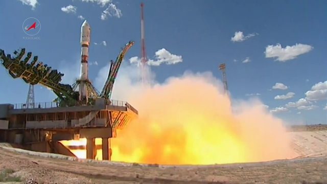
Soyuz Rocket Deploys 73 Satellites
0 Views0 Comments0 Likes
On July 14, 2017, a Russian Soyuz booster lifted off from Kazakhstan on a complex mission to deploy 73 satellites into three different orbits, including a Russian spacecraft to locate forest fires, 48 CubeSats for Planet’s global Earth observation fleet, and eight nanosatellites for Spire Global’s commercial weather network.


