
Tag: satellites

TOPEX/JASON Sees 22-Year Sea Level Rise
1.45K Views0 Comments0 Likes
This visualization shows total sea level change between 1992 and 2014, based on data collected from the TOPEX/Poseidon, Jason-1, and Jason-2 satellites. Blue regions are where sea level has gone down, and orange/red regions are where sea level has gone up. Since 1992, seas around the world have risen an average of nearly 3 inches. The color range for this visualization is -7 cm to +7 cm (-2.76 inches to +2.76 inches), though measured data extends above and below 7cm(2.76 inches). This particular range was chosen to highlight variations in sea level change. Download the visualization: http://svs.gsfc.nasa.gov/cgi-bin/deta....
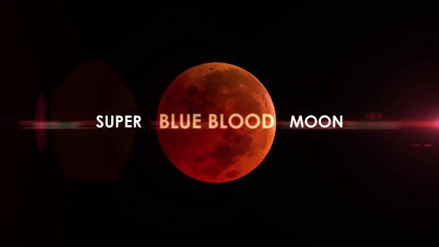
Super Blue Blood Moon and Lunar Eclipse
4.40K Views0 Comments0 Likes
Jan. 31, 2018, brought a lunar trifecta: the super blue blood Moon! Starting at 5:30 a.m. Eastern, NASA TV offered a livestream of the Moon. This full moon is the third in a series of “supermoons,” when the Moon is closer to Earth in its orbit -- known as perigee -- and about 14 percent brighter than usual.
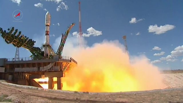
Soyuz Rocket Deploys 73 Satellites
5.34K Views0 Comments0 Likes
On July 14, 2017, a Russian Soyuz booster lifted off from Kazakhstan on a complex mission to deploy 73 satellites into three different orbits, including a Russian spacecraft to locate forest fires, 48 CubeSats for Planet’s global Earth observation fleet, and eight nanosatellites for Spire Global’s commercial weather network.
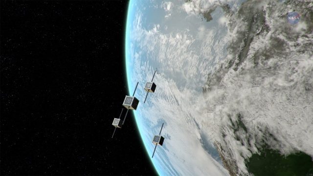
ScienceCasts: NASA Embraces Small Satellites
5.93K Views0 Comments0 Likes
NASA is embracing small satellite designs, from tiny CubeSats to micro-satellites. These miniature marvels are providing many ways to collect science data and to demonstrate new technologies.
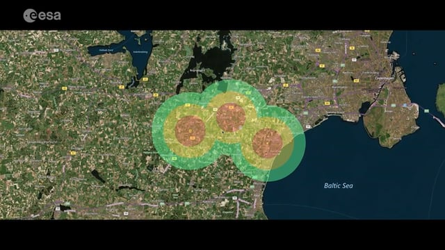
Satellite-Based Wildlife-Monitoring Tool for Airports
1.40K Views0 Comments0 Likes
Wildlife habitats close to airports pose a serious risk to safety at takeoff and landing. A new service lets airports use Earth-observation satellites to identify and manage these areas.
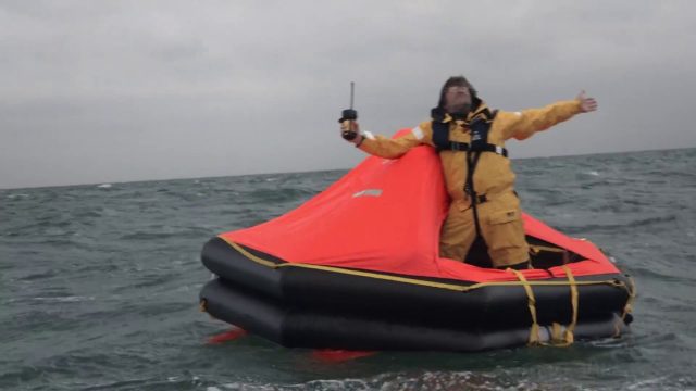
Satellite-Based Search and Rescue
5.04K Views0 Comments0 Likes
With the launch of Initial Services, Galileo will help search and rescue operators respond to distress signals faster and more effectively while also lowering their own exposure to risk.
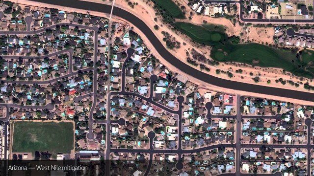
Satellite Imagery to Catch Environmental Changes
4.84K Views0 Comments0 Likes
How governments are using high-resolution satellite imagery to catch environmental issues before they become health hazards - and EPA fines.
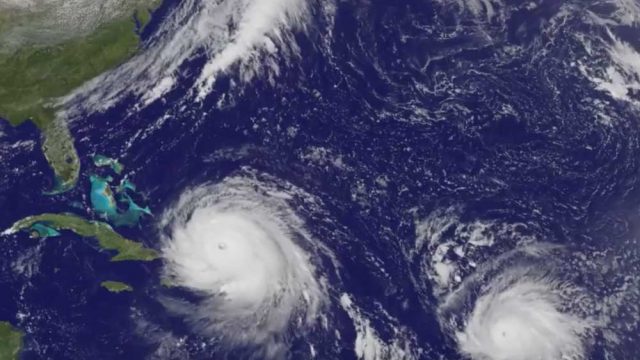
Satellite Animation Sees Hurricanes Katia, Irma and Jose
5.30K Views0 Comments0 Likes
This animation of NOAA's GOES East satellite imagery from Sept. 5 at 7:45 a.m. EDT (1145 UTC) to Sept. 8 ending at 7:45 a.m. EDT (1145 UTC) shows Category 4 Hurricane Irma approach the Bahamas, followed by Hurricane Jose approaching the Leeward Islands. Hurricane Katia continues to spin in the southwestern Gulf of Mexico.
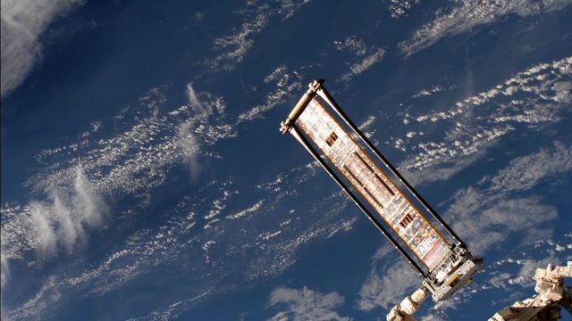
ROSA Deploys on International Space Station
4.99K Views0 Comments0 Likes
The Roll-Out Solar Array (ROSA) was deployed from the end of the Canadarm2 robotic arm Sunday, June 18 outside the International Space Station.
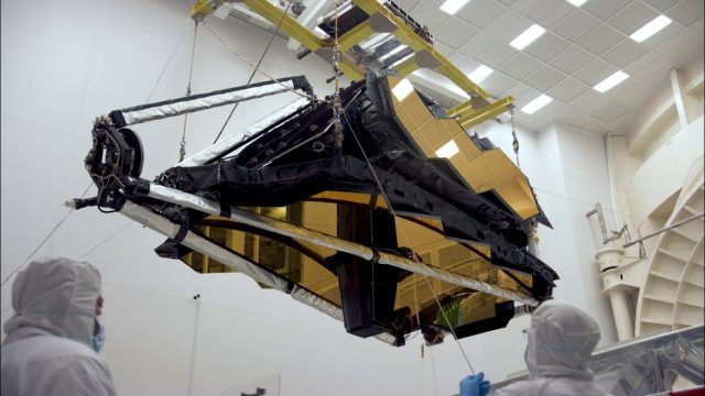
NASA’s James Webb Space Telescope Arrives
4.34K Views0 Comments0 Likes
The optical telescope and integrated science instrument module (OTIS) of NASA's James Webb Space Telescope arrived at Northrop Grumman Aerospace Systems in Redondo Beach, California, on Friday, Feb. 2.


