


Category: Vendor Videos

RideAmigos UNITY
0 Views0 Comments0 Likes
Uniting entities that create the data needed to provide rich visualizations and insights into commuter habits globally, Unity enables unlimited public and private networks within a region to create behavioral changes and eliminate traffic by allowing users to sync data to Esri ArcGIS software for modal analysis. Users can also explore how each mode contributes to greenhouse gas emissions and climate change.
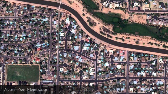
Satellite Imagery to Catch Environmental Changes
0 Views0 Comments0 Likes
How governments are using high-resolution satellite imagery to catch environmental issues before they become health hazards - and EPA fines.
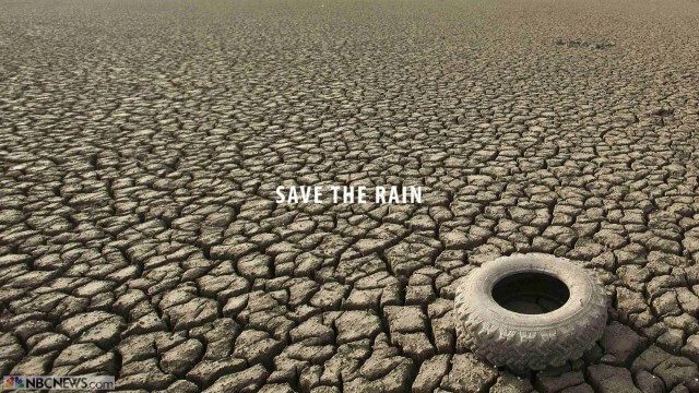
Save the Rain
0 Views0 Comments0 Likes
Users are able to make smarter choices and save water when it is available. The next time it rains, users can capture rainwater that lands on their homes and use it again to water plants, trees, and lawns; wash cars; and even flush toilets.
senseFly Mini Drones
0 Views0 Comments0 Likes
Imagine being able to see the world from a totally new point of view.

Simulating Spaces for Social Distancing
0 Views0 Comments0 Likes
Todd Danielson, Informed Infrastructure's editorial director, interviewed Eduardo Lazzarotto, Bentley Systems’ director of Product Management for Facilities Engineering, via webcam.
Skybox Imaging Captures World’s First High-Resolution, HD Video of Earth from Space
0 Views0 Comments0 Likes

Smart Mapping from Esri
0 Views0 Comments0 Likes
Smart Mapping is an exciting new capability in ArcGIS Online that will change how you make maps.

SpaceCurve Introduces Spatial at the Speed of Reality
0 Views0 Comments0 Likes
GeoSpatial Stream's Todd Danielson conducted an Internet Interview with SpaceCurve's CEO Dane Coyer and Founder Andrew Rogers. They spoke about the company's inception, Big Data, spatial indexing and business applications as well as how SpaceCurve created new technologies to integrate these varied components.


Spike Kickstarter Video from ikeGPS
0 Views0 Comments0 Likes
Spike is the world’s first laser accurate Smartphone measurement solution enabling you to safely and accurately measure an object up to 600 feet (200 m) away. With a simple snap from your Smartphone, you can measure height, width, and area from a photo, and capture target location. Measurement and location are saved with the picture, and can be easily shared via email as a PDF or Spike File (XML).


