


Category: Vendor Videos

RideAmigos UNITY
2.26K Views0 Comments0 Likes
Uniting entities that create the data needed to provide rich visualizations and insights into commuter habits globally, Unity enables unlimited public and private networks within a region to create behavioral changes and eliminate traffic by allowing users to sync data to Esri ArcGIS software for modal analysis. Users can also explore how each mode contributes to greenhouse gas emissions and climate change.

Simulating Spaces for Social Distancing
797 Views0 Comments0 Likes
Todd Danielson, Informed Infrastructure's editorial director, interviewed Eduardo Lazzarotto, Bentley Systems’ director of Product Management for Facilities Engineering, via webcam.
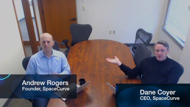
SpaceCurve Introduces Spatial at the Speed of Reality
3.59K Views0 Comments0 Likes
GeoSpatial Stream's Todd Danielson conducted an Internet Interview with SpaceCurve's CEO Dane Coyer and Founder Andrew Rogers. They spoke about the company's inception, Big Data, spatial indexing and business applications as well as how SpaceCurve created new technologies to integrate these varied components.
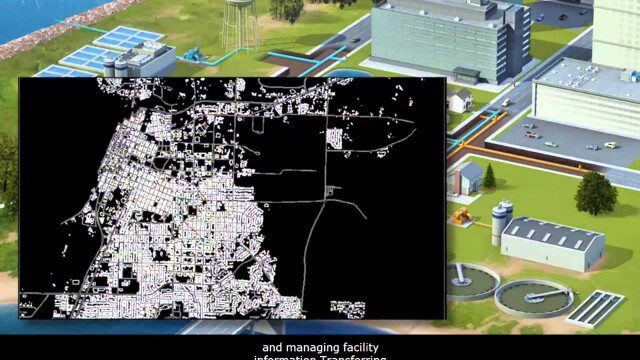
AECO Software to Manage the Urban Water Infrastructure Lifecycle
2.38K Views0 Comments0 Likes
Utilities and their consultants around the world rely on Bentley’s water solution to deliver intelligent infrastructure, ultimately providing clean water and managing sewerage and storm runoff. What architectural, engineering, construction, and operations (AECO) professionals can learn: • Maintain a centralized asset repository and manage facility information with Bentley’s integrated water and geospatial products • Model, analyze, and design water and wastewater pipe networks, using Bentley’s easy-to-use hydraulics and hydrology software • Design and build water and wastewater treatment plants in a fully-managed, collaborative team environment, using Bentley’s plant, structural, and building applications.

Urban Heat Risk Explorer
3.58K Views0 Comments0 Likes
Helping cities prepare for, respond to, and recover from extreme heat events, the app provides users with a better understanding of heat risks in cities and communicates with users on ways they can protect themselves during extreme heat events.

Google’s Project Tango – Journey
2.31K Views0 Comments0 Likes
Over the past 18 months, Project Tango has been collaborating with robotics laboratories from around the world to concentrate the past decade of research and computer vision into a new class of mobile device.
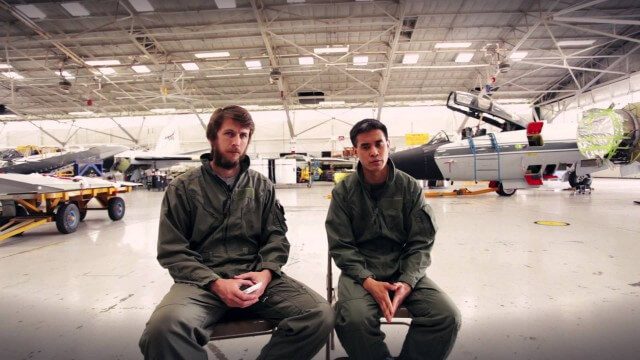
Project Tango: NASA SPHERES
2.17K Views0 Comments0 Likes
Since the summer of 2013, the Project Tango team has been working closely with a team at the NASA Ames Research Center. The goal: to integrate a Project Tango prototype onto a robotic platform, called SPHERES, that flies inside the International Space Station.


Geodesign Summit 2015: Speaker Highlights
3.69K Views0 Comments0 Likes
The Geodesign Summit 2015 featured a variety of speakers and topics focused on designing a better and smarter built environment. This video produced by GeoSpatial Stream highlights some of the best, funniest and most thought-provoking moments.

Smart Mapping from Esri
3.18K Views0 Comments0 Likes
Smart Mapping is an exciting new capability in ArcGIS Online that will change how you make maps.


