


Category: Found on the Internet
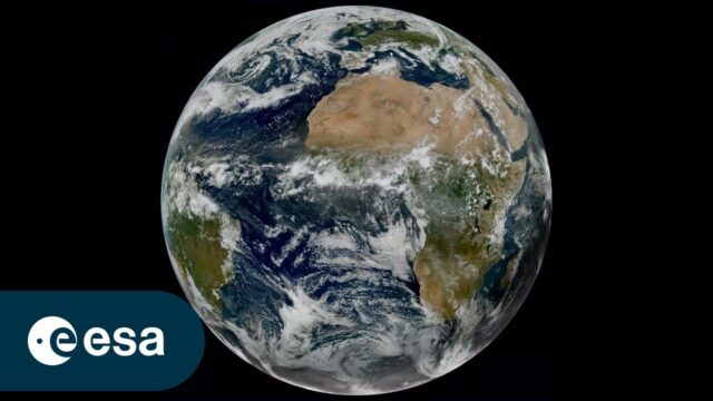
Meteosat Third Generation: Painting the Full Picture
0 Views0 Comments0 Likes
In a significant leap forward for meteorology, the preliminary data obtained by Meteosat Third Generation’s two instruments, the Flexible Combined Imager (FCI) and the Lightning Imager (LI), were successfully combined...

What’s NASA Trying to Find at the Bottom of the Ocean?
0 Views0 Comments0 Likes
We look at the discoveries NASA has made by exploring our oceans. Credits: Writer: Jon McColgan Editor: Nathália Gardin Narrator: Alex McColgan
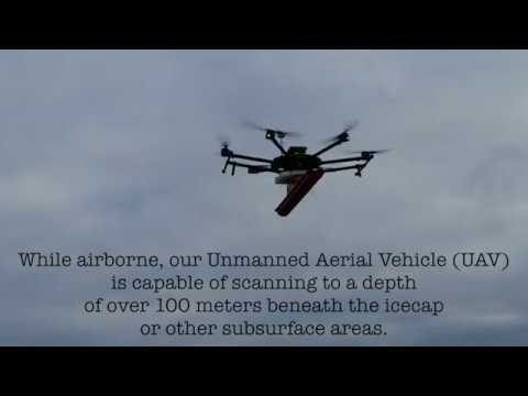
Drone with Ground Penetrating Radar (GPR)
1.67K Views0 Comments0 Likes
GPR Drone technology can be used in areas where deep ground penetration is required but high resolution is not very important.

A New Satellite to Understand How Earth Is Losing Its Cool
784 Views0 Comments0 Likes
ESA’s Earth Explorer FORUM mission will provide new insight into the planet’s radiation budget and how it is controlled.

Air Quality in Washington, D.C.
0 Views0 Comments0 Likes
A video production for NASA's Earth Information Center about air quality in Washington, D.C. Air pollution in DC has declined by 50% in the last two decades. NASA uses sensors aboard satellites and aircraft to obta...
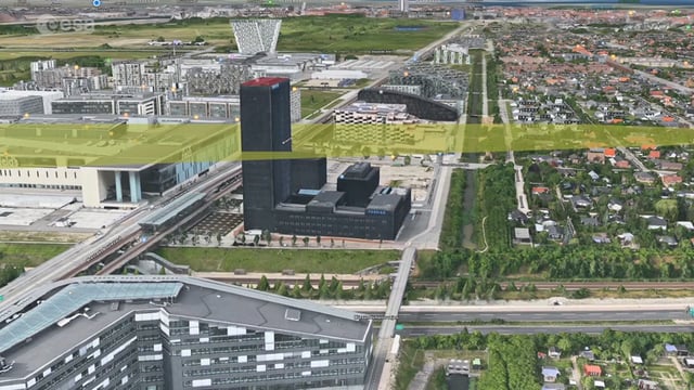
Ascend – Obstacle management solution
5.77K Views0 Comments0 Likes
Ascend XYZ in Denmark has developed a service to help airports to comply with airside safety regulations. The service uses satellites and aircraft combined with smart web-based software to record and monitor potential obstacles that encroach on restricted zones at airports and therefore pose a risk to flight safety. This project was supported within ESA's ARTES Applications programme.
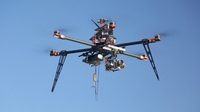
Drones for Aerial Survey and 3D Modelling Updated
2.20K Views0 Comments0 Likes
This video replaces an earlier upload demonstrating the extraction of 3D detail for buildings and/ or terrain from high resolution drone aerial photographs using photogrammetry and geo-referencing. This version includes high definition footage from a simulated autonomous circular aerial survey of an industrial asset, incorporating VidiAir's precision ground survey control points (significantly more accurate than Google Earth), EMF/ RF protection and laser range-finding with telemetry - an important consideration when flying in close proximity to structures/ obstacles, particularly in gusting winds.

NASA Langley Celebrates 100 Years
5.42K Views0 Comments0 Likes
Something happened 100 years ago that changed forever the way we fly, the way we explore space and how we study our home planet. That something was the establishment of what is now NASA’s Langley Research Center in Hampton, Virginia, which commemorated its 100th anniversary on July 17, 2017.
SWIPA 2017: Snow, Water, Ice and Permafrost in the Arctic
4.50K Views0 Comments0 Likes
A video summarizes information products and materials presenting the results of the 2017 Snow, Water, Ice and Permafrost in the Arctic (SWIPA) assessment coordinated by the Arctic Monitoring and Assessment Programme (AMAP).
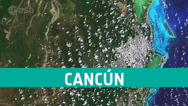
Earth from Space: Cancún, Mexico
14 Views0 Comments0 Likes
The Copernicus Sentinel-2 takes us over Cancún, on the northeast coast of Mexico’s Yucatán Peninsula, in this edition of ESA's Earth from Space program.


