


Category: Found on the Internet

Professor Lauren Gardner Discusses How the COVID-19 Dashboard is Built and Maintained
0 Views0 Comments0 Likes
The COVID-19 dashboard built by the Center for Systems Science and Engineering (CSSE) at Johns Hopkins University gets over a billion requests a day from around the world. Since its creation in late January 2020, it h...

Proposed Bus Terminal in NYC
0 Views0 Comments0 Likes
Pelli Clarke Pelli Architects proposed a relatively compact terminal to be built exclusively on Port Authority-owned land just west of the current facility between West 38th and West 40th streets that would cost $3.7 billion to construct.
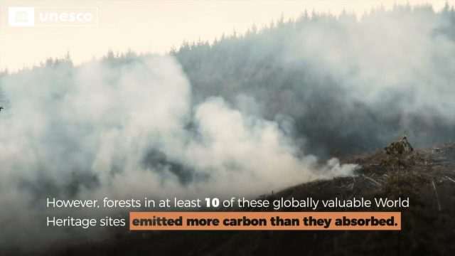
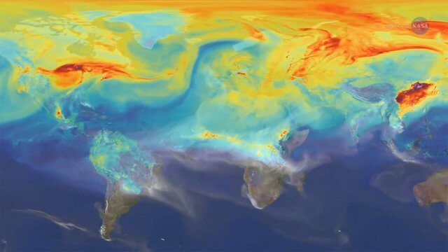
Quantifying Climate Benefits from UNESCO World Heritage Forests
0 Views0 Comments0 Likes
Forests contribute to the global climate system by both emitting and absorbing carbon dioxide (CO2) from the atmosphere. However, our understanding of the transfer of CO2 between forests and the atmosphere at specifi...
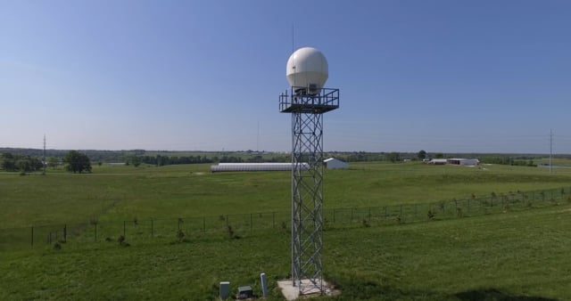
Radar Making Rainfall Forecasts More Accurate
0 Views0 Comments0 Likes
Researchers from the University of Missouri have developed a system that improves the precision of forecasts by accounting for evaporation in rainfall estimates, particularly for locations 30 miles or more from the nearest National Weather Service radar.

Rainwater Modeling in Rotterdam
0 Views0 Comments0 Likes
On the Benthemsquare in Rotterdam the worlds first water square will be realised, an attractive city plaza that offers space for water, sports and greenery. The water square combines water storage with the improvement of the quality of urban public space. The animation was made by Studio Analoog.
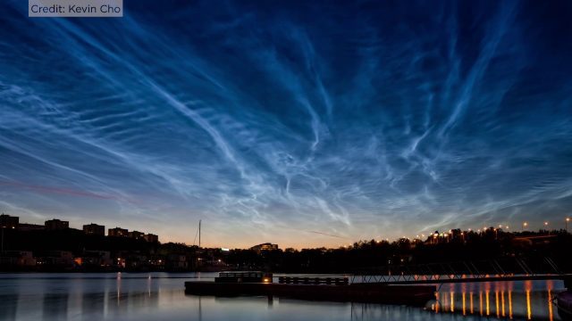
Rare Electric Blue Clouds Observed by NASA Balloon
0 Views0 Comments0 Likes
On the cusp of our atmosphere live a thin group of seasonal electric blue clouds. Forming fifty miles above the poles in summer, these clouds are known as noctilucent clouds or polar mesospheric clouds.

Read a Map and Use a Compass
0 Views0 Comments0 Likes
Simon King and Ordnance Survey provide basic instruction on map and compass use.
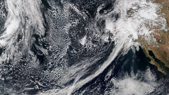
Recent Rains Drench California
0 Views0 Comments0 Likes
Recent rainfalls have drenched the state of California. Imagery from NASA satellites show the result of several atmospheric rivers, known as the Pineapple Express, which carry moisture from as far away as the Hawaiian Islands.

ReROLL Game Using Geotech
0 Views0 Comments0 Likes
Reshuffling Heat on a Warming Planet
0 Views0 Comments0 Likes
Earth's oceans could be concealing a mystery about climate change. Researchers have recently found evidence of hidden heat hundreds of meters below the ocean's surface.


