


Category: Found on the Internet

White House Innovation for Disaster Response and Recovery Demo Day
1.68K Views0 Comments0 Likes
The White House hosts an event bringing together technologists, entrepreneurs, and members of the disaster response community to showcase tools that will make a tangible impact in the lives of survivors of large-scale emergencies.
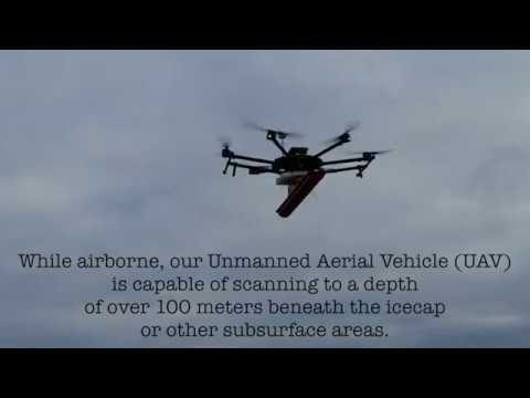
Drone with Ground Penetrating Radar (GPR)
1.67K Views0 Comments0 Likes
GPR Drone technology can be used in areas where deep ground penetration is required but high resolution is not very important.

Landing on a Comet – The Rosetta Mission
1.66K Views0 Comments0 Likes
After a 10-year journey of some seven billion kilometres, the Rosetta mission is now heading towards its next major milestone – setting the lander Philae on a comet. On 12 November 2014, a lander is scheduled to touch down on a comet for the first time in the history of spaceflight. “We don’t know exactly what awaits us there,” says lander Project Manager Stephan Ulamec from the German Aerospace Center (Deutsches Zentrum für Luft- und Raumfahrt; DLR).
ACEC Colorado Award Winner: Data Fusion Predicts Habitat Quality
1.65K Views0 Comments0 Likes
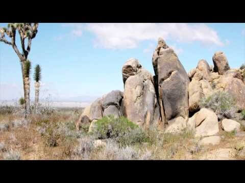
Edwards Air Force Base is located in California’s Mojave Desert, which is home to unique and threatened species such as the desert tortoise, the Joshua tree and desert springparsley. The Air Force monitors impacts of its operations on habitats using multispectral satellite imagery and traditional aerial and field approaches. Hyperspectral imagery and Light Detection and Ranging (LiDAR) remotesensing technologies are being used as more cost-effective methods to collect and analyze spatial data related to habitat quality. Merrick & Company, the primary mapping consultant, was responsible for overall technical implementation, aviation coordination, sensor integration, LiDAR acquisition and point cloud post-processing. Fusing and modeling discreet remotely sensed data from several digital sensors is used to assess habitat quality for inventory and preservation of unique desert species, enabling systematic comparisons to be made over time for effective management of the desert ecosystem. The data also helps to substantiate that operations on Edwards Air Force Base do not degrade habitat quality that may result in the loss of sensitive species in the region.
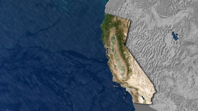
Open California: Our Data, Your Creativity
1.64K Views0 Comments0 Likes
We're releasing our growing California archive under an a CC BY-SA license. Join our community of image analysts, scientists, developers, and researchers: https://www.planet.com/open-california/
Translating Airborne Electromagnetic Data into Geological Understanding
1.61K Views0 Comments0 Likes
In this Geoscience Australia Snapshot video, Dr Ian Roach from Geoscience Australia gives an overview of the benefits of using airborne electromagnetic (AEM) survey data. This survey technique is a key tool for mapping geology undercover and has potential implications for understanding the energy, minerals and regional geology of the survey area.
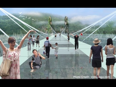
Safety Test of World’s Longest Glass Bridge
1.60K Views0 Comments0 Likes
The world's highest and longest glass bridge, Zhangjiajie Grand Canyon Glass Bridge, opened to the public on Aug. 20, 2016. It offers a way to enjoy a panoramic view of the stunning Zhangjiajie Grand Canyon — if you dare to walk on it!
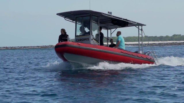
CORAL Probes Great Barrier Reef
1.58K Views0 Comments0 Likes
The three-year COral Reef Airborne Laboratory (CORAL) mission will survey a portion of the world's coral reefs to assess the condition of these threatened ecosystems and understand their relation to the environment, including physical, chemical and human factors.
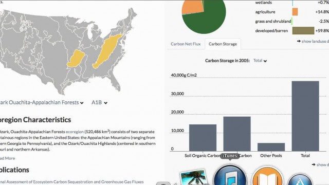
USGS LandCarbon Viewer Tutorial
1.58K Views0 Comments0 Likes
This video, narrated by USGS scientist Brad Reed, provides a brief tutorial on the use of the USGS LandCarbon Viewing tool.
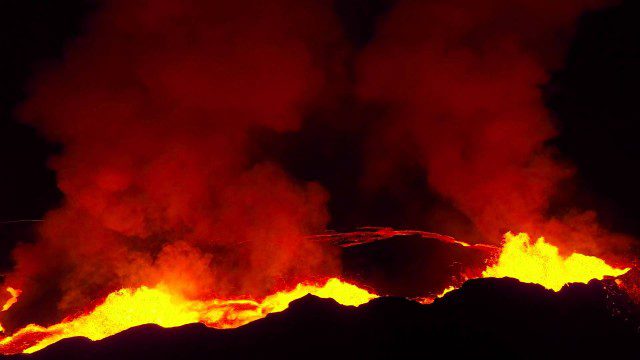
Drones Capture Images of Erupting Iceland Volcano, Part 2
1.57K Views0 Comments0 Likes
A companion piece to the first DJI Feat, which takes viewers on a journey close to the active lava eruptions of the Bardarbunga volcanic system in remote Iceland. Footage was captured with DJI Phantom 2 quadcopters using Lightbridge for wireless, high-definition remote video.


